QGIS at the Federal Department of Town and Country Planning, Peninsular Malaysia
Introduction
The Federal Department of Town and Country Planning, Peninsular Malaysia (JPBD) is a federal agency that advises matters on town and country planning. The scope of administration for the department however is limited to Peninsular Malaysia as Sabah and Sarawak in East Malaysia have their respective town planning agencies. Town and country planning is on the concurrent list in the Federal Legislation, thus, at the federal level, JPBD advises the Housing and Local Government Minister from which JPBD gets its patronage as well as to advise the National Physical Planning Council chaired by the Prime Minister. At the state level, the state director advises the State Planning Committee chaired by the Chief Minister. At the local level, JPBD advises local planning authorities on planning matters by being involved in the preparation of mandatory development plans. At Headquarters, the National Physical Plan Division prepares the National Physical Plan while four regional project offices assist in the preparation of State Structure Plans, District Local Plans and Special Area Plans. As public agencies were traditionally established base on their specialization, JPBD is the custodian of landuse information.
The Project
QGIS was first introduced to the Malaysian Open Source community as a viable alternative to proprietary GIS for public agencies by JPBD at the Malaysian Government Open Source Conference (MyGOSSCON) in 2009 and to the Malaysian GIS community at the 4th National GIS Conference and Exhibition (NGIS) in 2010. JPBD has traditionally been a user of proprietary GIS thus the introduction of QGIS was a real eye opener not only from the point-of-view of Open Source Software (OSS), what more, OSS GIS. Open source philosophy was different thus QGIS felt alien, unsure and unsafe, not surprisingly the idea to use QGIS did not receive much support internally, in fact, it faced resistance in 2010 from the top managment all the way down to the support group.

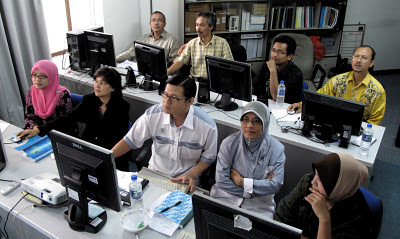
MyGOSSCON, 2009
On the opposite side, request for technical talks on QGIS came from other technical agencies which JPBD gave to the Ministry of Works and the Department of Irrigation and Drainage. Other works to promote QGIS from JPBD came in the form of newsletter articles on QGIS to the Open Source Competency Centre (OSCC) at the Prime Minister’s Department and articles introducing QGIS to the Survey Department’s GIS Bulletin and the Ministry of Natural Resource’s Public Sector GeoSpatial Bulletin. In the meantime, JPBD researched on developing a slope analysis module for QGIS’s Windows and Ubuntu version.
The study highlighted pros and cons of customizing a module and the high level of commitment from the management needed to ensure its continual success and adoption. In 2011, JPBD began to further research on QGIS more as an analytical tool rather than a mapping tool in order to pioneer untapped modules or new approaches at exploiting QGIS.
The department eventually promoted the QGIS-GRASS package instead of merely QGIS as it was found to be most powerful and helpful for town planning purposes such as cleaning topology error and overcoming limitations of the default standard inputs. That was merely the beginning.
Northern Project Office get QGIS training
In order to centralize and share findings in the use of QGIS for town planning purpose which could also be use in other fields dealing with spatial analysis, an unofficial blog established by the author called “QGIS MALAYSIA” at http://www.qgismalaysia.blogspot.com was made to generate a QGIS community in Malaysia. External agencies seem to have more interest in QGIS than JPBD itself and upon their request, JPBD gave QGIS training to the Fire and Safety Department as well as to the Ministry of Education whom later was convinced QGIS will be their de facto GIS tool.
Hearing this, JPBD’s Research and Development Division took the initiative and requested for QGIS training and subsequently 12 persons were trained. Word of mouth (a godsend thing, though at times, extremely detrimental) spread that QGIS was indeed user-friendly, easy to use and at par with proprietary GIS in mapping task and could take on proprietary GIS when optimized with GRASS modules.
Interest in QGIS stirred and in 2012, with the support of all project office directors, an all-out effort was undertaken by the National Landuse Information Division that spearheaded QGIS to train the 4 project offices as they hold the greatest number of GIS users. By the end of 2012, it is anticipated that at least 320 staff throughout JPBD will use QGIS which accounts for approximately 90 % of GIS users in the department.
That is not all. States town planning departments have also requested QGIS training such as Perak including strong interest from poorer states like Perlis and Kelantan. If this catches on, it is anticipated that the use of QGIS may dominate states planning departments and even extend to local planning authorities, many of which are not wealthy. In the meantime, JPBD is seriously studying the use of the QGIS-PosgreSQL-PostGIS package for every planning office’s client GIS-geodatabase server structure to serve as the foundation of JPBD’s integrated landuse (iPLAN) network.
Outcome from using QGIS
On the assumption of RM10,000 per proprietary GIS licence, the use of 320 QGIS installations will help save the federal government RM3,200,000;
A total eradication of pirate GIS and increasing trust and confidence in the use of OSS in general and specifically OSS GIS;
QGIS training has been simplier to manage. This means cross-learning between staff, divisions, public agencies and even local planning authorities that use QGIS can be more effective because the GIS used is uniform;
The use of QGIS helps towards synergy with a PostgreSQL-PostGIS geodatabase which the department is planning to use as the foundation of landuse geodatabase throughout Peninsular Malaysia.
It has been faster to process data verification and clean topology error.
Users become more courageous and begin to venture into Google Maps and other Internet sources for secondary information;
QGIS being user-friendly encourages users to be more adventureous and explore the many plugins available to their advantage and make their task easier.
GIS a complex tool becomes a friend rather than a hinderance.
Author

Abbas Abdul Wahab
This article was contributed in January 2012 by Abbas Abdul Wahab. Abbas graduated as a town planner from Gloucestershire College of Arts & Design, United Kingdom in 1980 and has a Masters of Science in GIS & Geomatic Engineering from Putra University Malaysia in 2002. He is currently the Head of the National Landuse Information Unit at the National Landuse Information Division of the Federal Department of Town & Country Planning, Peninsular Malaysia.