Base class for all map layer types. More...
#include <qgsmaplayer.h>
Public Types | |
| enum | LayerFlag { Identifiable = 1 << 0 , Removable = 1 << 1 , Searchable = 1 << 2 , Private = 1 << 3 } |
| Flags for the map layer. More... | |
| typedef QFlags< LayerFlag > | LayerFlags |
| enum | PropertyType { Style = 0 , Metadata } |
| Maplayer has a style and a metadata property. More... | |
| enum | ReadFlag { FlagDontResolveLayers = 1 << 0 , FlagTrustLayerMetadata = 1 << 1 , FlagReadExtentFromXml = 1 << 2 , FlagForceReadOnly = 1 << 3 } |
| Flags which control project read behavior. More... | |
| typedef QFlags< ReadFlag > | ReadFlags |
| enum class | SaveStyleResult { Success = 0 , QmlGenerationFailed = 1 << 0 , SldGenerationFailed = 1 << 1 , DatabaseWriteFailed = 1 << 2 } |
| Results of saving styles to database. More... | |
| typedef QFlags< SaveStyleResult > | SaveStyleResults |
| Results of saving styles to database. | |
| typedef QFlags< StyleCategory > | StyleCategories |
| enum | StyleCategory { LayerConfiguration = 1 << 0 , Symbology = 1 << 1 , Symbology3D = 1 << 2 , Labeling = 1 << 3 , Fields = 1 << 4 , Forms = 1 << 5 , Actions = 1 << 6 , MapTips = 1 << 7 , Diagrams = 1 << 8 , AttributeTable = 1 << 9 , Rendering = 1 << 10 , CustomProperties = 1 << 11 , GeometryOptions = 1 << 12 , Relations = 1 << 13 , Temporal = 1 << 14 , Legend = 1 << 15 , Elevation = 1 << 16 , Notes = 1 << 17 , AllVisualStyleCategories = Symbology | Symbology3D | Labeling | Diagrams , AllAttributeCategories = Fields | Forms | AttributeTable , AllStyleCategories = LayerConfiguration | Symbology | Symbology3D | Labeling | Fields | Forms | Actions | MapTips | Diagrams | AttributeTable | Rendering | CustomProperties | GeometryOptions | Relations | Temporal | Legend | Elevation | Notes } |
| Categories of style to distinguish appropriate sections for import/export. More... | |
Public Slots | |
| void | emitStyleChanged () |
| Triggers an emission of the styleChanged() signal. | |
| QgsProject * | project () const |
| Returns the parent project if this map layer is added to a project. | |
| virtual bool | setDependencies (const QSet< QgsMapLayerDependency > &layers) |
| Sets the list of dependencies. | |
| void | setMaximumScale (double scale) |
| Sets the maximum map scale (i.e. | |
| void | setMinimumScale (double scale) |
| Sets the minimum map scale (i.e. | |
| void | setRefreshOnNofifyMessage (const QString &message) |
| Set the notification message that triggers repaint If refresh on notification is enabled, the notification will triggerRepaint only if the notification message is equal to. | |
| void | setRefreshOnNotifyEnabled (bool enabled) |
| Set whether provider notification is connected to triggerRepaint. | |
| void | setScaleBasedVisibility (bool enabled) |
| Sets whether scale based visibility is enabled for the layer. | |
| virtual void | setTransformContext (const QgsCoordinateTransformContext &transformContext)=0 |
| Sets the coordinate transform context to transformContext. | |
| void | trigger3DUpdate () |
| Will advise any 3D maps that this layer requires to be updated in the scene. | |
| void | triggerRepaint (bool deferredUpdate=false) |
| Will advise the map canvas (and any other interested party) that this layer requires to be repainted. | |
Signals | |
| void | autoRefreshIntervalChanged (int interval) |
| Emitted when the auto refresh interval changes. | |
| void | beforeResolveReferences (QgsProject *project) |
| Emitted when all layers are loaded and references can be resolved, just before the references of this layer are resolved. | |
| void | blendModeChanged (QPainter::CompositionMode blendMode) |
| Signal emitted when the blend mode is changed, through QgsMapLayer::setBlendMode(). | |
| void | configChanged () |
| Emitted whenever the configuration is changed. | |
| void | crs3DChanged () |
| Emitted when the crs3D() of the layer has changed. | |
| void | crsChanged () |
| Emitted when the crs() of the layer has changed. | |
| void | customPropertyChanged (const QString &key) |
| Emitted when a custom property of the layer has been changed or removed. | |
| void | dataChanged () |
| Data of layer changed. | |
| void | dataSourceChanged () |
| Emitted whenever the layer's data source has been changed. | |
| void | dependenciesChanged () |
| Emitted when dependencies are changed. | |
| void | editingStarted () |
| Emitted when editing on this layer has started. | |
| void | editingStopped () |
| Emitted when edited changes have been successfully written to the data provider. | |
| void | flagsChanged () |
| Emitted when layer's flags have been modified. | |
| void | idChanged (const QString &id) |
| Emitted when the layer's ID has been changed. | |
| void | isValidChanged () |
| Emitted when the validity of this layer changed. | |
| void | layerModified () |
| Emitted when modifications has been done on layer. | |
| void | legendChanged () |
| Signal emitted when legend of the layer has changed. | |
| void | mapTipsEnabledChanged () |
| Emitted when map tips are enabled or disabled for the layer. | |
| void | mapTipTemplateChanged () |
| Emitted when the map tip template changes. | |
| void | metadataChanged () |
| Emitted when the layer's metadata is changed. | |
| void | nameChanged () |
| Emitted when the name has been changed. | |
| void | opacityChanged (double opacity) |
| Emitted when the layer's opacity is changed, where opacity is a value between 0 (transparent) and 1 (opaque). | |
| void | recalculateExtents () const |
| This is used to send a request that any mapcanvas using this layer update its extents. | |
| void | renderer3DChanged () |
| Signal emitted when 3D renderer associated with the layer has changed. | |
| void | rendererChanged () |
| Signal emitted when renderer is changed. | |
| void | repaintRequested (bool deferredUpdate=false) |
| By emitting this signal the layer tells that either appearance or content have been changed and any view showing the rendered layer should refresh itself. | |
| void | request3DUpdate () |
| Signal emitted when a layer requires an update in any 3D maps. | |
| void | statusChanged (const QString &status) |
| Emit a signal with status (e.g. to be caught by QgisApp and display a msg on status bar). | |
| void | styleChanged () |
| Signal emitted whenever a change affects the layer's style. | |
| void | styleLoaded (QgsMapLayer::StyleCategories categories) |
| Emitted when a style has been loaded. | |
| void | verticalCrsChanged () |
| Emitted when the verticalCrs() of the layer has changed. | |
| void | willBeDeleted () |
| Emitted in the destructor when the layer is about to be deleted, but it is still in a perfectly valid state: the last chance for other pieces of code for some cleanup if they use the layer. | |
Public Member Functions | |
| QgsMapLayer (const QgsMapLayer &)=delete | |
| QgsMapLayer (Qgis::LayerType type=Qgis::LayerType::Vector, const QString &name=QString(), const QString &source=QString()) | |
| Constructor for QgsMapLayer. | |
| ~QgsMapLayer () override | |
| Q_DECL_DEPRECATED QString | abstract () const |
| Returns the abstract of the layer used by QGIS Server in GetCapabilities request. | |
| virtual bool | accept (QgsObjectEntityVisitorInterface *visitor, const QgsObjectVisitorContext &context) const |
| Accepts the specified object visitor, causing it to visit all relevant objects associated with the layer. | |
| virtual bool | accept (QgsStyleEntityVisitorInterface *visitor) const |
| Accepts the specified symbology visitor, causing it to visit all symbols associated with the layer. | |
| Q_DECL_DEPRECATED QString | attribution () const |
| Returns the attribution of the layer used by QGIS Server in GetCapabilities request. | |
| Q_DECL_DEPRECATED QString | attributionUrl () const |
| Returns the attribution URL of the layer used by QGIS Server in GetCapabilities request. | |
| int | autoRefreshInterval () const |
| Returns the auto refresh interval (in milliseconds). | |
| Qgis::AutoRefreshMode | autoRefreshMode () const |
| Returns the layer's automatic refresh mode. | |
| QPainter::CompositionMode | blendMode () const |
| Returns the current blending mode for a layer. | |
| virtual QgsMapLayer * | clone () const =0 |
| Returns a new instance equivalent to this one except for the id which is still unique. | |
| virtual QgsMapLayerRenderer * | createMapRenderer (QgsRenderContext &rendererContext)=0 |
| Returns new instance of QgsMapLayerRenderer that will be used for rendering of given context. | |
| QgsCoordinateReferenceSystem | crs () const |
| Returns the layer's spatial reference system. | |
| QgsCoordinateReferenceSystem | crs3D () const |
| Returns the CRS to use for the layer when transforming 3D data, or when z/elevation value handling is important. | |
| template<class T> | |
| T | customEnumProperty (const QString &key, const T &defaultValue) |
| Returns the property value for a property based on an enum. | |
| template<class T> | |
| T | customFlagProperty (const QString &key, const T &defaultValue) |
| Returns the property value for a property based on a flag. | |
| const QgsObjectCustomProperties & | customProperties () const |
| Read all custom properties from layer. | |
| Q_INVOKABLE QVariant | customProperty (const QString &value, const QVariant &defaultValue=QVariant()) const |
| Read a custom property from layer. | |
| Q_INVOKABLE QStringList | customPropertyKeys () const |
| Returns list of all keys within custom properties. | |
| virtual Q_INVOKABLE QgsDataProvider * | dataProvider () |
Returns the layer's data provider, it may be nullptr. | |
| virtual const QgsDataProvider * | dataProvider () const |
Returns the layer's data provider in a const-correct manner, it may be nullptr. | |
| Q_DECL_DEPRECATED QString | dataUrl () const |
| Returns the DataUrl of the layer used by QGIS Server in GetCapabilities request. | |
| Q_DECL_DEPRECATED QString | dataUrlFormat () const |
| Returns the DataUrl format of the layer used by QGIS Server in GetCapabilities request. | |
| virtual bool | deleteStyleFromDatabase (const QString &styleId, QString &msgError) |
| Deletes a style from the database. | |
| virtual QSet< QgsMapLayerDependency > | dependencies () const |
| Gets the list of dependencies. | |
| virtual QgsMapLayerElevationProperties * | elevationProperties () |
| Returns the layer's elevation properties. | |
| virtual QgsError | error () const |
| Gets current status error. | |
| void | exportNamedMetadata (QDomDocument &doc, QString &errorMsg) const |
| Export the current metadata of this layer as named metadata in a QDomDocument. | |
| virtual void | exportNamedStyle (QDomDocument &doc, QString &errorMsg, const QgsReadWriteContext &context=QgsReadWriteContext(), QgsMapLayer::StyleCategories categories=QgsMapLayer::AllStyleCategories) const |
| Export the properties of this layer as named style in a QDomDocument. | |
| virtual Q_DECL_DEPRECATED void | exportSldStyle (QDomDocument &doc, QString &errorMsg) const |
| Export the properties of this layer as SLD style in a QDomDocument. | |
| virtual Q_DECL_DEPRECATED void | exportSldStyleV2 (QDomDocument &doc, QString &errorMsg, QgsSldExportContext &exportContext) const |
| Export the properties of this layer as SLD style in a QDomDocument. | |
| virtual QDomDocument | exportSldStyleV3 (QgsSldExportContext &exportContext) const |
| Export the properties of this layer as SLD style in a QDomDocument. | |
| virtual Q_INVOKABLE QgsRectangle | extent () const |
| Returns the extent of the layer. | |
| virtual QgsBox3D | extent3D () const |
| Returns the 3D extent of the layer. | |
| QgsMapLayer::LayerFlags | flags () const |
| Returns the flags for this layer. | |
| virtual QString | getStyleFromDatabase (const QString &styleId, QString &msgError) |
| Returns the named style corresponding to style id provided. | |
| Q_DECL_DEPRECATED bool | hasAutoRefreshEnabled () const |
Returns true if auto refresh is enabled for the layer. | |
| virtual bool | hasMapTips () const |
Returns true if the layer contains map tips. | |
| bool | hasScaleBasedVisibility () const |
| Returns whether scale based visibility is enabled for the layer. | |
| virtual QString | htmlMetadata () const |
| Obtain a formatted HTML string containing assorted metadata for this layer. | |
| QString | id () const |
| Returns the layer's unique ID, which is used to access this layer from QgsProject. | |
| bool | importNamedMetadata (QDomDocument &document, QString &errorMessage) |
| Import the metadata of this layer from a QDomDocument. | |
| virtual bool | importNamedStyle (QDomDocument &doc, QString &errorMsg, QgsMapLayer::StyleCategories categories=QgsMapLayer::AllStyleCategories) |
| Import the properties of this layer from a QDomDocument. | |
| virtual bool | isEditable () const |
Returns true if the layer can be edited. | |
| bool | isInScaleRange (double scale) const |
| Tests whether the layer should be visible at the specified scale. | |
| virtual bool | isModified () const |
Returns true if the layer has been modified since last commit/save. | |
| bool | isRefreshOnNotifyEnabled () const |
Returns true if the refresh on provider nofification is enabled. | |
| virtual bool | isSpatial () const |
Returns true if the layer is considered a spatial layer, ie it has some form of geometry associated with it. | |
| virtual bool | isTemporary () const |
Returns true if the layer is considered a temporary layer. | |
| bool | isValid () const |
| Returns the status of the layer. | |
| Q_DECL_DEPRECATED QString | keywordList () const |
| Returns the keyword list of the layer used by QGIS Server in GetCapabilities request. | |
| QgsMapLayerLegend * | legend () const |
Can be nullptr. | |
| QString | legendPlaceholderImage () const |
| Returns path to the placeholder image or an empty string if a generated legend is shown. | |
| Q_DECL_DEPRECATED QString | legendUrl () const |
| Returns the URL for the layer's legend. | |
| Q_DECL_DEPRECATED QString | legendUrlFormat () const |
| Returns the format for a URL based layer legend. | |
| virtual int | listStylesInDatabase (QStringList &ids, QStringList &names, QStringList &descriptions, QString &msgError) |
| Lists all the style in db split into related to the layer and not related to. | |
| virtual QString | loadDefaultMetadata (bool &resultFlag) |
| Retrieve the default metadata for this layer if one exists (either as a .qmd file on disk or as a record in the users metadata table in their personal qgis.db). | |
| virtual QString | loadDefaultStyle (bool &resultFlag) |
| Retrieve the default style for this layer if one exists (either as a .qml file on disk or as a record in the users style table in their personal qgis.db). | |
| virtual QString | loadNamedMetadata (const QString &uri, bool &resultFlag) |
| Retrieve a named metadata for this layer if one exists (either as a .qmd file on disk or as a record in the users style table in their personal qgis.db). | |
| bool | loadNamedMetadataFromDatabase (const QString &db, const QString &uri, QString &qmd) |
| Retrieve a named metadata for this layer from a sqlite database. | |
| virtual QString | loadNamedStyle (const QString &theURI, bool &resultFlag, bool loadFromLocalDb, QgsMapLayer::StyleCategories categories=QgsMapLayer::AllStyleCategories, Qgis::LoadStyleFlags flags=Qgis::LoadStyleFlags()) |
| Loads a named style from file/local db/datasource db. | |
| virtual QString | loadNamedStyle (const QString &uri, bool &resultFlag, QgsMapLayer::StyleCategories categories=QgsMapLayer::AllStyleCategories, Qgis::LoadStyleFlags flags=Qgis::LoadStyleFlags()) |
| Retrieve a named style for this layer if one exists (either as a .qml file on disk or as a record in the users style table in their personal qgis.db). | |
| virtual bool | loadNamedStyleFromDatabase (const QString &db, const QString &uri, QString &qml) |
| Retrieve a named style for this layer from a sqlite database. | |
| virtual QString | loadSldStyle (const QString &uri, bool &resultFlag) |
| Attempts to style the layer using the formatting from an SLD type file. | |
| bool | mapTipsEnabled () const |
| Returns true if map tips are enabled for this layer. | |
| QString | mapTipTemplate () const |
| The mapTip is a pretty, html representation for feature information. | |
| double | maximumScale () const |
| Returns the maximum map scale (i.e. | |
| virtual const QgsLayerMetadata & | metadata () const |
| Returns a reference to the layer's metadata store. | |
| virtual QString | metadataUri () const |
| Retrieve the metadata URI for this layer (either as a .qmd file on disk or as a record in the users style table in their personal qgis.db). | |
| Q_DECL_DEPRECATED QString | metadataUrl () const |
| Returns the metadata URL of the layer used by QGIS Server in GetCapabilities request. | |
| Q_DECL_DEPRECATED QString | metadataUrlFormat () const |
| Returns the metadata format of the layer used by QGIS Server in GetCapabilities request. | |
| Q_DECL_DEPRECATED QString | metadataUrlType () const |
| Returns the metadata type of the layer used by QGIS Server in GetCapabilities request. | |
| double | minimumScale () const |
| Returns the minimum map scale (i.e. | |
| QString | name () const |
| Returns the display name of the layer. | |
| virtual double | opacity () const |
| Returns the opacity for the layer, where opacity is a value between 0 (totally transparent) and 1.0 (fully opaque). | |
| QgsMapLayer & | operator= (const QgsMapLayer &)=delete |
| QString | originalXmlProperties () const |
| Returns the XML properties of the original layer as they were when the layer was first read from the project file. | |
| virtual QgsAbstractProfileSource * | profileSource () |
| Returns the layer's profile source if it has profile capabilities. | |
| virtual Qgis::MapLayerProperties | properties () const |
| Returns the map layer properties of this layer. | |
| QgsProviderMetadata * | providerMetadata () const |
Returns the layer data provider's metadata, it may be nullptr. | |
| QString | providerType () const |
| Returns the provider type (provider key) for this layer. | |
| QString | publicSource (bool hidePassword=false) const |
| Gets a version of the internal layer definition that has sensitive bits removed (for example, the password). | |
| bool | readLayerXml (const QDomElement &layerElement, QgsReadWriteContext &context, QgsMapLayer::ReadFlags flags=QgsMapLayer::ReadFlags(), QgsDataProvider *preloadedProvider=nullptr) |
| Sets state from DOM document. | |
| bool | readOnly () const |
| Returns if this layer is read only. | |
| virtual bool | readSld (const QDomNode &node, QString &errorMessage) |
| virtual bool | readStyle (const QDomNode &node, QString &errorMessage, QgsReadWriteContext &context, StyleCategories categories=AllStyleCategories) |
| Read the style for the current layer from the DOM node supplied. | |
| virtual bool | readSymbology (const QDomNode &node, QString &errorMessage, QgsReadWriteContext &context, StyleCategories categories=AllStyleCategories)=0 |
| Read the symbology for the current layer from the DOM node supplied. | |
| QString | refreshOnNotifyMessage () const |
| Returns the message that should be notified by the provider to triggerRepaint. | |
| virtual Q_INVOKABLE void | reload () |
| Synchronises with changes in the datasource. | |
| void | removeCustomProperty (const QString &key) |
| Remove a custom property from layer. | |
| QgsAbstract3DRenderer * | renderer3D () const |
| Returns 3D renderer associated with the layer. | |
| virtual void | resolveReferences (QgsProject *project) |
| Resolve references to other layers (kept as layer IDs after reading XML) into layer objects. | |
| virtual QString | saveDefaultMetadata (bool &resultFlag) |
| Save the current metadata of this layer as the default metadata (either as a .qmd file on disk or as a record in the users style table in their personal qgis.db). | |
| virtual Q_DECL_DEPRECATED QString | saveDefaultStyle (bool &resultFlag) |
| Save the properties of this layer as the default style (either as a .qml file on disk or as a record in the users style table in their personal qgis.db). | |
| virtual QString | saveDefaultStyle (bool &resultFlag, StyleCategories categories) |
| Save the properties of this layer as the default style (either as a .qml file on disk or as a record in the users style table in their personal qgis.db). | |
| QString | saveNamedMetadata (const QString &uri, bool &resultFlag) |
| Save the current metadata of this layer as a named metadata (either as a .qmd file on disk or as a record in the users style table in their personal qgis.db). | |
| virtual QString | saveNamedStyle (const QString &uri, bool &resultFlag, StyleCategories categories=AllStyleCategories) |
| Save the properties of this layer as a named style (either as a .qml file on disk or as a record in the users style table in their personal qgis.db). | |
| virtual QString | saveSldStyle (const QString &uri, bool &resultFlag) const |
| Saves the properties of this layer to an SLD format file. | |
| virtual QString | saveSldStyleV2 (bool &resultFlag, QgsSldExportContext &exportContext) const |
| Saves the properties of this layer to an SLD format file. | |
| virtual Q_DECL_DEPRECATED void | saveStyleToDatabase (const QString &name, const QString &description, bool useAsDefault, const QString &uiFileContent, QString &msgError, QgsMapLayer::StyleCategories categories=QgsMapLayer::AllStyleCategories) |
| Saves QML and SLD representations of the layer's style to a table in the database. | |
| QgsMapLayer::SaveStyleResults | saveStyleToDatabaseV2 (const QString &name, const QString &description, bool useAsDefault, const QString &uiFileContent, QString &msgError, QgsMapLayer::StyleCategories categories=QgsMapLayer::AllStyleCategories) |
| Saves QML and SLD representations of the layer's style to a table in the database. | |
| virtual QgsMapLayerSelectionProperties * | selectionProperties () |
| Returns the layer's selection properties. | |
| QgsMapLayerServerProperties * | serverProperties () |
| Returns QGIS Server Properties for the map layer. | |
| const QgsMapLayerServerProperties * | serverProperties () const |
| Returns QGIS Server Properties const for the map layer. | |
| Q_DECL_DEPRECATED void | setAbstract (const QString &abstract) |
| Sets the abstract of the layer used by QGIS Server in GetCapabilities request. | |
| Q_DECL_DEPRECATED void | setAttribution (const QString &attrib) |
| Sets the attribution of the layerused by QGIS Server in GetCapabilities request. | |
| Q_DECL_DEPRECATED void | setAttributionUrl (const QString &attribUrl) |
| Sets the attribution URL of the layer used by QGIS Server in GetCapabilities request. | |
| Q_DECL_DEPRECATED void | setAutoRefreshEnabled (bool enabled) |
| Sets whether auto refresh is enabled for the layer. | |
| void | setAutoRefreshInterval (int interval) |
| Sets the auto refresh interval (in milliseconds) for the layer. | |
| void | setAutoRefreshMode (Qgis::AutoRefreshMode mode) |
| Sets the automatic refresh mode for the layer. | |
| void | setBlendMode (QPainter::CompositionMode blendMode) |
| Set the blending mode used for rendering a layer. | |
| void | setCrs (const QgsCoordinateReferenceSystem &srs, bool emitSignal=true) |
| Sets layer's spatial reference system. | |
| template<class T> | |
| void | setCustomEnumProperty (const QString &key, const T &value) |
| Set the value of a property based on an enum. | |
| template<class T> | |
| void | setCustomFlagProperty (const QString &key, const T &value) |
| Set the value of a property based on a flag. | |
| void | setCustomProperties (const QgsObjectCustomProperties &properties) |
| Set custom properties for layer. | |
| Q_INVOKABLE void | setCustomProperty (const QString &key, const QVariant &value) |
| Set a custom property for layer. | |
| void | setDataSource (const QString &dataSource, const QString &baseName, const QString &provider, const QgsDataProvider::ProviderOptions &options, bool loadDefaultStyleFlag=false) |
| Updates the data source of the layer. | |
| void | setDataSource (const QString &dataSource, const QString &baseName, const QString &provider, const QgsDataProvider::ProviderOptions &options, Qgis::DataProviderReadFlags flags) |
| Updates the data source of the layer. | |
| void | setDataSource (const QString &dataSource, const QString &baseName=QString(), const QString &provider=QString(), bool loadDefaultStyleFlag=false) |
| Updates the data source of the layer. | |
| Q_DECL_DEPRECATED void | setDataUrl (const QString &dataUrl) |
| Sets the DataUrl of the layer used by QGIS Server in GetCapabilities request. | |
| Q_DECL_DEPRECATED void | setDataUrlFormat (const QString &dataUrlFormat) |
| Sets the DataUrl format of the layer used by QGIS Server in GetCapabilities request. | |
| void | setFlags (QgsMapLayer::LayerFlags flags) |
| Returns the flags for this layer. | |
| bool | setId (const QString &id) |
| Sets the layer's id. | |
| Q_DECL_DEPRECATED void | setKeywordList (const QString &keywords) |
| Sets the keyword list of the layerused by QGIS Server in GetCapabilities request. | |
| virtual void | setLayerOrder (const QStringList &layers) |
| Reorders the previously selected sublayers of this layer from bottom to top. | |
| void | setLegend (QgsMapLayerLegend *legend) |
| Assign a legend controller to the map layer. | |
| void | setLegendPlaceholderImage (const QString &imgPath) |
| Set placeholder image for legend. | |
| Q_DECL_DEPRECATED void | setLegendUrl (const QString &legendUrl) |
| Sets the URL for the layer's legend. | |
| Q_DECL_DEPRECATED void | setLegendUrlFormat (const QString &legendUrlFormat) |
| Sets the format for a URL based layer legend. | |
| void | setMapTipsEnabled (bool enabled) |
| Enable or disable map tips for this layer. | |
| void | setMapTipTemplate (const QString &mapTipTemplate) |
| The mapTip is a pretty, html representation for feature information. | |
| virtual void | setMetadata (const QgsLayerMetadata &metadata) |
| Sets the layer's metadata store. | |
| Q_DECL_DEPRECATED void | setMetadataUrl (const QString &metaUrl) |
| Sets the metadata URL of the layer used by QGIS Server in GetCapabilities request. | |
| Q_DECL_DEPRECATED void | setMetadataUrlFormat (const QString &metaUrlFormat) |
| Sets the metadata format of the layer used by QGIS Server in GetCapabilities request. | |
| Q_DECL_DEPRECATED void | setMetadataUrlType (const QString &metaUrlType) |
| Set the metadata type of the layer used by QGIS Server in GetCapabilities request MetadataUrlType indicates the standard to which the metadata complies. | |
| void | setName (const QString &name) |
| Set the display name of the layer. | |
| virtual void | setOpacity (double opacity) |
| Sets the opacity for the layer, where opacity is a value between 0 (totally transparent) and 1.0 (fully opaque). | |
| void | setOriginalXmlProperties (const QString &originalXmlProperties) |
| Sets the original XML properties for the layer to originalXmlProperties. | |
| void | setRenderer3D (QgsAbstract3DRenderer *renderer) |
| Sets 3D renderer for the layer. | |
| Q_DECL_DEPRECATED void | setShortName (const QString &shortName) |
| Sets the short name of the layer used by QGIS Server to identify the layer. | |
| virtual void | setSubLayerVisibility (const QString &name, bool visible) |
| Set the visibility of the given sublayer name. | |
| Q_DECL_DEPRECATED void | setTitle (const QString &title) |
| Sets the title of the layer used by QGIS Server in GetCapabilities request. | |
| bool | setVerticalCrs (const QgsCoordinateReferenceSystem &crs, QString *errorMessage=nullptr) |
| Sets the layer's vertical coordinate reference system. | |
| Q_DECL_DEPRECATED QString | shortName () const |
| Returns the short name of the layer used by QGIS Server to identify the layer. | |
| QString | source () const |
| Returns the source for the layer. | |
| QgsMapLayerStyleManager * | styleManager () const |
| Gets access to the layer's style manager. | |
| virtual QString | styleURI () const |
| Retrieve the style URI for this layer (either as a .qml file on disk or as a record in the users style table in their personal qgis.db). | |
| virtual QStringList | subLayers () const |
| Returns the sublayers of this layer. | |
| virtual bool | supportsEditing () const |
| Returns whether the layer supports editing or not. | |
| virtual QgsMapLayerTemporalProperties * | temporalProperties () |
| Returns the layer's temporal properties. | |
| virtual QDateTime | timestamp () const |
| Time stamp of data source in the moment when data/metadata were loaded by provider. | |
| Q_DECL_DEPRECATED QString | title () const |
| Returns the title of the layer used by QGIS Server in GetCapabilities request. | |
| QgsCoordinateTransformContext | transformContext () const |
| Returns the layer data provider coordinate transform context or a default transform context if the layer does not have a valid data provider. | |
| Qgis::LayerType | type () const |
| Returns the type of the layer. | |
| QUndoStack * | undoStack () |
| Returns pointer to layer's undo stack. | |
| QUndoStack * | undoStackStyles () |
| Returns pointer to layer's style undo stack. | |
| QgsCoordinateReferenceSystem | verticalCrs () const |
| Returns the layer's vertical coordinate reference system. | |
| Q_INVOKABLE QgsRectangle | wgs84Extent (bool forceRecalculate=false) const |
| Returns the WGS84 extent (EPSG:4326) of the layer according to ReadFlag::FlagTrustLayerMetadata. | |
| bool | writeLayerXml (QDomElement &layerElement, QDomDocument &document, const QgsReadWriteContext &context) const |
| Stores state in DOM node. | |
| virtual bool | writeStyle (QDomNode &node, QDomDocument &doc, QString &errorMessage, const QgsReadWriteContext &context, StyleCategories categories=AllStyleCategories) const |
| Write just the symbology information for the layer into the document. | |
| virtual bool | writeSymbology (QDomNode &node, QDomDocument &doc, QString &errorMessage, const QgsReadWriteContext &context, StyleCategories categories=AllStyleCategories) const =0 |
| Write the style for the layer into the document provided. | |
Static Public Member Functions | |
| static QString | extensionPropertyType (PropertyType type) |
| Returns the extension of a Property. | |
| static QString | formatLayerName (const QString &name) |
| A convenience function to capitalize and format a layer name. | |
| static QString | generateId (const QString &layerName) |
| Generates an unique identifier for this layer, the generate ID is prefixed by layerName. | |
| static Qgis::DataProviderReadFlags | providerReadFlags (const QDomNode &layerNode, QgsMapLayer::ReadFlags layerReadFlags) |
| Returns provider read flag deduced from layer read flags layerReadFlags and a dom node layerNode that describes a layer (corresponding to maplayer tag in a DOM document project file read by QgsProject). | |
Protected Member Functions | |
| void | appendError (const QgsErrorMessage &error) |
| Add error message. | |
| void | clone (QgsMapLayer *layer) const |
| Copies attributes like name, short name, ... into another layer. | |
| QString | crsHtmlMetadata () const |
| Returns a HTML fragment containing the layer's CRS metadata, for use in the htmlMetadata() method. | |
| QString | customPropertyHtmlMetadata () const |
| Returns an HTML fragment containing custom property information, for use in the htmlMetadata() method. | |
| virtual QString | decodedSource (const QString &source, const QString &dataProvider, const QgsReadWriteContext &context) const |
| Called by readLayerXML(), used by derived classes to decode provider's specific data source from project files. | |
| virtual QString | encodedSource (const QString &source, const QgsReadWriteContext &context) const |
| Called by writeLayerXML(), used by derived classes to encode provider's specific data source to project files. | |
| QString | generalHtmlMetadata () const |
| Returns an HTML fragment containing general metadata information, for use in the htmlMetadata() method. | |
| Q_DECL_DEPRECATED bool | hasDependencyCycle (const QSet< QgsMapLayerDependency > &) const |
Checks whether a new set of dependencies will introduce a cycle this method is now deprecated and always return false, because circular dependencies are now correctly managed. | |
| void | invalidateWgs84Extent () |
| Invalidates the WGS84 extent. | |
| void | readCommonStyle (const QDomElement &layerElement, const QgsReadWriteContext &context, StyleCategories categories=AllStyleCategories) |
| Read style data common to all layer types. | |
| void | readCustomProperties (const QDomNode &layerNode, const QString &keyStartsWith=QString()) |
| Read custom properties from project file. | |
| void | readStyleManager (const QDomNode &layerNode) |
| Read style manager's configuration (if any). To be called by subclasses. | |
| virtual bool | readXml (const QDomNode &layer_node, QgsReadWriteContext &context) |
| Called by readLayerXML(), used by children to read state specific to them from project files. | |
| void | setError (const QgsError &error) |
| Sets error message. | |
| virtual void | setExtent (const QgsRectangle &rect) |
| Sets the extent. | |
| virtual void | setExtent3D (const QgsBox3D &box) |
| Sets the extent. | |
| void | setProviderType (const QString &providerType) |
| Sets the providerType (provider key). | |
| void | setValid (bool valid) |
| Sets whether layer is valid or not. | |
| void | writeCommonStyle (QDomElement &layerElement, QDomDocument &document, const QgsReadWriteContext &context, StyleCategories categories=AllStyleCategories) const |
| Write style data common to all layer types. | |
| void | writeCustomProperties (QDomNode &layerNode, QDomDocument &doc) const |
| Write custom properties to project file. | |
| void | writeStyleManager (QDomNode &layerNode, QDomDocument &doc) const |
| Write style manager's configuration (if exists). To be called by subclasses. | |
| virtual bool | writeXml (QDomNode &layer_node, QDomDocument &document, const QgsReadWriteContext &context) const |
| Called by writeLayerXML(), used by children to write state specific to them to project files. | |
Protected Attributes | |
| int | mBlockStyleChangedSignal = 0 |
| If non-zero, the styleChanged signal should not be emitted. | |
| QString | mDataSource |
| Data source description string, varies by layer type. | |
| QSet< QgsMapLayerDependency > | mDependencies |
| List of layers that may modify this layer on modification. | |
| QgsError | mError |
| Error. | |
| bool | mIsRefreshOnNofifyEnabled = false |
| QString | mLayerName |
| Name of the layer - used for display. | |
| double | mLayerOpacity = 1.0 |
| Layer opacity. | |
| std::unique_ptr< QgsDataProvider > | mPreloadedProvider |
| Optionally used when loading a project, it is released when the layer is effectively created. | |
| QString | mProviderKey |
| Data provider key (name of the data provider). | |
| QgsMapLayer::ReadFlags | mReadFlags = QgsMapLayer::ReadFlags() |
| Read flags. It's up to the subclass to respect these when restoring state from XML. | |
| QString | mRefreshOnNofifyMessage |
| bool | mShouldValidateCrs = true |
true if the layer's CRS should be validated and invalid CRSes are not permitted. | |
| bool | mValid = false |
| Indicates if the layer is valid and can be drawn. | |
Properties | |
| int | autoRefreshInterval |
| QgsCoordinateReferenceSystem | crs |
| QgsCoordinateReferenceSystem | crs3D |
| QgsMapLayer::LayerFlags | flags |
| QString | id |
| bool | isValid |
| bool | mapTipsEnabled |
| QString | mapTipTemplate |
| QgsLayerMetadata | metadata |
| QString | name |
| double | opacity |
| QgsMapLayerSelectionProperties * | selectionProperties |
| Qgis::LayerType | type |
| QgsCoordinateReferenceSystem | verticalCrs |
Friends | |
| class | QgsVectorLayer |
| class | TestQgsMapLayer |
| class | TestQgsProject |
Detailed Description
Base class for all map layer types.
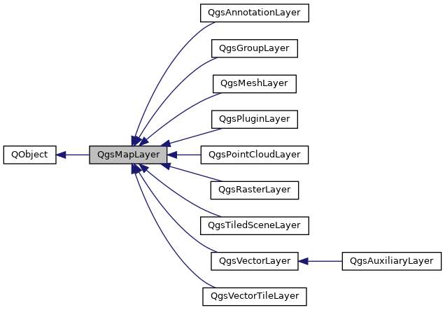
This is the base class for all map layer types (vector, raster, mesh, point cloud, annotations, etc).
Definition at line 82 of file qgsmaplayer.h.
Member Typedef Documentation
◆ LayerFlags
| typedef QFlags< LayerFlag > QgsMapLayer::LayerFlags |
Definition at line 170 of file qgsmaplayer.h.
◆ ReadFlags
| typedef QFlags< ReadFlag > QgsMapLayer::ReadFlags |
Definition at line 673 of file qgsmaplayer.h.
◆ SaveStyleResults
| typedef QFlags< SaveStyleResult > QgsMapLayer::SaveStyleResults |
◆ StyleCategories
| typedef QFlags< StyleCategory > QgsMapLayer::StyleCategories |
Definition at line 204 of file qgsmaplayer.h.
Member Enumeration Documentation
◆ LayerFlag
Flags for the map layer.
- Note
- Flags are options specified by the user used for the UI but are not preventing any API call.
- Since
- QGIS 3.4
Definition at line 162 of file qgsmaplayer.h.
◆ PropertyType
Maplayer has a style and a metadata property.
| Enumerator | |
|---|---|
| Style | |
| Metadata | |
Definition at line 151 of file qgsmaplayer.h.
◆ ReadFlag
Flags which control project read behavior.
- Since
- QGIS 3.10
Definition at line 665 of file qgsmaplayer.h.
◆ SaveStyleResult
|
strong |
Results of saving styles to database.
- Since
- QGIS 4.0
Definition at line 776 of file qgsmaplayer.h.
◆ StyleCategory
Categories of style to distinguish appropriate sections for import/export.
- Since
- QGIS 3.4
Definition at line 177 of file qgsmaplayer.h.
Constructor & Destructor Documentation
◆ QgsMapLayer() [1/2]
| QgsMapLayer::QgsMapLayer | ( | Qgis::LayerType | type = Qgis::LayerType::Vector, |
| const QString & | name = QString(), | ||
| const QString & | source = QString() ) |
Constructor for QgsMapLayer.
- Parameters
-
type layer type name display name for the layer source datasource of layer
Definition at line 92 of file qgsmaplayer.cpp.
◆ ~QgsMapLayer()
|
override |
Definition at line 120 of file qgsmaplayer.cpp.
◆ QgsMapLayer() [2/2]
|
delete |
Member Function Documentation
◆ abstract()
| QString QgsMapLayer::abstract | ( | ) | const |
Returns the abstract of the layer used by QGIS Server in GetCapabilities request.
- Deprecated
- QGIS 3.38. Use serverProperties()->abstract() instead.
Definition at line 296 of file qgsmaplayer.cpp.
◆ accept() [1/2]
|
virtual |
Accepts the specified object visitor, causing it to visit all relevant objects associated with the layer.
Returns true if the visitor should continue visiting other objects, or false if visiting should be canceled.
- Since
- QGIS 4.0
Reimplemented in QgsRasterLayer.
Definition at line 2961 of file qgsmaplayer.cpp.
◆ accept() [2/2]
|
virtual |
Accepts the specified symbology visitor, causing it to visit all symbols associated with the layer.
Returns true if the visitor should continue visiting other objects, or false if visiting should be canceled.
- Since
- QGIS 3.10
Reimplemented in QgsRasterLayer.
Definition at line 2954 of file qgsmaplayer.cpp.
◆ appendError()
|
inlineprotected |
Add error message.
Definition at line 2342 of file qgsmaplayer.h.
◆ attribution()
| QString QgsMapLayer::attribution | ( | ) | const |
Returns the attribution of the layer used by QGIS Server in GetCapabilities request.
- Deprecated
- QGIS 3.38. Use serverProperties()->attribution() instead.
Definition at line 352 of file qgsmaplayer.cpp.
◆ attributionUrl()
| QString QgsMapLayer::attributionUrl | ( | ) | const |
Returns the attribution URL of the layer used by QGIS Server in GetCapabilities request.
- Deprecated
- QGIS 3.38. Use serverProperties()->attributionUrl() instead.
Definition at line 366 of file qgsmaplayer.cpp.
◆ autoRefreshInterval()
| int QgsMapLayer::autoRefreshInterval | ( | ) | const |
Returns the auto refresh interval (in milliseconds).
Note that auto refresh is only active when hasAutoRefreshEnabled() is true.
Definition at line 1120 of file qgsmaplayer.cpp.
◆ autoRefreshIntervalChanged
|
signal |
Emitted when the auto refresh interval changes.
- See also
- setAutoRefreshInterval()
◆ autoRefreshMode()
| Qgis::AutoRefreshMode QgsMapLayer::autoRefreshMode | ( | ) | const |
Returns the layer's automatic refresh mode.
- Since
- QGIS 3.34
Definition at line 1113 of file qgsmaplayer.cpp.
◆ beforeResolveReferences
|
signal |
Emitted when all layers are loaded and references can be resolved, just before the references of this layer are resolved.
- Since
- QGIS 3.10
◆ blendMode()
| QPainter::CompositionMode QgsMapLayer::blendMode | ( | ) | const |
Returns the current blending mode for a layer.
- See also
- setBlendMode()
Definition at line 549 of file qgsmaplayer.cpp.
◆ blendModeChanged
|
signal |
Signal emitted when the blend mode is changed, through QgsMapLayer::setBlendMode().
◆ clone() [1/2]
|
pure virtual |
Returns a new instance equivalent to this one except for the id which is still unique.
- Returns
- a new layer instance
Implemented in QgsAnnotationLayer, QgsAuxiliaryLayer, QgsGroupLayer, QgsMeshLayer, QgsPluginLayer, QgsPointCloudLayer, QgsRasterLayer, QgsTiledSceneLayer, QgsVectorLayer, and QgsVectorTileLayer.
◆ clone() [2/2]
|
protected |
Copies attributes like name, short name, ... into another layer.
- Parameters
-
layer The copy recipient
Definition at line 128 of file qgsmaplayer.cpp.
◆ configChanged
|
signal |
Emitted whenever the configuration is changed.
The project listens to this signal to be marked as dirty.
◆ createMapRenderer()
|
pure virtual |
Returns new instance of QgsMapLayerRenderer that will be used for rendering of given context.
Implemented in QgsAnnotationLayer, QgsGroupLayer, QgsMeshLayer, QgsPointCloudLayer, QgsRasterLayer, QgsTiledSceneLayer, QgsVectorLayer, and QgsVectorTileLayer.
◆ crs()
| QgsCoordinateReferenceSystem QgsMapLayer::crs | ( | ) | const |
Returns the layer's spatial reference system.
- Warning
- Since QGIS 3.38, consider using crs3D() whenever transforming 3D data or whenever z/elevation value handling is important.
- See also
- setCrs()
- crs3D()
- verticalCrs()
- crsChanged()
Definition at line 1246 of file qgsmaplayer.cpp.
◆ crs3D()
| QgsCoordinateReferenceSystem QgsMapLayer::crs3D | ( | ) | const |
Returns the CRS to use for the layer when transforming 3D data, or when z/elevation value handling is important.
The returned CRS will take into account verticalCrs() when appropriate, e.g. it may return a compound CRS consisting of crs() + verticalCrs(). This method may still return a 2D CRS, e.g in the case that crs() is a 2D CRS and no verticalCrs() has been set for the layer. Check QgsCoordinateReferenceSystem::type() on the returned value to determine the type of CRS returned by this method.
- Warning
- It is NOT guaranteed that the returned CRS will actually be a 3D CRS, but rather it is guaranteed that the returned CRS is ALWAYS the most appropriate CRS to use when handling 3D data.
- See also
- crs()
- verticalCrs()
- crs3DChanged()
- Since
- QGIS 3.38
Definition at line 1284 of file qgsmaplayer.cpp.
◆ crs3DChanged
|
signal |
Emitted when the crs3D() of the layer has changed.
- See also
- crs3D()
- crsChanged()
- verticalCrsChanged()
- Since
- QGIS 3.38
◆ crsChanged
|
signal |
Emitted when the crs() of the layer has changed.
◆ crsHtmlMetadata()
|
protected |
Returns a HTML fragment containing the layer's CRS metadata, for use in the htmlMetadata() method.
- Note
- Not available in Python bindings.
- Since
- QGIS 3.20
Definition at line 3333 of file qgsmaplayer.cpp.
◆ customEnumProperty()
|
inline |
Returns the property value for a property based on an enum.
This forces the output to be a valid and existing entry of the enum. Hence if the property value is incorrect, the given default value is returned. This tries first with property as a string (as the enum) and then as an integer value.
- Note
- The enum needs to be declared with Q_ENUM, and flags with Q_FLAG (not Q_FLAGS).
- Since
- QGIS 3.22
Definition at line 860 of file qgsmaplayer.h.
◆ customFlagProperty()
|
inline |
Returns the property value for a property based on a flag.
This forces the output to be a valid and existing entry of the flag. Hence if the property value is incorrect, the given default value is returned. This tries first with property as a string (using a byte array) and then as an integer value.
- Note
- The flag needs to be declared with Q_FLAG (not Q_FLAGS).
- for Python bindings, a custom implementation is achieved in Python directly.
- Since
- QGIS 3.22
Definition at line 936 of file qgsmaplayer.h.
◆ customProperties()
| const QgsObjectCustomProperties & QgsMapLayer::customProperties | ( | ) | const |
Read all custom properties from layer.
Properties are stored in a map and saved in project file.
- See also
- setCustomProperties
- Since
- QGIS 3.14
Definition at line 2600 of file qgsmaplayer.cpp.
◆ customProperty()
| QVariant QgsMapLayer::customProperty | ( | const QString & | value, |
| const QVariant & | defaultValue = QVariant() ) const |
Read a custom property from layer.
Properties are stored in a map and saved in project file.
- See also
- setCustomProperty()
Definition at line 2607 of file qgsmaplayer.cpp.
◆ customPropertyChanged
|
signal |
Emitted when a custom property of the layer has been changed or removed.
- Since
- QGIS 3.18
◆ customPropertyHtmlMetadata()
|
protected |
Returns an HTML fragment containing custom property information, for use in the htmlMetadata() method.
- Note
- Not available in Python bindings.
- Since
- QGIS 3.40
Definition at line 3293 of file qgsmaplayer.cpp.
◆ customPropertyKeys()
| QStringList QgsMapLayer::customPropertyKeys | ( | ) | const |
Returns list of all keys within custom properties.
Properties are stored in a map and saved in project file.
- See also
- customProperty()
Definition at line 2571 of file qgsmaplayer.cpp.
◆ dataChanged
|
signal |
Data of layer changed.
◆ dataProvider() [1/2]
|
virtual |
Returns the layer's data provider, it may be nullptr.
Reimplemented in QgsAnnotationLayer, QgsGroupLayer, QgsMeshLayer, QgsPluginLayer, QgsPointCloudLayer, QgsRasterLayer, QgsTiledSceneLayer, QgsVectorLayer, and QgsVectorTileLayer.
Definition at line 242 of file qgsmaplayer.cpp.
◆ dataProvider() [2/2]
|
virtual |
Returns the layer's data provider in a const-correct manner, it may be nullptr.
- Note
- not available in Python bindings
Reimplemented in QgsAnnotationLayer, QgsGroupLayer, QgsMeshLayer, QgsPluginLayer, QgsPointCloudLayer, QgsRasterLayer, QgsTiledSceneLayer, QgsVectorLayer, and QgsVectorTileLayer.
Definition at line 249 of file qgsmaplayer.cpp.
◆ dataSourceChanged
|
signal |
◆ dataUrl()
| QString QgsMapLayer::dataUrl | ( | ) | const |
Returns the DataUrl of the layer used by QGIS Server in GetCapabilities request.
- Deprecated
- QGIS 3.38. Use serverProperties()->dataUrl() instead.
Definition at line 324 of file qgsmaplayer.cpp.
◆ dataUrlFormat()
| QString QgsMapLayer::dataUrlFormat | ( | ) | const |
Returns the DataUrl format of the layer used by QGIS Server in GetCapabilities request.
- Deprecated
- QGIS 3.38. Use serverProperties()->dataUrlFormat() instead.
Definition at line 338 of file qgsmaplayer.cpp.
◆ decodedSource()
|
protectedvirtual |
Called by readLayerXML(), used by derived classes to decode provider's specific data source from project files.
Typically resolving absolute or relative paths, usernames and passwords or drivers prefixes ("HDF5:")
- Parameters
-
source data source to decode, typically read from layer's DOM element "datasource" dataProvider string identification of data provider (e.g. "ogr"), typically read from layer's DOM element context reading context (e.g. for conversion between relative and absolute paths)
- Returns
- decoded source, typically to be used as the layer's datasource
- Since
- QGIS 3.2
Reimplemented in QgsMeshLayer, QgsPointCloudLayer, QgsRasterLayer, QgsTiledSceneLayer, QgsVectorLayer, and QgsVectorTileLayer.
Definition at line 936 of file qgsmaplayer.cpp.
◆ deleteStyleFromDatabase()
|
virtual |
Deletes a style from the database.
- Parameters
-
styleId the provider's layer_styles table id of the style to delete msgError will be set to a descriptive error message if any occurs
- Returns
truein case of success
Definition at line 2640 of file qgsmaplayer.cpp.
◆ dependencies()
|
virtual |
Gets the list of dependencies.
This includes data dependencies set by the user (
- See also
- setDataDependencies) as well as dependencies given by the provider
- Returns
- a set of QgsMapLayerDependency
Reimplemented in QgsVectorLayer.
Definition at line 2982 of file qgsmaplayer.cpp.
◆ dependenciesChanged
|
signal |
Emitted when dependencies are changed.
◆ editingStarted
|
signal |
Emitted when editing on this layer has started.
- Since
- QGIS 3.22 in the QgsMapLayer base class
◆ editingStopped
|
signal |
Emitted when edited changes have been successfully written to the data provider.
- Since
- QGIS 3.22 in the QgsMapLayer base class
◆ elevationProperties()
|
inlinevirtual |
Returns the layer's elevation properties.
This may be nullptr, depending on the layer type.
- Since
- QGIS 3.18
Reimplemented in QgsMeshLayer, QgsPointCloudLayer, QgsRasterLayer, QgsTiledSceneLayer, and QgsVectorLayer.
Definition at line 1820 of file qgsmaplayer.h.
◆ emitStyleChanged
|
slot |
Triggers an emission of the styleChanged() signal.
Definition at line 2896 of file qgsmaplayer.cpp.
◆ encodedSource()
|
protectedvirtual |
Called by writeLayerXML(), used by derived classes to encode provider's specific data source to project files.
Typically resolving absolute or relative paths, usernames and passwords or drivers prefixes ("HDF5:")
- Parameters
-
source data source to encode, typically QgsMapLayer::source() context writing context (e.g. for conversion between relative and absolute paths)
- Returns
- encoded source, typically to be written in the DOM element "datasource"
- Since
- QGIS 3.2
Reimplemented in QgsMeshLayer, QgsPointCloudLayer, QgsRasterLayer, QgsTiledSceneLayer, QgsVectorLayer, and QgsVectorTileLayer.
Definition at line 928 of file qgsmaplayer.cpp.
◆ error()
|
virtual |
Gets current status error.
This error describes some principal problem for which layer cannot work and thus is not valid. It is not last error after accessing data by draw() etc.
Definition at line 2736 of file qgsmaplayer.cpp.
◆ exportNamedMetadata()
| void QgsMapLayer::exportNamedMetadata | ( | QDomDocument & | doc, |
| QString & | errorMsg ) const |
Export the current metadata of this layer as named metadata in a QDomDocument.
- Parameters
-
doc the target QDomDocument errorMsg will be set to a descriptive message if an error occurs
Definition at line 1772 of file qgsmaplayer.cpp.
◆ exportNamedStyle()
|
virtual |
Export the properties of this layer as named style in a QDomDocument.
- Parameters
-
doc the target QDomDocument errorMsg will be set to a descriptive message if an error occurs context read write context categories the style categories to export during the execution of writeSymbology
Definition at line 1793 of file qgsmaplayer.cpp.
◆ exportSldStyle()
|
virtual |
Export the properties of this layer as SLD style in a QDomDocument.
- Parameters
-
doc the target QDomDocument errorMsg will be set to a descriptive message if an error occurs during the execution of writeSymbology
- Deprecated
- QGIS 3.44. Use exportSldStyleV3() instead.
Definition at line 2107 of file qgsmaplayer.cpp.
◆ exportSldStyleV2()
|
virtual |
Export the properties of this layer as SLD style in a QDomDocument.
- Parameters
-
doc the target QDomDocument errorMsg will be set to a descriptive message if an error occurs during the execution of writeSymbology() exportContext SLD export context
- Deprecated
- QGIS 3.44. Use exportSldStyleV3() instead.
Definition at line 2115 of file qgsmaplayer.cpp.
◆ exportSldStyleV3()
|
virtual |
Export the properties of this layer as SLD style in a QDomDocument.
Errors and warnings raised during the conversion should be retrieved from exportContext.
- Parameters
-
exportContext SLD export context
- Since
- QGIS 3.44
Definition at line 2123 of file qgsmaplayer.cpp.
◆ extensionPropertyType()
|
static |
Returns the extension of a Property.
- Returns
- The extension
Definition at line 79 of file qgsmaplayer.cpp.
◆ extent()
|
virtual |
Returns the extent of the layer.
Reimplemented in QgsAnnotationLayer, QgsGroupLayer, QgsMeshLayer, QgsPointCloudLayer, QgsTiledSceneLayer, and QgsVectorLayer.
Definition at line 523 of file qgsmaplayer.cpp.
◆ extent3D()
|
virtual |
Returns the 3D extent of the layer.
- Since
- QGIS 3.36
Reimplemented in QgsVectorLayer.
Definition at line 530 of file qgsmaplayer.cpp.
◆ flags()
| QgsMapLayer::LayerFlags QgsMapLayer::flags | ( | ) | const |
Returns the flags for this layer.
- Note
- Flags are options specified by the user used for the UI but are not preventing any API call. For instance, even if the Removable flag is not set, the layer can still be removed with the API but the action will not be listed in the legend menu.
- See also
- properties()
- Since
- QGIS 3.4
Definition at line 171 of file qgsmaplayer.cpp.
◆ flagsChanged
|
signal |
◆ formatLayerName()
|
static |
A convenience function to capitalize and format a layer name.
Definition at line 1429 of file qgsmaplayer.cpp.
◆ generalHtmlMetadata()
|
protected |
Returns an HTML fragment containing general metadata information, for use in the htmlMetadata() method.
- Note
- Not available in Python bindings.
- Since
- QGIS 3.22
Definition at line 3202 of file qgsmaplayer.cpp.
◆ generateId()
|
static |
Generates an unique identifier for this layer, the generate ID is prefixed by layerName.
- Since
- QGIS 3.8
Definition at line 2937 of file qgsmaplayer.cpp.
◆ getStyleFromDatabase()
|
virtual |
Returns the named style corresponding to style id provided.
Definition at line 2633 of file qgsmaplayer.cpp.
◆ hasAutoRefreshEnabled()
| bool QgsMapLayer::hasAutoRefreshEnabled | ( | ) | const |
Returns true if auto refresh is enabled for the layer.
- Deprecated
- QGIS 3.40. Use autoRefreshMode() instead.
Definition at line 1105 of file qgsmaplayer.cpp.
◆ hasDependencyCycle()
|
inlineprotected |
Checks whether a new set of dependencies will introduce a cycle this method is now deprecated and always return false, because circular dependencies are now correctly managed.
- Deprecated
- QGIS 3.10
Definition at line 2374 of file qgsmaplayer.h.
◆ hasMapTips()
|
virtual |
Returns true if the layer contains map tips.
- See also
- mapTipTemplate()
- setMapTipTemplate()
Reimplemented in QgsVectorLayer.
Definition at line 2968 of file qgsmaplayer.cpp.
◆ hasScaleBasedVisibility()
| bool QgsMapLayer::hasScaleBasedVisibility | ( | ) | const |
Returns whether scale based visibility is enabled for the layer.
- Returns
trueif scale based visibility is enabled
Definition at line 1097 of file qgsmaplayer.cpp.
◆ htmlMetadata()
|
virtual |
Obtain a formatted HTML string containing assorted metadata for this layer.
Reimplemented in QgsAnnotationLayer, QgsGroupLayer, QgsMeshLayer, QgsPointCloudLayer, QgsRasterLayer, QgsTiledSceneLayer, QgsVectorLayer, and QgsVectorTileLayer.
Definition at line 2882 of file qgsmaplayer.cpp.
◆ id()
| QString QgsMapLayer::id | ( | ) | const |
Returns the layer's unique ID, which is used to access this layer from QgsProject.
- See also
- setId()
- idChanged()
Definition at line 196 of file qgsmaplayer.cpp.
◆ idChanged
|
signal |
◆ importNamedMetadata()
| bool QgsMapLayer::importNamedMetadata | ( | QDomDocument & | document, |
| QString & | errorMessage ) |
Import the metadata of this layer from a QDomDocument.
- Parameters
-
document source QDomDocument errorMessage will be set to a descriptive message if an error occurs
- Returns
trueon success
Definition at line 1713 of file qgsmaplayer.cpp.
◆ importNamedStyle()
|
virtual |
Import the properties of this layer from a QDomDocument.
- Parameters
-
doc source QDomDocument errorMsg will be set to a descriptive message if an error occurs during the execution of readSymbology() categories the style categories to import
- Returns
trueon success
Definition at line 1727 of file qgsmaplayer.cpp.
◆ invalidateWgs84Extent()
|
protected |
Invalidates the WGS84 extent.
If FlagTrustLayerMetadata is enabled, the extent is not invalidated because we want to trust metadata whatever happens.
- Since
- QGIS 3.20
Definition at line 3191 of file qgsmaplayer.cpp.
◆ isEditable()
|
virtual |
Returns true if the layer can be edited.
Reimplemented in QgsAnnotationLayer, QgsMeshLayer, QgsPointCloudLayer, and QgsVectorLayer.
Definition at line 2743 of file qgsmaplayer.cpp.
◆ isInScaleRange()
| bool QgsMapLayer::isInScaleRange | ( | double | scale | ) | const |
Tests whether the layer should be visible at the specified scale.
The scale value indicates the scale denominator, e.g. 1000.0 for a 1:1000 map.
- Returns
trueif the layer is visible at the given scale.
Definition at line 1086 of file qgsmaplayer.cpp.
◆ isModified()
|
virtual |
Returns true if the layer has been modified since last commit/save.
- Note
- default implementation returns
false.
- Since
- QGIS 3.22 in the base class QgsMapLayer.
Reimplemented in QgsMeshLayer, QgsPointCloudLayer, and QgsVectorLayer.
Definition at line 2750 of file qgsmaplayer.cpp.
◆ isRefreshOnNotifyEnabled()
|
inline |
Returns true if the refresh on provider nofification is enabled.
Definition at line 1752 of file qgsmaplayer.h.
◆ isSpatial()
|
virtual |
Returns true if the layer is considered a spatial layer, ie it has some form of geometry associated with it.
Reimplemented in QgsRasterLayer, and QgsVectorLayer.
Definition at line 2757 of file qgsmaplayer.cpp.
◆ isTemporary()
|
virtual |
Returns true if the layer is considered a temporary layer.
These include memory-only layers such as those created by the "memory" data provider, layers stored inside a local temporary folder (such as the "/tmp" folder on Linux) or layer with temporary data (as temporary mesh layer dataset)
- Since
- QGIS 3.10.1
Definition at line 2764 of file qgsmaplayer.cpp.
◆ isValid()
| bool QgsMapLayer::isValid | ( | ) | const |
Returns the status of the layer.
An invalid layer is one which has a bad datasource or other problem. Child classes set this flag when initialized.
- Returns
trueif the layer is valid and can be accessed
Definition at line 1070 of file qgsmaplayer.cpp.
◆ isValidChanged
|
signal |
Emitted when the validity of this layer changed.
- Since
- QGIS 3.16
◆ keywordList()
| QString QgsMapLayer::keywordList | ( | ) | const |
Returns the keyword list of the layer used by QGIS Server in GetCapabilities request.
- Deprecated
- QGIS 3.38. Use serverProperties()->keywordList() instead.
Definition at line 310 of file qgsmaplayer.cpp.
◆ layerModified
|
signal |
Emitted when modifications has been done on layer.
- Since
- QGIS 3.22 in the QgsMapLayer base class
◆ legend()
| QgsMapLayerLegend * QgsMapLayer::legend | ( | ) | const |
Can be nullptr.
Definition at line 2821 of file qgsmaplayer.cpp.
◆ legendChanged
|
signal |
Signal emitted when legend of the layer has changed.
◆ legendPlaceholderImage()
|
inline |
Returns path to the placeholder image or an empty string if a generated legend is shown.
- Returns
- placeholder image path
- Since
- QGIS 3.22
Definition at line 1835 of file qgsmaplayer.h.
◆ legendUrl()
| QString QgsMapLayer::legendUrl | ( | ) | const |
Returns the URL for the layer's legend.
- Deprecated
- QGIS 3.44. Use serverProperties()->legendUrl() instead.
Definition at line 380 of file qgsmaplayer.cpp.
◆ legendUrlFormat()
| QString QgsMapLayer::legendUrlFormat | ( | ) | const |
Returns the format for a URL based layer legend.
- Deprecated
- QGIS 3.44. Use serverProperties()->legendUrlFormat() instead.
Definition at line 394 of file qgsmaplayer.cpp.
◆ listStylesInDatabase()
|
virtual |
Lists all the style in db split into related to the layer and not related to.
- Parameters
-
ids the list in which will be stored the style db ids names the list in which will be stored the style names descriptions the list in which will be stored the style descriptions msgError will be set to a descriptive error message if any occurs
- Returns
- the number of styles related to current layer (-1 on not implemented)
- Note
- Since QGIS 3.2 Styles related to the layer are ordered with the default style first then by update time for Postgres, MySQL and Spatialite.
Definition at line 2626 of file qgsmaplayer.cpp.
◆ loadDefaultMetadata()
|
virtual |
Retrieve the default metadata for this layer if one exists (either as a .qmd file on disk or as a record in the users metadata table in their personal qgis.db).
- Parameters
-
resultFlag will be set to falseif we did not manage to load the default metadata.
- Returns
- a QString with any status messages
Reimplemented in QgsTiledSceneLayer, and QgsVectorTileLayer.
Definition at line 1517 of file qgsmaplayer.cpp.
◆ loadDefaultStyle()
|
virtual |
Retrieve the default style for this layer if one exists (either as a .qml file on disk or as a record in the users style table in their personal qgis.db).
- Parameters
-
resultFlag will be set to falseif we did not manage to load the default style.
- Returns
- a QString with any status messages
- See also
- loadNamedStyle()
Reimplemented in QgsMeshLayer, QgsPointCloudLayer, QgsTiledSceneLayer, QgsVectorLayer, and QgsVectorTileLayer.
Definition at line 1531 of file qgsmaplayer.cpp.
◆ loadNamedMetadata()
|
virtual |
Retrieve a named metadata for this layer if one exists (either as a .qmd file on disk or as a record in the users style table in their personal qgis.db).
- Parameters
-
uri the file name or other URI for the metadata file. First an attempt will be made to see if this is a file and load that, if that fails the qgis.db metadata table will be consulted to see if there is a metadata who's key matches the URI. resultFlag will be set to falseif we did not manage to load the default metadata.
- Returns
- a QString with any status messages
Definition at line 1853 of file qgsmaplayer.cpp.
◆ loadNamedMetadataFromDatabase()
| bool QgsMapLayer::loadNamedMetadataFromDatabase | ( | const QString & | db, |
| const QString & | uri, | ||
| QString & | qmd ) |
Retrieve a named metadata for this layer from a sqlite database.
- Parameters
-
db path to sqlite database uri uri for table qmd will be set to QMD xml metadata content from database
- Returns
trueif style was successfully loaded
Definition at line 1538 of file qgsmaplayer.cpp.
◆ loadNamedStyle() [1/2]
|
virtual |
Loads a named style from file/local db/datasource db.
- Parameters
-
theURI the URI of the style or the URI of the layer resultFlag will be set to trueif a named style is correctly loadedloadFromLocalDb if trueforces to load from local db instead of datasource onecategories the style categories to be loaded. flags flags controlling how the style should be loaded (since QGIS 3.38)
- Returns
- status message, which may indicate success or contain an error message
Reimplemented in QgsMeshLayer.
Definition at line 2691 of file qgsmaplayer.cpp.
◆ loadNamedStyle() [2/2]
|
virtual |
Retrieve a named style for this layer if one exists (either as a .qml file on disk or as a record in the users style table in their personal qgis.db).
- Parameters
-
uri the file name or other URI for the style file. First an attempt will be made to see if this is a file and load that, if that fails the qgis.db styles table will be consulted to see if there is a style who's key matches the URI. resultFlag will be set to falseif we did not manage to load the default style.categories the style categories to be loaded. flags flags controlling how the style should be loaded (since QGIS 3.38)
- Returns
- a QString with any status messages
- See also
- loadDefaultStyle()
Reimplemented in QgsMeshLayer.
Definition at line 1604 of file qgsmaplayer.cpp.
◆ loadNamedStyleFromDatabase()
|
virtual |
Retrieve a named style for this layer from a sqlite database.
- Parameters
-
db path to sqlite database uri uri for table qml will be set to QML style content from database
- Returns
trueif style was successfully loaded
Definition at line 1545 of file qgsmaplayer.cpp.
◆ loadSldStyle()
|
virtual |
Attempts to style the layer using the formatting from an SLD type file.
- Parameters
-
uri uri of source SLD file resultFlag will be set to falseif the SLD file could not be loaded
- Returns
- a string with any status or error messages
- See also
- saveSldStyle()
Definition at line 2286 of file qgsmaplayer.cpp.
◆ mapTipsEnabled()
| bool QgsMapLayer::mapTipsEnabled | ( | ) | const |
Returns true if map tips are enabled for this layer.
- Since
- QGIS 3.32
Definition at line 1031 of file qgsmaplayer.cpp.
◆ mapTipsEnabledChanged
|
signal |
Emitted when map tips are enabled or disabled for the layer.
- See also
- setMapTipsEnabled()
- Since
- QGIS 3.32
◆ mapTipTemplate()
| QString QgsMapLayer::mapTipTemplate | ( | ) | const |
The mapTip is a pretty, html representation for feature information.
It may also contain embedded expressions.
- Since
- QGIS 3.30
Definition at line 1002 of file qgsmaplayer.cpp.
◆ mapTipTemplateChanged
|
signal |
Emitted when the map tip template changes.
- Since
- QGIS 3.30
◆ maximumScale()
| double QgsMapLayer::maximumScale | ( | ) | const |
Returns the maximum map scale (i.e.
most "zoomed in" scale) at which the layer will be visible. The scale value indicates the scale denominator, e.g. 1000.0 for a 1:1000 map. A scale of 0 indicates no maximum scale visibility.
- Note
- Scale based visibility is only used if setScaleBasedVisibility() is set to
true.
Definition at line 1189 of file qgsmaplayer.cpp.
◆ metadata()
|
virtual |
Returns a reference to the layer's metadata store.
- See also
- setMetadata()
- metadataChanged()
Definition at line 1175 of file qgsmaplayer.cpp.
◆ metadataChanged
|
signal |
Emitted when the layer's metadata is changed.
- See also
- setMetadata()
- metadata()
◆ metadataUri()
|
virtual |
Retrieve the metadata URI for this layer (either as a .qmd file on disk or as a record in the users style table in their personal qgis.db).
- Returns
- a QString with the metadata file name
Definition at line 1481 of file qgsmaplayer.cpp.
◆ metadataUrl()
| QString QgsMapLayer::metadataUrl | ( | ) | const |
Returns the metadata URL of the layer used by QGIS Server in GetCapabilities request.
MetadataUrl is a a link to the detailed, standardized metadata about the data. Since QGIS 3.22, it returns the first metadata URL link.
- Returns
- the layer metadata URL
- See also
- serverProperties()
- Deprecated
- QGIS 3.22
Definition at line 420 of file qgsmaplayer.cpp.
◆ metadataUrlFormat()
| QString QgsMapLayer::metadataUrlFormat | ( | ) | const |
Returns the metadata format of the layer used by QGIS Server in GetCapabilities request.
MetadataUrlType indicates how the metadata is structured. Since QGIS 3.22, it returns the first metadata URL format.
- Returns
- the layer metadata format
- See also
- serverProperties()
- Deprecated
- QGIS 3.22
Definition at line 486 of file qgsmaplayer.cpp.
◆ metadataUrlType()
| QString QgsMapLayer::metadataUrlType | ( | ) | const |
Returns the metadata type of the layer used by QGIS Server in GetCapabilities request.
MetadataUrlType indicates the standard to which the metadata complies. Since QGIS 3.22, it returns the first metadata URL type.
- Returns
- the layer metadata type
- See also
- serverProperties()
- Deprecated
- QGIS 3.22
Definition at line 453 of file qgsmaplayer.cpp.
◆ minimumScale()
| double QgsMapLayer::minimumScale | ( | ) | const |
Returns the minimum map scale (i.e.
most "zoomed out" scale) at which the layer will be visible. The scale value indicates the scale denominator, e.g. 1000.0 for a 1:1000 map. A scale of 0 indicates no minimum scale visibility.
- Note
- Scale based visibility is only used if setScaleBasedVisibility() is set to
true.
Definition at line 1210 of file qgsmaplayer.cpp.
◆ name()
| QString QgsMapLayer::name | ( | ) | const |
Returns the display name of the layer.
- See also
- setName()
Definition at line 233 of file qgsmaplayer.cpp.
◆ nameChanged
|
signal |
Emitted when the name has been changed.
◆ opacity()
|
virtual |
Returns the opacity for the layer, where opacity is a value between 0 (totally transparent) and 1.0 (fully opaque).
- See also
- setOpacity()
- opacityChanged()
- Note
- Prior to QGIS 3.18, this method was available for vector layers only
- Since
- QGIS 3.18
Reimplemented in QgsRasterLayer.
Definition at line 568 of file qgsmaplayer.cpp.
◆ opacityChanged
|
signal |
Emitted when the layer's opacity is changed, where opacity is a value between 0 (transparent) and 1 (opaque).
- See also
- setOpacity()
- opacity()
- Note
- Prior to QGIS 3.18, this signal was available for vector layers only
- Since
- QGIS 3.18
◆ operator=()
|
delete |
◆ originalXmlProperties()
| QString QgsMapLayer::originalXmlProperties | ( | ) | const |
Returns the XML properties of the original layer as they were when the layer was first read from the project file.
In case of new layers this is normally empty.
The storage format for the XML is qlr
- Since
- QGIS 3.6
Definition at line 2923 of file qgsmaplayer.cpp.
◆ profileSource()
|
inlinevirtual |
Returns the layer's profile source if it has profile capabilities.
This may be nullptr, depending on the layer type.
- Since
- QGIS 3.44
Reimplemented in QgsMeshLayer, QgsPointCloudLayer, QgsRasterLayer, and QgsVectorLayer.
Definition at line 1828 of file qgsmaplayer.h.
◆ project
|
slot |
Returns the parent project if this map layer is added to a project.
Otherwise returns nullptr
- Since
- QGIS 3.18
Definition at line 3028 of file qgsmaplayer.cpp.
◆ properties()
|
virtual |
Returns the map layer properties of this layer.
- Note
- properties() differ from flags() in that flags() are user settable, and reflect options that users can enable for map layers. In contrast properties() are reflections of inherent capabilities for the layer, which cannot be directly changed by users.
- Since
- QGIS 3.22
Reimplemented in QgsAnnotationLayer, QgsRasterLayer, QgsTiledSceneLayer, and QgsVectorTileLayer.
Definition at line 189 of file qgsmaplayer.cpp.
◆ providerMetadata()
| QgsProviderMetadata * QgsMapLayer::providerMetadata | ( | ) | const |
Returns the layer data provider's metadata, it may be nullptr.
- Since
- QGIS 3.40
Definition at line 256 of file qgsmaplayer.cpp.
◆ providerReadFlags()
|
static |
Returns provider read flag deduced from layer read flags layerReadFlags and a dom node layerNode that describes a layer (corresponding to maplayer tag in a DOM document project file read by QgsProject).
This static method is used when loading a project.
- Since
- QGIS 3.32
Definition at line 1038 of file qgsmaplayer.cpp.
◆ providerType()
| QString QgsMapLayer::providerType | ( | ) | const |
Returns the provider type (provider key) for this layer.
Definition at line 2452 of file qgsmaplayer.cpp.
◆ publicSource()
| QString QgsMapLayer::publicSource | ( | bool | hidePassword = false | ) | const |
Gets a version of the internal layer definition that has sensitive bits removed (for example, the password).
This function should be used when displaying the source name for general viewing.
- Parameters
-
hidePassword trueto replace the value of credentials with 'xxxxxxxx',falseto completely remove credentials (key and value). Since QGIS 3.34
- See also
- source()
Definition at line 500 of file qgsmaplayer.cpp.
◆ readCommonStyle()
|
protected |
Read style data common to all layer types.
Definition at line 2459 of file qgsmaplayer.cpp.
◆ readCustomProperties()
|
protected |
Read custom properties from project file.
- Parameters
-
layerNode note to read from keyStartsWith reads only properties starting with the specified string (or all if the string is empty)
Definition at line 955 of file qgsmaplayer.cpp.
◆ readLayerXml()
| bool QgsMapLayer::readLayerXml | ( | const QDomElement & | layerElement, |
| QgsReadWriteContext & | context, | ||
| QgsMapLayer::ReadFlags | flags = QgsMapLayer::ReadFlags(), | ||
| QgsDataProvider * | preloadedProvider = nullptr ) |
Sets state from DOM document.
- Parameters
-
layerElement The DOM element corresponding to maplayer tag context writing context (e.g. for conversion between relative and absolute paths) flags optional argument which can be used to control layer reading behavior. preloadedProvider optional preloaded data provider that will be used as data provider for this layer, takes ownership (since QGIS 3.32)
- Note
- The DOM node corresponds to a DOM document project file XML element read by QgsProject.
This, in turn, calls readXml() (and then readSymbology()), which is overridable by sub-classes so that they can read their own specific state from the given DOM node.
Invoked by QgsProject::read().
- Returns
trueif successful
Definition at line 576 of file qgsmaplayer.cpp.
◆ readOnly()
|
inline |
Returns if this layer is read only.
Definition at line 551 of file qgsmaplayer.h.
◆ readSld()
|
inlinevirtual |
Reimplemented in QgsVectorLayer.
Definition at line 1400 of file qgsmaplayer.h.
◆ readStyle()
|
virtual |
Read the style for the current layer from the DOM node supplied.
- Parameters
-
node node that will contain the style definition for this layer. errorMessage reference to string that will be updated with any error messages context reading context (used for transform from relative to absolute paths) categories the style categories to be read
- Returns
truein case of success.
- Note
- To be implemented in subclasses. Default implementation does nothing and returns
false.
Reimplemented in QgsAnnotationLayer, QgsMeshLayer, QgsPointCloudLayer, QgsRasterLayer, QgsTiledSceneLayer, and QgsVectorLayer.
Definition at line 2365 of file qgsmaplayer.cpp.
◆ readStyleManager()
|
protected |
Read style manager's configuration (if any). To be called by subclasses.
Definition at line 979 of file qgsmaplayer.cpp.
◆ readSymbology()
|
pure virtual |
Read the symbology for the current layer from the DOM node supplied.
- Parameters
-
node node that will contain the symbology definition for this layer. errorMessage reference to string that will be updated with any error messages context reading context (used for transform from relative to absolute paths) categories the style categories to be read
- Returns
truein case of success.
Implemented in QgsAnnotationLayer, QgsGroupLayer, QgsMeshLayer, QgsPointCloudLayer, QgsRasterLayer, QgsTiledSceneLayer, QgsVectorLayer, and QgsVectorTileLayer.
◆ readXml()
|
protectedvirtual |
Called by readLayerXML(), used by children to read state specific to them from project files.
Reimplemented in QgsAnnotationLayer, QgsGroupLayer, QgsMeshLayer, QgsPointCloudLayer, QgsRasterLayer, QgsTiledSceneLayer, QgsVectorLayer, and QgsVectorTileLayer.
Definition at line 724 of file qgsmaplayer.cpp.
◆ recalculateExtents
|
signal |
This is used to send a request that any mapcanvas using this layer update its extents.
◆ refreshOnNotifyMessage()
|
inline |
Returns the message that should be notified by the provider to triggerRepaint.
Definition at line 1746 of file qgsmaplayer.h.
◆ reload()
|
inlinevirtual |
Synchronises with changes in the datasource.
Reimplemented in QgsMeshLayer, QgsRasterLayer, and QgsVectorLayer.
Definition at line 556 of file qgsmaplayer.h.
◆ removeCustomProperty()
| void QgsMapLayer::removeCustomProperty | ( | const QString & | key | ) |
Remove a custom property from layer.
Properties are stored in a map and saved in project file.
- See also
- setCustomProperty()
Definition at line 2615 of file qgsmaplayer.cpp.
◆ renderer3D()
| QgsAbstract3DRenderer * QgsMapLayer::renderer3D | ( | ) | const |
Returns 3D renderer associated with the layer.
May be nullptr.
Definition at line 2848 of file qgsmaplayer.cpp.
◆ renderer3DChanged
|
signal |
Signal emitted when 3D renderer associated with the layer has changed.
◆ rendererChanged
|
signal |
Signal emitted when renderer is changed.
- See also
- styleChanged()
◆ repaintRequested
|
signal |
By emitting this signal the layer tells that either appearance or content have been changed and any view showing the rendered layer should refresh itself.
If deferredUpdate is true then the layer will only be repainted when the canvas is next re-rendered, and will not trigger any canvas redraws itself.
◆ request3DUpdate
|
signal |
Signal emitted when a layer requires an update in any 3D maps.
- Since
- QGIS 3.18
◆ resolveReferences()
|
virtual |
Resolve references to other layers (kept as layer IDs after reading XML) into layer objects.
Reimplemented in QgsAnnotationLayer, QgsGroupLayer, and QgsVectorLayer.
Definition at line 945 of file qgsmaplayer.cpp.
◆ saveDefaultMetadata()
|
virtual |
Save the current metadata of this layer as the default metadata (either as a .qmd file on disk or as a record in the users style table in their personal qgis.db).
- Parameters
-
resultFlag will be set to falseif we did not manage to save the default metadata.
- Returns
- a QString with any status messages
Definition at line 1488 of file qgsmaplayer.cpp.
◆ saveDefaultStyle() [1/2]
|
virtual |
Save the properties of this layer as the default style (either as a .qml file on disk or as a record in the users style table in their personal qgis.db).
- Parameters
-
resultFlag will be set to falseif we did not manage to save the default style.
- Returns
- a QString with any status messages
- See also
- loadNamedStyle()
- saveNamedStyle()
- Deprecated
- QGIS 3.26
Definition at line 1832 of file qgsmaplayer.cpp.
◆ saveDefaultStyle() [2/2]
|
virtual |
Save the properties of this layer as the default style (either as a .qml file on disk or as a record in the users style table in their personal qgis.db).
- Parameters
-
resultFlag will be set to falseif we did not manage to save the default style.categories the style categories to be saved (since QGIS 3.26)
- Returns
- a QString with any status messages
- See also
- loadNamedStyle()
- saveNamedStyle()
Definition at line 1839 of file qgsmaplayer.cpp.
◆ saveNamedMetadata()
| QString QgsMapLayer::saveNamedMetadata | ( | const QString & | uri, |
| bool & | resultFlag ) |
Save the current metadata of this layer as a named metadata (either as a .qmd file on disk or as a record in the users style table in their personal qgis.db).
- Parameters
-
uri the file name or other URI for the metadata file. First an attempt will be made to see if this is a file and save to that, if that fails the qgis.db metadata table will be used to create a metadata entry who's key matches the URI. resultFlag will be set to falseif we did not manage to save the default metadata.
- Returns
- a QString with any status messages
Definition at line 1846 of file qgsmaplayer.cpp.
◆ saveNamedStyle()
|
virtual |
Save the properties of this layer as a named style (either as a .qml file on disk or as a record in the users style table in their personal qgis.db).
- Parameters
-
uri the file name or other URI for the style file. First an attempt will be made to see if this is a file and save to that, if that fails the qgis.db styles table will be used to create a style entry who's key matches the URI. resultFlag will be set to falseif we did not manage to save the default style.categories the style categories to be saved.
- Returns
- a QString with any status messages
- See also
- saveDefaultStyle()
Definition at line 2100 of file qgsmaplayer.cpp.
◆ saveSldStyle()
|
virtual |
Saves the properties of this layer to an SLD format file.
- Parameters
-
uri uri of destination for exported SLD file. resultFlag will be set to falseif the SLD file could not be generated
- Returns
- a string with any status or error messages
- See also
- loadSldStyle()
- saveSldStyleV2()
Definition at line 2206 of file qgsmaplayer.cpp.
◆ saveSldStyleV2()
|
virtual |
Saves the properties of this layer to an SLD format file.
- Parameters
-
resultFlag will be set to falseif the SLD file could not be generatedexportContext SLD export context
- Returns
- a string with any status or error messages
- See also
- loadSldStyle()
- Since
- QGIS 3.30
Definition at line 2213 of file qgsmaplayer.cpp.
◆ saveStyleToDatabase()
|
virtual |
Saves QML and SLD representations of the layer's style to a table in the database.
- Parameters
-
name Style name description A description of the style useAsDefault Set to trueif style should be used as the default style for the layeruiFileContent msgError will be set to a descriptive error message if any occurs categories the style categories to be saved.
- Note
- Prior to QGIS 3.24, this method would show a message box warning when a style with the same styleName already existed to confirm replacing the style with the user. Since 3.24, calling this method will ALWAYS overwrite any existing style with the same name. Use QgsProviderRegistry::styleExists() to test in advance if a style already exists and handle this appropriately in your client code.
- Deprecated
- QGIS 4.0. Use saveStyleToDatabaseV2() instead.
Definition at line 2647 of file qgsmaplayer.cpp.
◆ saveStyleToDatabaseV2()
| QgsMapLayer::SaveStyleResults QgsMapLayer::saveStyleToDatabaseV2 | ( | const QString & | name, |
| const QString & | description, | ||
| bool | useAsDefault, | ||
| const QString & | uiFileContent, | ||
| QString & | msgError, | ||
| QgsMapLayer::StyleCategories | categories = QgsMapLayer::AllStyleCategories ) |
Saves QML and SLD representations of the layer's style to a table in the database.
- Parameters
-
name Style name description A description of the style useAsDefault Set to trueif style should be used as the default style for the layeruiFileContent msgError will be set to a descriptive error message if any occurs categories the style categories to be saved.
- Returns
- flags representing whether QML or SLD storing was successful
- Since
- QGIS 4.0
Definition at line 2652 of file qgsmaplayer.cpp.
◆ selectionProperties()
|
inlinevirtual |
Returns the layer's selection properties.
This may be nullptr, depending on the layer type.
- Since
- QGIS 3.34
Reimplemented in QgsVectorLayer.
Definition at line 1806 of file qgsmaplayer.h.
◆ serverProperties() [1/2]
|
inline |
Returns QGIS Server Properties for the map layer.
- Since
- QGIS 3.22
Definition at line 445 of file qgsmaplayer.h.
◆ serverProperties() [2/2]
|
inline |
Returns QGIS Server Properties const for the map layer.
- Since
- QGIS 3.22
Definition at line 451 of file qgsmaplayer.h.
◆ setAbstract()
| void QgsMapLayer::setAbstract | ( | const QString & | abstract | ) |
Sets the abstract of the layer used by QGIS Server in GetCapabilities request.
- Deprecated
- QGIS 3.38. Use serverProperties()->setAbstract() instead.
Definition at line 289 of file qgsmaplayer.cpp.
◆ setAttribution()
| void QgsMapLayer::setAttribution | ( | const QString & | attrib | ) |
Sets the attribution of the layerused by QGIS Server in GetCapabilities request.
- Deprecated
- QGIS 3.38. Use serverProperties()->setAttribution() instead.
Definition at line 345 of file qgsmaplayer.cpp.
◆ setAttributionUrl()
| void QgsMapLayer::setAttributionUrl | ( | const QString & | attribUrl | ) |
Sets the attribution URL of the layer used by QGIS Server in GetCapabilities request.
- Deprecated
- QGIS 3.38. Use serverProperties()->setAttributionUrl() instead.
Definition at line 359 of file qgsmaplayer.cpp.
◆ setAutoRefreshEnabled()
| void QgsMapLayer::setAutoRefreshEnabled | ( | bool | enabled | ) |
Sets whether auto refresh is enabled for the layer.
- Deprecated
- QGIS 3.40. Use setAutoRefreshMode() instead.
Definition at line 1144 of file qgsmaplayer.cpp.
◆ setAutoRefreshInterval()
| void QgsMapLayer::setAutoRefreshInterval | ( | int | interval | ) |
Sets the auto refresh interval (in milliseconds) for the layer.
This will cause the layer to be automatically redrawn on a matching interval. Note that auto refresh must be enabled by calling setAutoRefreshMode().
Note that auto refresh triggers deferred repaints of the layer. Any map canvas must be refreshed separately in order to view the refreshed layer.
Definition at line 1127 of file qgsmaplayer.cpp.
◆ setAutoRefreshMode()
| void QgsMapLayer::setAutoRefreshMode | ( | Qgis::AutoRefreshMode | mode | ) |
Sets the automatic refresh mode for the layer.
- Since
- QGIS 3.34
Definition at line 1151 of file qgsmaplayer.cpp.
◆ setBlendMode()
| void QgsMapLayer::setBlendMode | ( | QPainter::CompositionMode | blendMode | ) |
Set the blending mode used for rendering a layer.
- Parameters
-
blendMode new blending mode
- See also
- blendMode()
Definition at line 537 of file qgsmaplayer.cpp.
◆ setCrs()
| void QgsMapLayer::setCrs | ( | const QgsCoordinateReferenceSystem & | srs, |
| bool | emitSignal = true ) |
Sets layer's spatial reference system.
If emitSignal is true, changing the CRS will trigger a crsChanged() signal. Additionally, if crs is a compound CRS, then the verticalCrsChanged() signal will also be emitted.
- See also
- crs()
- crsChanged()
- setVerticalCrs()
Definition at line 1291 of file qgsmaplayer.cpp.
◆ setCustomEnumProperty()
|
inline |
Set the value of a property based on an enum.
The property will be saved as string.
- Note
- The enum needs to be declared with Q_ENUM, and flags with Q_FLAG (not Q_FLAGS).
- Since
- QGIS 3.22
Definition at line 911 of file qgsmaplayer.h.
◆ setCustomFlagProperty()
|
inline |
Set the value of a property based on a flag.
The property will be saved as string.
- Note
- The flag needs to be declared with Q_FLAG (not Q_FLAGS).
- See also
- customFlagProperty
- customEnumProperty
- Since
- QGIS 3.22
Definition at line 999 of file qgsmaplayer.h.
◆ setCustomProperties()
| void QgsMapLayer::setCustomProperties | ( | const QgsObjectCustomProperties & | properties | ) |
Set custom properties for layer.
Current properties are dropped.
Definition at line 2589 of file qgsmaplayer.cpp.
◆ setCustomProperty()
| void QgsMapLayer::setCustomProperty | ( | const QString & | key, |
| const QVariant & | value ) |
Set a custom property for layer.
Properties are stored in a map and saved in project file.
Definition at line 2578 of file qgsmaplayer.cpp.
◆ setDataSource() [1/3]
| void QgsMapLayer::setDataSource | ( | const QString & | dataSource, |
| const QString & | baseName, | ||
| const QString & | provider, | ||
| const QgsDataProvider::ProviderOptions & | options, | ||
| bool | loadDefaultStyleFlag = false ) |
Updates the data source of the layer.
The dataSource argument must specify the new data source string for the layer. The format varies depending on the specified data provider in use. See QgsDataSourceUri and the documentation for the various QgsMapLayer subclasses for further details on data source strings.
The baseName argument specifies the user-visible name to use for the layer. (See name() or setName()).
The provider argument is used to specify the unique key of the data provider to use for the layer. This must match one of the values returned by QgsProviderRegistry::instance()->providerList(). (See providerType()).
The options argument can be used to pass additional layer properties to the new data provider.
If loadDefaultStyleFlag is set to true then the layer's existing style will be reset to the default for the data source.
- Note
- If loadDefaultStyleFlag is
falsethen the layer's renderer and legend will be preserved only if the geometry type of the new data source matches the current geometry type of the layer.
After setting a new data source callers can test isValid() to determine whether the new source and provider are valid and ready for use. If setting the new data source fails and the layer returns false to isValid(), then descriptive errors relating to setting the data source can be retrieved by calling error().
- See also
- dataSourceChanged()
- Since
- QGIS 3.6
Definition at line 2408 of file qgsmaplayer.cpp.
◆ setDataSource() [2/3]
| void QgsMapLayer::setDataSource | ( | const QString & | dataSource, |
| const QString & | baseName, | ||
| const QString & | provider, | ||
| const QgsDataProvider::ProviderOptions & | options, | ||
| Qgis::DataProviderReadFlags | flags ) |
Updates the data source of the layer.
The dataSource argument must specify the new data source string for the layer. The format varies depending on the specified data provider in use. See QgsDataSourceUri and the documentation for the various QgsMapLayer subclasses for further details on data source strings.
The baseName argument specifies the user-visible name to use for the layer. (See name() or setName()).
The provider argument is used to specify the unique key of the data provider to use for the layer. This must match one of the values returned by QgsProviderRegistry::instance()->providerList(). (See providerType()).
The options argument can be used to pass additional layer properties to the new data provider.
The flags argument specifies provider read flags which control the data provider construction, such as QgsDataProvider::ReadFlag::FlagTrustDataSource, QgsDataProvider::ReadFlag::FlagLoadDefaultStyle, etc.
- Note
- The layer's renderer and legend will be preserved only if the geometry type of the new data source matches the current geometry type of the layer.
After setting a new data source callers can test isValid() to determine whether the new source and provider are valid and ready for use. If setting the new data source fails and the layer returns false to isValid(), then descriptive errors relating to setting the data source can be retrieved by calling error().
- See also
- dataSourceChanged()
- Since
- QGIS 3.20
Definition at line 2425 of file qgsmaplayer.cpp.
◆ setDataSource() [3/3]
| void QgsMapLayer::setDataSource | ( | const QString & | dataSource, |
| const QString & | baseName = QString(), | ||
| const QString & | provider = QString(), | ||
| bool | loadDefaultStyleFlag = false ) |
Updates the data source of the layer.
The dataSource argument must specify the new data source string for the layer. The format varies depending on the specified data provider in use. See QgsDataSourceUri and the documentation for the various QgsMapLayer subclasses for further details on data source strings.
The baseName argument specifies the user-visible name to use for the layer. (See name() or setName()). If not specified, then the current name will be left unchanged (since QGIS 3.40).
The provider argument is used to specify the unique key of the data provider to use for the layer. This must match one of the values returned by QgsProviderRegistry::instance()->providerList(). (See providerType()). If not specified, then the current data provider will be used (since QGIS 3.40).
If loadDefaultStyleFlag is set to true then the layer's existing style will be reset to the default for the data source.
- Note
- If loadDefaultStyleFlag is
falsethen the layer's renderer and legend will be preserved only if the geometry type of the new data source matches the current geometry type of the layer.
After setting a new data source callers can test isValid() to determine whether the new source and provider are valid and ready for use. If setting the new data source fails and the layer returns false to isValid(), then descriptive errors relating to setting the data source can be retrieved by calling error().
This method was defined in QgsVectorLayer since 2.10 and was marked as deprecated since 3.2
- See also
- dataSourceChanged()
- Since
- QGIS 3.20
Definition at line 2389 of file qgsmaplayer.cpp.
◆ setDataUrl()
| void QgsMapLayer::setDataUrl | ( | const QString & | dataUrl | ) |
Sets the DataUrl of the layer used by QGIS Server in GetCapabilities request.
- Deprecated
- QGIS 3.38. Use serverProperties()->setDataUrl() instead.
Definition at line 317 of file qgsmaplayer.cpp.
◆ setDataUrlFormat()
| void QgsMapLayer::setDataUrlFormat | ( | const QString & | dataUrlFormat | ) |
Sets the DataUrl format of the layer used by QGIS Server in GetCapabilities request.
- Deprecated
- QGIS 3.38. Use serverProperties()->setDataUrlFormat() instead.
Definition at line 331 of file qgsmaplayer.cpp.
◆ setDependencies
|
virtualslot |
Sets the list of dependencies.
- See also
- dependencies()
- Parameters
-
layers set of QgsMapLayerDependency. Only user-defined dependencies will be added
- Returns
falseif a dependency cycle has been detected
Reimplemented in QgsVectorLayer.
Definition at line 2989 of file qgsmaplayer.cpp.
◆ setError()
|
inlineprotected |
Sets error message.
Definition at line 2344 of file qgsmaplayer.h.
◆ setExtent()
|
protectedvirtual |
Sets the extent.
Reimplemented in QgsPluginLayer, and QgsVectorLayer.
Definition at line 2904 of file qgsmaplayer.cpp.
◆ setExtent3D()
|
protectedvirtual |
Sets the extent.
- Since
- QGIS 3.36
Reimplemented in QgsVectorLayer.
Definition at line 2909 of file qgsmaplayer.cpp.
◆ setFlags()
| void QgsMapLayer::setFlags | ( | QgsMapLayer::LayerFlags | flags | ) |
Returns the flags for this layer.
- Note
- Flags are options specified by the user used for the UI but are not preventing any API call. For instance, even if the Removable flag is not set, the layer can still be removed with the API but the action will not be listed in the legend menu.
- See also
- properties()
- Since
- QGIS 3.4
Definition at line 178 of file qgsmaplayer.cpp.
◆ setId()
| bool QgsMapLayer::setId | ( | const QString & | id | ) |
Sets the layer's id.
Returns true if the layer ID was successfully changed, or false if it could not be changed (e.g. because the layer is owned by a QgsProject or QgsMapLayerStore).
- Warning
- It is the caller's responsibility to ensure that the layer ID is unique in the desired context. Generally this method should not be called, and the auto generated ID should be used instead.
- This method should not be called on layers which already belong to a QgsProject or QgsMapLayerStore.
- See also
- id()
- idChanged()
- Since
- QGIS 3.38
Definition at line 204 of file qgsmaplayer.cpp.
◆ setKeywordList()
| void QgsMapLayer::setKeywordList | ( | const QString & | keywords | ) |
Sets the keyword list of the layerused by QGIS Server in GetCapabilities request.
- Deprecated
- QGIS 3.38. Use serverProperties()->setKeywordList() instead.
Definition at line 303 of file qgsmaplayer.cpp.
◆ setLayerOrder()
|
virtual |
Reorders the previously selected sublayers of this layer from bottom to top.
(Useful for providers that manage their own layers, such as WMS).
Reimplemented in QgsRasterLayer.
Definition at line 1224 of file qgsmaplayer.cpp.
◆ setLegend()
| void QgsMapLayer::setLegend | ( | QgsMapLayerLegend * | legend | ) |
Assign a legend controller to the map layer.
The object will be responsible for providing legend items.
- Parameters
-
legend Takes ownership of the object. Can be nullptr.
Definition at line 2802 of file qgsmaplayer.cpp.
◆ setLegendPlaceholderImage()
|
inline |
Set placeholder image for legend.
If the string is empty, a generated legend will be shown.
- Parameters
-
imgPath file path to the placeholder image
- Since
- QGIS 3.22
Definition at line 1842 of file qgsmaplayer.h.
◆ setLegendUrl()
| void QgsMapLayer::setLegendUrl | ( | const QString & | legendUrl | ) |
Sets the URL for the layer's legend.
- Deprecated
- QGIS 3.44. Use serverProperties()->setLegendUrl() instead.
Definition at line 373 of file qgsmaplayer.cpp.
◆ setLegendUrlFormat()
| void QgsMapLayer::setLegendUrlFormat | ( | const QString & | legendUrlFormat | ) |
Sets the format for a URL based layer legend.
- Deprecated
- QGIS 3.44. Use serverProperties()->setLegendUrlFormat() instead.
Definition at line 387 of file qgsmaplayer.cpp.
◆ setMapTipsEnabled()
| void QgsMapLayer::setMapTipsEnabled | ( | bool | enabled | ) |
Enable or disable map tips for this layer.
- Parameters
-
enabled Whether map tips are enabled for this layer
- Since
- QGIS 3.32
Definition at line 1020 of file qgsmaplayer.cpp.
◆ setMapTipTemplate()
| void QgsMapLayer::setMapTipTemplate | ( | const QString & | mapTipTemplate | ) |
The mapTip is a pretty, html representation for feature information.
It may also contain embedded expressions.
- Since
- QGIS 3.30
Definition at line 1009 of file qgsmaplayer.cpp.
◆ setMaximumScale
|
slot |
Sets the maximum map scale (i.e.
most "zoomed in" scale) at which the layer will be visible. The scale value indicates the scale denominator, e.g. 1000.0 for a 1:1000 map. A scale of 0 indicates no maximum scale visibility.
- Note
- Scale based visibility is only used if setScaleBasedVisibility() is set to
true.
Definition at line 1182 of file qgsmaplayer.cpp.
◆ setMetadata()
|
virtual |
Sets the layer's metadata store.
- See also
- metadata()
- metadataChanged()
Definition at line 2873 of file qgsmaplayer.cpp.
◆ setMetadataUrl()
| void QgsMapLayer::setMetadataUrl | ( | const QString & | metaUrl | ) |
Sets the metadata URL of the layer used by QGIS Server in GetCapabilities request.
MetadataUrl is a a link to the detailed, standardized metadata about the data. Since QGIS 3.22, it edits the first metadata URL link.
- See also
- serverProperties()
- Deprecated
- QGIS 3.22
Definition at line 401 of file qgsmaplayer.cpp.
◆ setMetadataUrlFormat()
| void QgsMapLayer::setMetadataUrlFormat | ( | const QString & | metaUrlFormat | ) |
Sets the metadata format of the layer used by QGIS Server in GetCapabilities request.
MetadataUrlType indicates how the metadata is structured. Since QGIS 3.22, it edits the first metadata URL format.
- See also
- serverProperties()
- Deprecated
- QGIS 3.22
Definition at line 467 of file qgsmaplayer.cpp.
◆ setMetadataUrlType()
| void QgsMapLayer::setMetadataUrlType | ( | const QString & | metaUrlType | ) |
Set the metadata type of the layer used by QGIS Server in GetCapabilities request MetadataUrlType indicates the standard to which the metadata complies.
Since QGIS 3.22, it edits the first metadata URL type.
- See also
- serverProperties()
- Deprecated
- QGIS 3.22
Definition at line 434 of file qgsmaplayer.cpp.
◆ setMinimumScale
|
slot |
Sets the minimum map scale (i.e.
most "zoomed out" scale) at which the layer will be visible. The scale value indicates the scale denominator, e.g. 1000.0 for a 1:1000 map. A scale of 0 indicates no minimum scale visibility.
- Note
- Scale based visibility is only used if setScaleBasedVisibility() is set to
true.
Definition at line 1196 of file qgsmaplayer.cpp.
◆ setName()
| void QgsMapLayer::setName | ( | const QString & | name | ) |
◆ setOpacity()
|
virtual |
Sets the opacity for the layer, where opacity is a value between 0 (totally transparent) and 1.0 (fully opaque).
- See also
- opacity()
- opacityChanged()
- Note
- Prior to QGIS 3.18, this method was available for vector layers only
- Since
- QGIS 3.18
Reimplemented in QgsRasterLayer.
Definition at line 557 of file qgsmaplayer.cpp.
◆ setOriginalXmlProperties()
| void QgsMapLayer::setOriginalXmlProperties | ( | const QString & | originalXmlProperties | ) |
Sets the original XML properties for the layer to originalXmlProperties.
The storage format for the XML is qlr
- Since
- QGIS 3.6
Definition at line 2930 of file qgsmaplayer.cpp.
◆ setProviderType()
|
protected |
Sets the providerType (provider key).
Definition at line 2975 of file qgsmaplayer.cpp.
◆ setRefreshOnNofifyMessage
|
inlineslot |
Set the notification message that triggers repaint If refresh on notification is enabled, the notification will triggerRepaint only if the notification message is equal to.
- Parameters
-
message
Definition at line 1970 of file qgsmaplayer.h.
◆ setRefreshOnNotifyEnabled
|
slot |
Set whether provider notification is connected to triggerRepaint.
Definition at line 3006 of file qgsmaplayer.cpp.
◆ setRenderer3D()
| void QgsMapLayer::setRenderer3D | ( | QgsAbstract3DRenderer * | renderer | ) |
Sets 3D renderer for the layer.
Takes ownership of the renderer.
Definition at line 2835 of file qgsmaplayer.cpp.
◆ setScaleBasedVisibility
|
slot |
Sets whether scale based visibility is enabled for the layer.
- Parameters
-
enabled set to trueto enable scale based visibility
Definition at line 1203 of file qgsmaplayer.cpp.
◆ setShortName()
| void QgsMapLayer::setShortName | ( | const QString & | shortName | ) |
Sets the short name of the layer used by QGIS Server to identify the layer.
- Deprecated
- QGIS 3.38. Use serverProperties()->setShortName() instead.
Definition at line 261 of file qgsmaplayer.cpp.
◆ setSubLayerVisibility()
|
virtual |
Set the visibility of the given sublayer name.
- Parameters
-
name sublayer name visible sublayer visibility
Reimplemented in QgsRasterLayer.
Definition at line 1231 of file qgsmaplayer.cpp.
◆ setTitle()
| void QgsMapLayer::setTitle | ( | const QString & | title | ) |
Sets the title of the layer used by QGIS Server in GetCapabilities request.
- Deprecated
- QGIS 3.38. Use serverProperties()->setTitle() instead.
Definition at line 275 of file qgsmaplayer.cpp.
◆ setTransformContext
|
pure virtualslot |
Sets the coordinate transform context to transformContext.
- Since
- QGIS 3.8
Implemented in QgsAnnotationLayer, QgsGroupLayer, QgsPointCloudLayer, QgsTiledSceneLayer, and QgsVectorTileLayer.
◆ setValid()
|
protected |
Sets whether layer is valid or not.
Definition at line 2791 of file qgsmaplayer.cpp.
◆ setVerticalCrs()
| bool QgsMapLayer::setVerticalCrs | ( | const QgsCoordinateReferenceSystem & | crs, |
| QString * | errorMessage = nullptr ) |
Sets the layer's vertical coordinate reference system.
The verticalCrsChanged() signal will be raised if the vertical CRS is changed.
- Note
- If the layer crs() is a compound CRS, then the CRS returned for verticalCrs() will be the vertical component of crs(). Otherwise it will be the value explicitly set by this call.
- Parameters
-
crs the vertical CRS errorMessage will be set to a descriptive message if the vertical CRS could not be set
- Returns
trueif vertical CRS was successfully set
- See also
- verticalCrs()
- setCrs()
- Since
- QGIS 3.38
Definition at line 1323 of file qgsmaplayer.cpp.
◆ shortName()
| QString QgsMapLayer::shortName | ( | ) | const |
Returns the short name of the layer used by QGIS Server to identify the layer.
- Deprecated
- QGIS 3.38. Use serverProperties()->shortName() instead.
Definition at line 268 of file qgsmaplayer.cpp.
◆ source()
| QString QgsMapLayer::source | ( | ) | const |
Returns the source for the layer.
This source may contain usernames, passwords and other sensitive information.
- See also
- publicSource()
Definition at line 516 of file qgsmaplayer.cpp.
◆ statusChanged
|
signal |
Emit a signal with status (e.g. to be caught by QgisApp and display a msg on status bar).
◆ styleChanged
|
signal |
Signal emitted whenever a change affects the layer's style.
Ie this may be triggered by renderer changes, label style changes, or other style changes such as blend mode or layer opacity changes.
- Warning
- This signal should never be manually emitted. Instead call the emitStyleChanged() method to ensure that the signal is only emitted when appropriate.
- See also
- rendererChanged()
◆ styleLoaded
|
signal |
Emitted when a style has been loaded.
- Parameters
-
categories style categories
- Since
- QGIS 3.12
◆ styleManager()
| QgsMapLayerStyleManager * QgsMapLayer::styleManager | ( | ) | const |
Gets access to the layer's style manager.
Style manager allows switching between multiple styles.
Definition at line 2828 of file qgsmaplayer.cpp.
◆ styleURI()
|
virtual |
Retrieve the style URI for this layer (either as a .qml file on disk or as a record in the users style table in their personal qgis.db).
- Returns
- a QString with the style file name
- See also
- loadNamedStyle()
- saveNamedStyle()
Definition at line 1524 of file qgsmaplayer.cpp.
◆ subLayers()
|
virtual |
Returns the sublayers of this layer.
(Useful for providers that manage their own layers, such as WMS).
Reimplemented in QgsMeshLayer, and QgsRasterLayer.
Definition at line 1217 of file qgsmaplayer.cpp.
◆ supportsEditing()
|
virtual |
Returns whether the layer supports editing or not.
- Returns
falseif the layer is read only or the data provider has no editing capabilities.
- Note
- default implementation returns
false.
- Since
- QGIS 3.22 in the base class QgsMapLayer.
Reimplemented in QgsAnnotationLayer, QgsMeshLayer, QgsPointCloudLayer, and QgsVectorLayer.
Definition at line 1239 of file qgsmaplayer.cpp.
◆ temporalProperties()
|
inlinevirtual |
Returns the layer's temporal properties.
This may be nullptr, depending on the layer type.
- Since
- QGIS 3.14
Reimplemented in QgsMeshLayer, QgsRasterLayer, and QgsVectorLayer.
Definition at line 1813 of file qgsmaplayer.h.
◆ timestamp()
|
virtual |
Time stamp of data source in the moment when data/metadata were loaded by provider.
Reimplemented in QgsRasterLayer.
Definition at line 2889 of file qgsmaplayer.cpp.
◆ title()
| QString QgsMapLayer::title | ( | ) | const |
Returns the title of the layer used by QGIS Server in GetCapabilities request.
- Deprecated
- QGIS 3.38. Use serverProperties()->title() instead.
Definition at line 282 of file qgsmaplayer.cpp.
◆ transformContext()
| QgsCoordinateTransformContext QgsMapLayer::transformContext | ( | ) | const |
Returns the layer data provider coordinate transform context or a default transform context if the layer does not have a valid data provider.
- Since
- QGIS 3.8
Definition at line 1421 of file qgsmaplayer.cpp.
◆ trigger3DUpdate
|
slot |
Will advise any 3D maps that this layer requires to be updated in the scene.
Will emit a request3DUpdate() signal.
- Since
- QGIS 3.18
Definition at line 2866 of file qgsmaplayer.cpp.
◆ triggerRepaint
|
slot |
Will advise the map canvas (and any other interested party) that this layer requires to be repainted.
Will emit a repaintRequested() signal. If deferredUpdate is true then the layer will only be repainted when the canvas is next re-rendered, and will not trigger any canvas redraws itself.
- Note
- in 2.6 function moved from vector/raster subclasses to QgsMapLayer
Definition at line 2855 of file qgsmaplayer.cpp.
◆ type()
| Qgis::LayerType QgsMapLayer::type | ( | ) | const |
Returns the type of the layer.
Definition at line 163 of file qgsmaplayer.cpp.
◆ undoStack()
| QUndoStack * QgsMapLayer::undoStack | ( | ) |
Returns pointer to layer's undo stack.
Definition at line 2557 of file qgsmaplayer.cpp.
◆ undoStackStyles()
| QUndoStack * QgsMapLayer::undoStackStyles | ( | ) |
Returns pointer to layer's style undo stack.
Definition at line 2564 of file qgsmaplayer.cpp.
◆ verticalCrs()
| QgsCoordinateReferenceSystem QgsMapLayer::verticalCrs | ( | ) | const |
Returns the layer's vertical coordinate reference system.
If the layer crs() is a compound CRS, then the CRS returned will be the vertical component of crs(). Otherwise it will be the value explicitly set by a call to setVerticalCrs().
The returned CRS will be invalid if the layer has no vertical CRS.
- Note
- Consider also using crs3D(), which will return a CRS which takes into account both crs() and verticalCrs().
- See also
- crs()
- crs3D()
- setVerticalCrs()
- Since
- QGIS 3.38
Definition at line 1254 of file qgsmaplayer.cpp.
◆ verticalCrsChanged
|
signal |
Emitted when the verticalCrs() of the layer has changed.
This signal will be emitted whenever the vertical CRS of the layer is changed, either as a direct result of a call to setVerticalCrs() or when setCrs() is called with a compound CRS.
- Since
- QGIS 3.38
◆ wgs84Extent()
| QgsRectangle QgsMapLayer::wgs84Extent | ( | bool | forceRecalculate = false | ) | const |
Returns the WGS84 extent (EPSG:4326) of the layer according to ReadFlag::FlagTrustLayerMetadata.
If that flag is activated, then the WGS84 extent read in the qgs project is returned. Otherwise, the actual WGS84 extent is returned.
- Parameters
-
forceRecalculate True to return the current WGS84 extent whatever the read flags
- Since
- QGIS 3.20
Definition at line 3051 of file qgsmaplayer.cpp.
◆ willBeDeleted
|
signal |
Emitted in the destructor when the layer is about to be deleted, but it is still in a perfectly valid state: the last chance for other pieces of code for some cleanup if they use the layer.
◆ writeCommonStyle()
|
protected |
Write style data common to all layer types.
Definition at line 840 of file qgsmaplayer.cpp.
◆ writeCustomProperties()
|
protected |
Write custom properties to project file.
Definition at line 972 of file qgsmaplayer.cpp.
◆ writeLayerXml()
| bool QgsMapLayer::writeLayerXml | ( | QDomElement & | layerElement, |
| QDomDocument & | document, | ||
| const QgsReadWriteContext & | context ) const |
Stores state in DOM node.
- Parameters
-
layerElement is a DOM element corresponding to maplayer tag document is a the DOM document being written context reading context (e.g. for conversion between relative and absolute paths)
- Note
- The DOM node corresponds to a DOM document project file XML element to be written by QgsProject.
This, in turn, calls writeXml() (and then writeSymbology), which is over-rideable by sub-classes so that they can write their own specific state to the given DOM node.
Invoked by QgsProject::write().
- Returns
trueif successful
Definition at line 754 of file qgsmaplayer.cpp.
◆ writeStyle()
|
virtual |
Write just the symbology information for the layer into the document.
- Parameters
-
node the node that will have the style element added to it. doc the document that will have the QDomNode added. errorMessage reference to string that will be updated with any error messages context writing context (used for transform from absolute to relative paths) categories the style categories to be written
- Returns
truein case of success.
- Note
- To be implemented in subclasses. Default implementation does nothing and returns
false. - There is a confusion of terms with the GUI. This method actually writes what is known as the symbology in the application.
Reimplemented in QgsAnnotationLayer, QgsMeshLayer, QgsPointCloudLayer, QgsRasterLayer, QgsTiledSceneLayer, and QgsVectorLayer.
Definition at line 2376 of file qgsmaplayer.cpp.
◆ writeStyleManager()
|
protected |
Write style manager's configuration (if exists). To be called by subclasses.
Definition at line 990 of file qgsmaplayer.cpp.
◆ writeSymbology()
|
pure virtual |
Write the style for the layer into the document provided.
- Parameters
-
node the node that will have the style element added to it. doc the document that will have the QDomNode added. errorMessage reference to string that will be updated with any error messages context writing context (used for transform from absolute to relative paths) categories the style categories to be written
- Note
- There is a confusion of terms with the GUI. This method actually writes what is called a style in the application.
- Returns
truein case of success.
Implemented in QgsAnnotationLayer, QgsGroupLayer, QgsMeshLayer, QgsPointCloudLayer, QgsRasterLayer, QgsTiledSceneLayer, QgsVectorLayer, and QgsVectorTileLayer.
◆ writeXml()
|
protectedvirtual |
Called by writeLayerXML(), used by children to write state specific to them to project files.
Reimplemented in QgsAnnotationLayer, QgsGroupLayer, QgsMeshLayer, QgsPointCloudLayer, QgsRasterLayer, QgsTiledSceneLayer, QgsVectorLayer, and QgsVectorTileLayer.
Definition at line 916 of file qgsmaplayer.cpp.
Friends And Related Symbol Documentation
◆ QgsVectorLayer
|
friend |
Definition at line 2569 of file qgsmaplayer.h.
◆ TestQgsMapLayer
|
friend |
Definition at line 2571 of file qgsmaplayer.h.
◆ TestQgsProject
|
friend |
Definition at line 2570 of file qgsmaplayer.h.
Member Data Documentation
◆ mBlockStyleChangedSignal
|
protected |
If non-zero, the styleChanged signal should not be emitted.
- Since
- QGIS 3.20
Definition at line 2406 of file qgsmaplayer.h.
◆ mDataSource
|
protected |
Data source description string, varies by layer type.
Definition at line 2358 of file qgsmaplayer.h.
◆ mDependencies
|
protected |
List of layers that may modify this layer on modification.
Definition at line 2367 of file qgsmaplayer.h.
◆ mError
|
protected |
Error.
Definition at line 2364 of file qgsmaplayer.h.
◆ mIsRefreshOnNofifyEnabled
|
protected |
Definition at line 2376 of file qgsmaplayer.h.
◆ mLayerName
|
protected |
Name of the layer - used for display.
Definition at line 2361 of file qgsmaplayer.h.
◆ mLayerOpacity
|
protected |
◆ mPreloadedProvider
|
protected |
Optionally used when loading a project, it is released when the layer is effectively created.
- Note
- Not available in Python bindings.
- Since
- QGIS 3.32
Definition at line 2453 of file qgsmaplayer.h.
◆ mProviderKey
|
protected |
Data provider key (name of the data provider).
Definition at line 2380 of file qgsmaplayer.h.
◆ mReadFlags
|
protected |
Read flags. It's up to the subclass to respect these when restoring state from XML.
Definition at line 2385 of file qgsmaplayer.h.
◆ mRefreshOnNofifyMessage
|
protected |
Definition at line 2377 of file qgsmaplayer.h.
◆ mShouldValidateCrs
|
protected |
true if the layer's CRS should be validated and invalid CRSes are not permitted.
- Since
- QGIS 3.10
Definition at line 2392 of file qgsmaplayer.h.
◆ mValid
|
protected |
Indicates if the layer is valid and can be drawn.
Definition at line 2355 of file qgsmaplayer.h.
Property Documentation
◆ autoRefreshInterval
|
readwrite |
Definition at line 88 of file qgsmaplayer.h.
◆ crs
|
readwrite |
Definition at line 90 of file qgsmaplayer.h.
◆ crs3D
|
read |
Definition at line 92 of file qgsmaplayer.h.
◆ flags
|
readwrite |
Definition at line 99 of file qgsmaplayer.h.
◆ id
|
readwrite |
Definition at line 86 of file qgsmaplayer.h.
◆ isValid
|
read |
Definition at line 94 of file qgsmaplayer.h.
◆ mapTipsEnabled
|
readwrite |
Definition at line 97 of file qgsmaplayer.h.
◆ mapTipTemplate
|
readwrite |
Definition at line 96 of file qgsmaplayer.h.
◆ metadata
|
readwrite |
Definition at line 89 of file qgsmaplayer.h.
◆ name
|
readwrite |
Definition at line 87 of file qgsmaplayer.h.
◆ opacity
|
readwrite |
Definition at line 95 of file qgsmaplayer.h.
◆ selectionProperties
|
read |
Definition at line 98 of file qgsmaplayer.h.
◆ type
|
read |
Definition at line 93 of file qgsmaplayer.h.
◆ verticalCrs
|
readwrite |
Definition at line 91 of file qgsmaplayer.h.
The documentation for this class was generated from the following files:
- /build/qgis-4.3.0+git20260716+18b5e825726+99sid/src/core/qgsmaplayer.h
- /build/qgis-4.3.0+git20260716+18b5e825726+99sid/src/core/qgsmaplayer.cpp
Generated on for QGIS API Documentation by