|
QGIS API Documentation
2.14.0-Essen
|
Base class for all map layer types. More...
#include <qgsmaplayer.h>
Public Types | |
| enum | LayerType { VectorLayer, RasterLayer, PluginLayer } |
| Layers enum defining the types of layers that can be added to a map. More... | |
Public Slots | |
| Q_DECL_DEPRECATED void | clearCacheImage () |
| Clear cached image. More... | |
| virtual void | invalidTransformInput () |
| Event handler for when a coordinate transform fails due to bad vertex error. More... | |
| virtual QString | metadata () |
| Obtain Metadata for this layer. More... | |
| void | setMaximumScale (const float theMaxScale) |
| Sets the maximum scale denominator at which the layer will be visible. More... | |
| void | setMinimumScale (const float theMinScale) |
| Sets the minimum scale denominator at which the layer will be visible. More... | |
| void | setScaleBasedVisibility (const bool enabled) |
| Sets whether scale based visibility is enabled for the layer. More... | |
| virtual QDateTime | timestamp () const |
| Time stamp of data source in the moment when data/metadata were loaded by provider. More... | |
| Q_DECL_DEPRECATED void | toggleScaleBasedVisibility (bool theVisibilityFlag) |
| Accessor for the scale based visilibility flag. More... | |
| void | triggerRepaint () |
| Will advice the map canvas (and any other interested party) that this layer requires to be repainted. More... | |
Signals | |
| void | blendModeChanged (QPainter::CompositionMode blendMode) |
| Signal emitted when the blend mode is changed, through QgsMapLayer::setBlendMode() More... | |
| void | dataChanged () |
| Data of layer changed. More... | |
| Q_DECL_DEPRECATED void | drawingProgress (int theProgress, int theTotalSteps) |
| void | layerCrsChanged () |
| Emit a signal that layer's CRS has been reset. More... | |
| void | layerNameChanged () |
| Emit a signal that the layer name has been changed. More... | |
| void | legendChanged () |
| Signal emitted when legend of the layer has changed. More... | |
| void | recalculateExtents () |
| This is used to send a request that any mapcanvas using this layer update its extents. More... | |
| void | rendererChanged () |
| Signal emitted when renderer is changed. More... | |
| void | repaintRequested () |
| By emitting this signal the layer tells that either appearance or content have been changed and any view showing the rendered layer should refresh itself. More... | |
| void | screenUpdateRequested () |
| void | statusChanged (const QString &theStatus) |
| Emit a signal with status (e.g. More... | |
Public Member Functions | |
| QgsMapLayer (QgsMapLayer::LayerType type=VectorLayer, const QString &lyrname=QString::null, const QString &source=QString::null) | |
| Constructor. More... | |
| virtual | ~QgsMapLayer () |
| Destructor. More... | |
| QString | abstract () const |
| Get the abstract of the layer used by QGIS Server in GetCapabilities request. More... | |
| QString | attribution () const |
| Get the attribution of the layer used by QGIS Server in GetCapabilities request Attribution indicates the provider of a Layer or collection of Layers. More... | |
| QString | attributionUrl () const |
| Get the attribution URL of the layer used by QGIS Server in GetCapabilities request Attribution indicates the provider of a Layer or collection of Layers. More... | |
| QPainter::CompositionMode | blendMode () const |
| Returns the current blending mode for a layer. More... | |
| Q_DECL_DEPRECATED QImage * | cacheImage () |
| virtual QgsMapLayerRenderer * | createMapRenderer (QgsRenderContext &rendererContext) |
| Return new instance of QgsMapLayerRenderer that will be used for rendering of given context. More... | |
| const QgsCoordinateReferenceSystem & | crs () const |
| Returns layer's spatial reference system. More... | |
| QVariant | customProperty (const QString &value, const QVariant &defaultValue=QVariant()) const |
| Read a custom property from layer. More... | |
| QString | dataUrl () const |
| Get the DataUrl of the layer used by QGIS Server in GetCapabilities request DataUrl is a a link to the underlying data represented by a particular layer. More... | |
| QString | dataUrlFormat () const |
| Get the DataUrl format of the layer used by QGIS Server in GetCapabilities request DataUrl is a a link to the underlying data represented by a particular layer. More... | |
| virtual bool | draw (QgsRenderContext &rendererContext) |
| This is the method that does the actual work of drawing the layer onto a paint device. More... | |
| virtual void | drawLabels (QgsRenderContext &rendererContext) |
| Draw labels. More... | |
| virtual QgsError | error () const |
| Get current status error. More... | |
| virtual void | exportNamedStyle (QDomDocument &doc, QString &errorMsg) |
| Export the properties of this layer as named style in a QDomDocument. More... | |
| virtual void | exportSldStyle (QDomDocument &doc, QString &errorMsg) |
| Export the properties of this layer as SLD style in a QDomDocument. More... | |
| virtual QgsRectangle | extent () |
| Return the extent of the layer. More... | |
| bool | hasScaleBasedVisibility () const |
| Returns whether scale based visibility is enabled for the layer. More... | |
| QString | id () const |
| Get this layer's unique ID, this ID is used to access this layer from map layer registry. More... | |
| virtual bool | importNamedStyle (QDomDocument &doc, QString &errorMsg) |
| Import the properties of this layer from a QDomDocument. More... | |
| virtual bool | isEditable () const |
| True if the layer can be edited. More... | |
| bool | isValid () |
| Return the status of the layer. More... | |
| QString | keywordList () const |
| Get the keyword list of the layer used by QGIS Server in GetCapabilities request. More... | |
| virtual Q_DECL_DEPRECATED QString | lastError () |
| virtual Q_DECL_DEPRECATED QString | lastErrorTitle () |
| QgsMapLayerLegend * | legend () const |
| Can be null. More... | |
| QString | legendUrl () const |
| QString | legendUrlFormat () const |
| virtual QString | loadDefaultStyle (bool &theResultFlag) |
| Retrieve the default style for this layer if one exists (either as a .qml file on disk or as a record in the users style table in their personal qgis.db) More... | |
| virtual QString | loadNamedStyle (const QString &theURI, bool &theResultFlag) |
| Retrieve a named style for this layer if one exists (either as a .qml file on disk or as a record in the users style table in their personal qgis.db) More... | |
| virtual bool | loadNamedStyleFromDb (const QString &db, const QString &theURI, QString &qml) |
| virtual QString | loadSldStyle (const QString &theURI, bool &theResultFlag) |
| float | maximumScale () const |
| Returns the maximum scale denominator at which the layer is visible. More... | |
| QString | metadataUrl () const |
| Get the metadata URL of the layer used by QGIS Server in GetCapabilities request MetadataUrl is a a link to the detailed, standardized metadata about the data. More... | |
| QString | metadataUrlFormat () const |
| Get the metadata format of the layer used by QGIS Server in GetCapabilities request MetadataUrlType indicates how the metadata is structured. More... | |
| QString | metadataUrlType () const |
| Get the metadata type of the layer used by QGIS Server in GetCapabilities request MetadataUrlType indicates the standard to which the metadata complies. More... | |
| float | minimumScale () const |
| Returns the minimum scale denominator at which the layer is visible. More... | |
| QString | name () const |
| Get the display name of the layer. More... | |
| virtual Q_DECL_DEPRECATED void | onCacheImageDelete () |
| QString | originalName () const |
| Get the original name of the layer. More... | |
| QString | publicSource () const |
| Gets a version of the internal layer definition that has sensitive bits removed (for example, the password). More... | |
| bool | readLayerXML (const QDomElement &layerElement) |
| Sets state from Dom document. More... | |
| virtual bool | readSld (const QDomNode &node, QString &errorMessage) |
| virtual bool | readSymbology (const QDomNode &node, QString &errorMessage)=0 |
| Read the symbology for the current layer from the Dom node supplied. More... | |
| virtual void | reload () |
| Synchronises with changes in the datasource. More... | |
| void | removeCustomProperty (const QString &key) |
| Remove a custom property from layer. More... | |
| virtual QString | saveDefaultStyle (bool &theResultFlag) |
| Save the properties of this layer as the default style (either as a .qml file on disk or as a record in the users style table in their personal qgis.db) More... | |
| virtual QString | saveNamedStyle (const QString &theURI, bool &theResultFlag) |
| Save the properties of this layer as a named style (either as a .qml file on disk or as a record in the users style table in their personal qgis.db) More... | |
| virtual QString | saveSldStyle (const QString &theURI, bool &theResultFlag) |
| void | setAbstract (const QString &abstract) |
| Set the abstract of the layer used by QGIS Server in GetCapabilities request. More... | |
| void | setAttribution (const QString &attrib) |
| Set the attribution of the layer used by QGIS Server in GetCapabilities request Attribution indicates the provider of a Layer or collection of Layers. More... | |
| void | setAttributionUrl (const QString &attribUrl) |
| Set the attribution URL of the layer used by QGIS Server in GetCapabilities request Attribution indicates the provider of a Layer or collection of Layers. More... | |
| void | setBlendMode (QPainter::CompositionMode blendMode) |
| Set the blending mode used for rendering a layer. More... | |
| Q_DECL_DEPRECATED void | setCacheImage (QImage *) |
| void | setCrs (const QgsCoordinateReferenceSystem &srs, bool emitSignal=true) |
| Sets layer's spatial reference system. More... | |
| void | setCustomProperty (const QString &key, const QVariant &value) |
| Set a custom property for layer. More... | |
| void | setDataUrl (const QString &dataUrl) |
| Set the DataUrl of the layer used by QGIS Server in GetCapabilities request DataUrl is a a link to the underlying data represented by a particular layer. More... | |
| void | setDataUrlFormat (const QString &dataUrlFormat) |
| Set the DataUrl format of the layer used by QGIS Server in GetCapabilities request DataUrl is a a link to the underlying data represented by a particular layer. More... | |
| void | setKeywordList (const QString &keywords) |
| Set the keyword list of the layer used by QGIS Server in GetCapabilities request. More... | |
| void | setLayerName (const QString &name) |
| Set the display name of the layer. More... | |
| virtual void | setLayerOrder (const QStringList &layers) |
| Reorders the previously selected sublayers of this layer from bottom to top (Useful for providers that manage their own layers, such as WMS) More... | |
| void | setLegend (QgsMapLayerLegend *legend) |
| Assign a legend controller to the map layer. More... | |
| void | setLegendUrl (const QString &legendUrl) |
| void | setLegendUrlFormat (const QString &legendUrlFormat) |
| void | setMetadataUrl (const QString &metaUrl) |
| Set the metadata URL of the layer used by QGIS Server in GetCapabilities request MetadataUrl is a a link to the detailed, standardized metadata about the data. More... | |
| void | setMetadataUrlFormat (const QString &metaUrlFormat) |
| Set the metadata format of the layer used by QGIS Server in GetCapabilities request MetadataUrlType indicates how the metadata is structured. More... | |
| void | setMetadataUrlType (const QString &metaUrlType) |
| Set the metadata type of the layer used by QGIS Server in GetCapabilities request MetadataUrlType indicates the standard to which the metadata complies. More... | |
| void | setShortName (const QString &shortName) |
| Set the short name of the layer used by QGIS Server to identify the layer. More... | |
| virtual void | setSubLayerVisibility (const QString &name, bool vis) |
| Set the visibility of the given sublayer name. More... | |
| void | setTitle (const QString &title) |
| Set the title of the layer used by QGIS Server in GetCapabilities request. More... | |
| QString | shortName () const |
| Get the short name of the layer used by QGIS Server to identify the layer. More... | |
| QString | source () const |
| Returns the source for the layer. More... | |
| QgsMapLayerStyleManager * | styleManager () const |
| Get access to the layer's style manager. More... | |
| virtual QString | styleURI () |
| Retrieve the style URI for this layer (either as a .qml file on disk or as a record in the users style table in their personal qgis.db) More... | |
| virtual QStringList | subLayers () const |
| Returns the sublayers of this layer (Useful for providers that manage their own layers, such as WMS) More... | |
| QString | title () const |
| Get the title of the layer used by QGIS Server in GetCapabilities request. More... | |
| QgsMapLayer::LayerType | type () const |
| Get the type of the layer. More... | |
| QUndoStack * | undoStack () |
| Return pointer to layer's undo stack. More... | |
| bool | writeLayerXML (QDomElement &layerElement, QDomDocument &document, const QString &relativeBasePath=QString::null) |
| Stores state in Dom node. More... | |
| virtual bool | writeSymbology (QDomNode &node, QDomDocument &doc, QString &errorMessage) const =0 |
| Write the symbology for the layer into the docment provided. More... | |
 Public Member Functions inherited from QObject Public Member Functions inherited from QObject | |
| QObject (QObject *parent) | |
| QObject (QObject *parent, const char *name) | |
| virtual | ~QObject () |
| bool | blockSignals (bool block) |
| QObject * | child (const char *objName, const char *inheritsClass, bool recursiveSearch) const |
| const QObjectList & | children () const |
| const char * | className () const |
| bool | connect (const QObject *sender, const char *signal, const char *method, Qt::ConnectionType type) const |
| void | deleteLater () |
| void | destroyed (QObject *obj) |
| bool | disconnect (const QObject *receiver, const char *method) |
| bool | disconnect (const char *signal, const QObject *receiver, const char *method) |
| void | dumpObjectInfo () |
| void | dumpObjectTree () |
| QList< QByteArray > | dynamicPropertyNames () const |
| virtual bool | event (QEvent *e) |
| virtual bool | eventFilter (QObject *watched, QEvent *event) |
| T | findChild (const QString &name) const |
| QList< T > | findChildren (const QRegExp ®Exp) const |
| QList< T > | findChildren (const QString &name) const |
| bool | inherits (const char *className) const |
| void | insertChild (QObject *object) |
| void | installEventFilter (QObject *filterObj) |
| bool | isA (const char *className) const |
| bool | isWidgetType () const |
| void | killTimer (int id) |
| virtual const QMetaObject * | metaObject () const |
| void | moveToThread (QThread *targetThread) |
| const char * | name () const |
| const char * | name (const char *defaultName) const |
| QString | objectName () const |
| QObject * | parent () const |
| QVariant | property (const char *name) const |
| void | removeChild (QObject *object) |
| void | removeEventFilter (QObject *obj) |
| void | setName (const char *name) |
| void | setObjectName (const QString &name) |
| void | setParent (QObject *parent) |
| bool | setProperty (const char *name, const QVariant &value) |
| bool | signalsBlocked () const |
| int | startTimer (int interval) |
| QThread * | thread () const |
Static Public Member Functions | |
| static QDomDocument | asLayerDefinition (const QList< QgsMapLayer * > &layers, const QString &relativeBasePath=QString::null) |
| Returns the given layer as a layer definition document Layer definitions store the data source as well as styling and custom properties. More... | |
| static QString | capitaliseLayerName (const QString &name) |
| A convenience function to (un)capitalise the layer name. More... | |
| static QList< QgsMapLayer * > | fromLayerDefinition (QDomDocument &document, bool addToRegistry=false, bool addToLegend=false) |
| Creates a new layer from a layer defininition document. More... | |
| static QList< QgsMapLayer * > | fromLayerDefinitionFile (const QString &qlrfile) |
| Static Public Member Functions inherited from QObject | |
| bool | connect (const QObject *sender, const char *signal, const QObject *receiver, const char *method, Qt::ConnectionType type) |
| bool | connect (const QObject *sender, const QMetaMethod &signal, const QObject *receiver, const QMetaMethod &method, Qt::ConnectionType type) |
| bool | disconnect (const QObject *sender, const char *signal, const QObject *receiver, const char *method) |
| bool | disconnect (const QObject *sender, const QMetaMethod &signal, const QObject *receiver, const QMetaMethod &method) |
| QString | tr (const char *sourceText, const char *disambiguation, int n) |
| QString | trUtf8 (const char *sourceText, const char *disambiguation, int n) |
Protected Member Functions | |
| void | appendError (const QgsErrorMessage &theMessage) |
| Add error message. More... | |
| void | readCustomProperties (const QDomNode &layerNode, const QString &keyStartsWith="") |
| Read custom properties from project file. More... | |
| void | readStyleManager (const QDomNode &layerNode) |
| Read style manager's configuration (if any). More... | |
| virtual bool | readXml (const QDomNode &layer_node) |
| Called by readLayerXML(), used by children to read state specific to them from project files. More... | |
| void | setError (const QgsError &theError) |
| Set error message. More... | |
| virtual void | setExtent (const QgsRectangle &rect) |
| Set the extent. More... | |
| void | setValid (bool valid) |
| Set whether layer is valid or not - should be used in constructor. More... | |
| void | writeCustomProperties (QDomNode &layerNode, QDomDocument &doc) const |
| Write custom properties to project file. More... | |
| void | writeStyleManager (QDomNode &layerNode, QDomDocument &doc) const |
| Write style manager's configuration (if exists). More... | |
| virtual bool | writeXml (QDomNode &layer_node, QDomDocument &document) |
| Called by writeLayerXML(), used by children to write state specific to them to project files. More... | |
| Protected Member Functions inherited from QObject | |
| bool | checkConnectArgs (const char *signal, const QObject *object, const char *method) |
| virtual void | childEvent (QChildEvent *event) |
| virtual void | connectNotify (const char *signal) |
| virtual void | customEvent (QEvent *event) |
| virtual void | disconnectNotify (const char *signal) |
| int | receivers (const char *signal) const |
| QObject * | sender () const |
| int | senderSignalIndex () const |
| virtual void | timerEvent (QTimerEvent *event) |
Protected Attributes | |
| QString | mAbstract |
| Description of the layer. More... | |
| QString | mAttribution |
| Attribution of the layer. More... | |
| QString | mAttributionUrl |
| QString | mDataSource |
| Data source description string, varies by layer type. More... | |
| QString | mDataUrl |
| DataUrl of the layer. More... | |
| QString | mDataUrlFormat |
| QgsError | mError |
| Error. More... | |
| QgsRectangle | mExtent |
| Extent of the layer. More... | |
| QString | mKeywordList |
| QString | mLayerName |
| Name of the layer - used for display. More... | |
| QString | mLayerOrigName |
| Original name of the layer. More... | |
| QString | mLegendUrl |
| WMS legend. More... | |
| QString | mLegendUrlFormat |
| QString | mMetadataUrl |
| MetadataUrl of the layer. More... | |
| QString | mMetadataUrlFormat |
| QString | mMetadataUrlType |
| QString | mShortName |
| QString | mTitle |
| bool | mValid |
| Indicates if the layer is valid and can be drawn. More... | |
Additional Inherited Members | |
| Static Protected Member Functions inherited from QObject | |
| QByteArray | normalizeSignalSlot (const char *signalSlot) |
| Properties inherited from QObject | |
| objectName | |
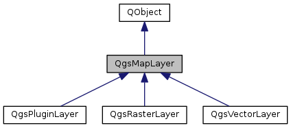
Base class for all map layer types.
This is the base class for all map layer types (vector, raster).
Definition at line 49 of file qgsmaplayer.h.
Layers enum defining the types of layers that can be added to a map.
| Enumerator | |
|---|---|
| VectorLayer | |
| RasterLayer | |
| PluginLayer | |
Definition at line 55 of file qgsmaplayer.h.
| QgsMapLayer::QgsMapLayer | ( | QgsMapLayer::LayerType | type = VectorLayer, |
| const QString & | lyrname = QString::null, |
||
| const QString & | source = QString::null |
||
| ) |
Constructor.
| type | Type of layer as defined in QgsMapLayer::LayerType enum |
| lyrname | Display Name of the layer |
| source | datasource of layer |
Definition at line 53 of file qgsmaplayer.cpp.
|
virtual |
Destructor.
Definition at line 92 of file qgsmaplayer.cpp.
|
inline |
Get the abstract of the layer used by QGIS Server in GetCapabilities request.
Definition at line 126 of file qgsmaplayer.h.
|
inlineprotected |
Add error message.
Definition at line 672 of file qgsmaplayer.h.
|
static |
Returns the given layer as a layer definition document Layer definitions store the data source as well as styling and custom properties.
Layer definitions can be used to load a layer and styling all from a single file.
Definition at line 776 of file qgsmaplayer.cpp.
|
inline |
Get the attribution of the layer used by QGIS Server in GetCapabilities request Attribution indicates the provider of a Layer or collection of Layers.
Definition at line 177 of file qgsmaplayer.h.
|
inline |
Get the attribution URL of the layer used by QGIS Server in GetCapabilities request Attribution indicates the provider of a Layer or collection of Layers.
Definition at line 189 of file qgsmaplayer.h.
| QPainter::CompositionMode QgsMapLayer::blendMode | ( | ) | const |
Returns the current blending mode for a layer.
Read blend mode for layer.
Definition at line 155 of file qgsmaplayer.cpp.
|
signal |
Signal emitted when the blend mode is changed, through QgsMapLayer::setBlendMode()
|
inline |
Definition at line 490 of file qgsmaplayer.h.
A convenience function to (un)capitalise the layer name.
Definition at line 1002 of file qgsmaplayer.cpp.
|
slot |
Clear cached image.
Definition at line 1653 of file qgsmaplayer.cpp.
|
inlinevirtual |
Return new instance of QgsMapLayerRenderer that will be used for rendering of given context.
Reimplemented in QgsVectorLayer, QgsRasterLayer, and QgsPluginLayer.
Definition at line 241 of file qgsmaplayer.h.
| const QgsCoordinateReferenceSystem & QgsMapLayer::crs | ( | ) | const |
Returns layer's spatial reference system.
Definition at line 983 of file qgsmaplayer.cpp.
| QVariant QgsMapLayer::customProperty | ( | const QString & | value, |
| const QVariant & | defaultValue = QVariant() |
||
| ) | const |
Read a custom property from layer.
Properties are stored in a map and saved in project file.
Definition at line 1602 of file qgsmaplayer.cpp.
|
signal |
Data of layer changed.
|
inline |
Get the DataUrl of the layer used by QGIS Server in GetCapabilities request DataUrl is a a link to the underlying data represented by a particular layer.
Definition at line 151 of file qgsmaplayer.h.
|
inline |
Get the DataUrl format of the layer used by QGIS Server in GetCapabilities request DataUrl is a a link to the underlying data represented by a particular layer.
Definition at line 163 of file qgsmaplayer.h.
|
virtual |
This is the method that does the actual work of drawing the layer onto a paint device.
| rendererContext | describes the extents, resolumon etc. that should be used when rendering the layer. |
Reimplemented in QgsVectorLayer, and QgsRasterLayer.
Definition at line 160 of file qgsmaplayer.cpp.
|
signal |
|
virtual |
Draw labels.
Reimplemented in QgsVectorLayer.
Definition at line 166 of file qgsmaplayer.cpp.
|
inlinevirtual |
Get current status error.
This error describes some principal problem for which layer cannot work and thus is not valid. It is not last error after accessing data by draw() etc.
Definition at line 357 of file qgsmaplayer.h.
|
virtual |
Export the properties of this layer as named style in a QDomDocument.
| doc | the target QDomDocument |
| errorMsg | this QString will be initialized on error during the execution of writeSymbology |
Definition at line 1226 of file qgsmaplayer.cpp.
|
virtual |
Export the properties of this layer as SLD style in a QDomDocument.
| doc | the target QDomDocument |
| errorMsg | this QString will be initialized on error during the execution of writeSymbology |
Definition at line 1425 of file qgsmaplayer.cpp.
|
virtual |
Return the extent of the layer.
Reimplemented in QgsVectorLayer.
Definition at line 142 of file qgsmaplayer.cpp.
|
static |
Creates a new layer from a layer defininition document.
Definition at line 792 of file qgsmaplayer.cpp.
|
static |
Definition at line 833 of file qgsmaplayer.cpp.
| bool QgsMapLayer::hasScaleBasedVisibility | ( | ) | const |
Returns whether scale based visibility is enabled for the layer.
Definition at line 934 of file qgsmaplayer.cpp.
| QString QgsMapLayer::id | ( | ) | const |
Get this layer's unique ID, this ID is used to access this layer from map layer registry.
Get this layer's unique ID.
Definition at line 105 of file qgsmaplayer.cpp.
|
virtual |
Import the properties of this layer from a QDomDocument.
| doc | source QDomDocument |
| errorMsg | this QString will be initialized on error during the execution of readSymbology |
Definition at line 1175 of file qgsmaplayer.cpp.
|
virtualslot |
Event handler for when a coordinate transform fails due to bad vertex error.
Definition at line 903 of file qgsmaplayer.cpp.
|
virtual |
True if the layer can be edited.
Reimplemented in QgsVectorLayer.
Definition at line 1614 of file qgsmaplayer.cpp.
| bool QgsMapLayer::isValid | ( | ) |
Return the status of the layer.
An invalid layer is one which has a bad datasource or other problem. Child classes set this flag when intialized
Definition at line 897 of file qgsmaplayer.cpp.
|
inline |
Get the keyword list of the layer used by QGIS Server in GetCapabilities request.
Definition at line 137 of file qgsmaplayer.h.
|
virtual |
Definition at line 915 of file qgsmaplayer.cpp.
|
virtual |
Definition at line 910 of file qgsmaplayer.cpp.
|
signal |
Emit a signal that layer's CRS has been reset.
|
signal |
Emit a signal that the layer name has been changed.
| QgsMapLayerLegend * QgsMapLayer::legend | ( | ) | const |
|
signal |
Signal emitted when legend of the layer has changed.
|
inline |
Definition at line 485 of file qgsmaplayer.h.
|
inline |
Definition at line 487 of file qgsmaplayer.h.
|
virtual |
Retrieve the default style for this layer if one exists (either as a .qml file on disk or as a record in the users style table in their personal qgis.db)
| theResultFlag | a reference to a flag that will be set to false if we did not manage to load the default style. |
Definition at line 1069 of file qgsmaplayer.cpp.
Retrieve a named style for this layer if one exists (either as a .qml file on disk or as a record in the users style table in their personal qgis.db)
| theURI | - the file name or other URI for the style file. First an attempt will be made to see if this is a file and load that, if that fails the qgis.db styles table will be consulted to see if there is a style who's key matches the URI. |
| theResultFlag | a reference to a flag that will be set to false if we did not manage to load the default style. |
Reimplemented in QgsVectorLayer.
Definition at line 1119 of file qgsmaplayer.cpp.
|
virtual |
Definition at line 1074 of file qgsmaplayer.cpp.
Definition at line 1529 of file qgsmaplayer.cpp.
| float QgsMapLayer::maximumScale | ( | ) | const |
Returns the maximum scale denominator at which the layer is visible.
Scale based visibility is only used if hasScaleBasedVisibility is true.
Definition at line 960 of file qgsmaplayer.cpp.
|
virtualslot |
Obtain Metadata for this layer.
Reimplemented in QgsVectorLayer, and QgsRasterLayer.
Definition at line 1663 of file qgsmaplayer.cpp.
|
inline |
Get the metadata URL of the layer used by QGIS Server in GetCapabilities request MetadataUrl is a a link to the detailed, standardized metadata about the data.
Definition at line 203 of file qgsmaplayer.h.
|
inline |
Get the metadata format of the layer used by QGIS Server in GetCapabilities request MetadataUrlType indicates how the metadata is structured.
Definition at line 227 of file qgsmaplayer.h.
|
inline |
Get the metadata type of the layer used by QGIS Server in GetCapabilities request MetadataUrlType indicates the standard to which the metadata complies.
Definition at line 215 of file qgsmaplayer.h.
| float QgsMapLayer::minimumScale | ( | ) | const |
Returns the minimum scale denominator at which the layer is visible.
Scale based visibility is only used if hasScaleBasedVisibility is true.
Definition at line 944 of file qgsmaplayer.cpp.
| QString QgsMapLayer::name | ( | ) | const |
Get the display name of the layer.
Read property of QString layerName.
Definition at line 123 of file qgsmaplayer.cpp.
|
inlinevirtual |
Definition at line 494 of file qgsmaplayer.h.
|
inline |
Get the original name of the layer.
Definition at line 93 of file qgsmaplayer.h.
| QString QgsMapLayer::publicSource | ( | ) | const |
Gets a version of the internal layer definition that has sensitive bits removed (for example, the password).
This function should be used when displaying the source name for general viewing.
Definition at line 129 of file qgsmaplayer.cpp.
|
protected |
Read custom properties from project file.
| layerNode | note to read from |
| keyStartsWith | reads only properties starting with the specified string (or all if the string is empty) |
Definition at line 865 of file qgsmaplayer.cpp.
| bool QgsMapLayer::readLayerXML | ( | const QDomElement & | layerElement | ) |
Sets state from Dom document.
| layerElement | The Dom element corresponding to ``maplayer'' tag |
The Dom node corresponds to a Dom document project file XML element read by QgsProject.
This, in turn, calls readXml(), which is over-rideable by sub-classes so that they can read their own specific state from the given Dom node.
Invoked by QgsProject::read().
Definition at line 171 of file qgsmaplayer.cpp.
Reimplemented in QgsVectorLayer.
Definition at line 460 of file qgsmaplayer.h.
|
protected |
Read style manager's configuration (if any).
To be called by subclasses.
Definition at line 875 of file qgsmaplayer.cpp.
|
pure virtual |
Read the symbology for the current layer from the Dom node supplied.
| node | node that will contain the symbology definition for this layer. |
| errorMessage | reference to string that will be updated with any error messages |
Implemented in QgsVectorLayer, and QgsRasterLayer.
|
protectedvirtual |
Called by readLayerXML(), used by children to read state specific to them from project files.
Reimplemented in QgsVectorLayer, and QgsRasterLayer.
Definition at line 517 of file qgsmaplayer.cpp.
|
signal |
This is used to send a request that any mapcanvas using this layer update its extents.
|
inlinevirtual |
Synchronises with changes in the datasource.
Reimplemented in QgsVectorLayer, and QgsRasterLayer.
Definition at line 236 of file qgsmaplayer.h.
| void QgsMapLayer::removeCustomProperty | ( | const QString & | key | ) |
Remove a custom property from layer.
Properties are stored in a map and saved in project file.
Definition at line 1607 of file qgsmaplayer.cpp.
|
signal |
Signal emitted when renderer is changed.
|
signal |
By emitting this signal the layer tells that either appearance or content have been changed and any view showing the rendered layer should refresh itself.
|
virtual |
Save the properties of this layer as the default style (either as a .qml file on disk or as a record in the users style table in their personal qgis.db)
| theResultFlag | a reference to a flag that will be set to false if we did not manage to save the default style. |
Definition at line 1275 of file qgsmaplayer.cpp.
Save the properties of this layer as a named style (either as a .qml file on disk or as a record in the users style table in their personal qgis.db)
| theURI | the file name or other URI for the style file. First an attempt will be made to see if this is a file and save to that, if that fails the qgis.db styles table will be used to create a style entry who's key matches the URI. |
| theResultFlag | a reference to a flag that will be set to false if we did not manage to save the default style. |
Definition at line 1280 of file qgsmaplayer.cpp.
Definition at line 1464 of file qgsmaplayer.cpp.
|
signal |
|
inline |
Set the abstract of the layer used by QGIS Server in GetCapabilities request.
Definition at line 121 of file qgsmaplayer.h.
|
inline |
Set the attribution of the layer used by QGIS Server in GetCapabilities request Attribution indicates the provider of a Layer or collection of Layers.
Definition at line 171 of file qgsmaplayer.h.
|
inline |
Set the attribution URL of the layer used by QGIS Server in GetCapabilities request Attribution indicates the provider of a Layer or collection of Layers.
Definition at line 183 of file qgsmaplayer.h.
| void QgsMapLayer::setBlendMode | ( | QPainter::CompositionMode | blendMode | ) |
Set the blending mode used for rendering a layer.
Write blend mode for layer.
Definition at line 148 of file qgsmaplayer.cpp.
| void QgsMapLayer::setCacheImage | ( | QImage * | ) |
Definition at line 1624 of file qgsmaplayer.cpp.
| void QgsMapLayer::setCrs | ( | const QgsCoordinateReferenceSystem & | srs, |
| bool | emitSignal = true |
||
| ) |
Sets layer's spatial reference system.
Definition at line 988 of file qgsmaplayer.cpp.
Set a custom property for layer.
Properties are stored in a map and saved in project file.
Definition at line 1597 of file qgsmaplayer.cpp.
|
inline |
Set the DataUrl of the layer used by QGIS Server in GetCapabilities request DataUrl is a a link to the underlying data represented by a particular layer.
Definition at line 145 of file qgsmaplayer.h.
|
inline |
Set the DataUrl format of the layer used by QGIS Server in GetCapabilities request DataUrl is a a link to the underlying data represented by a particular layer.
Definition at line 157 of file qgsmaplayer.h.
|
inlineprotected |
Set error message.
Definition at line 674 of file qgsmaplayer.h.
|
protectedvirtual |
Set the extent.
Reimplemented in QgsVectorLayer, and QgsPluginLayer.
Definition at line 1668 of file qgsmaplayer.cpp.
|
inline |
Set the keyword list of the layer used by QGIS Server in GetCapabilities request.
Definition at line 132 of file qgsmaplayer.h.
| void QgsMapLayer::setLayerName | ( | const QString & | name | ) |
Set the display name of the layer.
Write property of QString layerName.
| name | New name for the layer |
Definition at line 111 of file qgsmaplayer.cpp.
|
virtual |
Reorders the previously selected sublayers of this layer from bottom to top (Useful for providers that manage their own layers, such as WMS)
Reimplemented in QgsRasterLayer.
Definition at line 970 of file qgsmaplayer.cpp.
| void QgsMapLayer::setLegend | ( | QgsMapLayerLegend * | legend | ) |
Assign a legend controller to the map layer.
The object will be responsible for providing legend items.
| legend | Takes ownership of the object. Can be null pointer |
Definition at line 1629 of file qgsmaplayer.cpp.
|
inline |
Definition at line 484 of file qgsmaplayer.h.
|
inline |
Definition at line 486 of file qgsmaplayer.h.
|
slot |
Sets the maximum scale denominator at which the layer will be visible.
Scale based visibility is only used if setScaleBasedVisibility is set to true.
| theMaxScale | maximum scale denominator at which the layer should render |
Definition at line 950 of file qgsmaplayer.cpp.
|
inline |
Set the metadata URL of the layer used by QGIS Server in GetCapabilities request MetadataUrl is a a link to the detailed, standardized metadata about the data.
Definition at line 197 of file qgsmaplayer.h.
|
inline |
Set the metadata format of the layer used by QGIS Server in GetCapabilities request MetadataUrlType indicates how the metadata is structured.
Definition at line 221 of file qgsmaplayer.h.
|
inline |
Set the metadata type of the layer used by QGIS Server in GetCapabilities request MetadataUrlType indicates the standard to which the metadata complies.
Definition at line 209 of file qgsmaplayer.h.
|
slot |
Sets the minimum scale denominator at which the layer will be visible.
Scale based visibility is only used if setScaleBasedVisibility is set to true.
| theMinScale | minimum scale denominator at which the layer should render |
Definition at line 939 of file qgsmaplayer.cpp.
|
slot |
Sets whether scale based visibility is enabled for the layer.
| enabled | set to true to enable scale based visibility |
Definition at line 955 of file qgsmaplayer.cpp.
|
inline |
Set the short name of the layer used by QGIS Server to identify the layer.
Definition at line 99 of file qgsmaplayer.h.
|
virtual |
Set the visibility of the given sublayer name.
Reimplemented in QgsRasterLayer.
Definition at line 976 of file qgsmaplayer.cpp.
|
inline |
Set the title of the layer used by QGIS Server in GetCapabilities request.
Definition at line 110 of file qgsmaplayer.h.
|
protected |
Set whether layer is valid or not - should be used in constructor.
Definition at line 1619 of file qgsmaplayer.cpp.
|
inline |
Get the short name of the layer used by QGIS Server to identify the layer.
Definition at line 104 of file qgsmaplayer.h.
| QString QgsMapLayer::source | ( | ) | const |
Returns the source for the layer.
Definition at line 137 of file qgsmaplayer.cpp.
|
signal |
Emit a signal with status (e.g.
to be caught by QgisApp and display a msg on status bar)
| QgsMapLayerStyleManager * QgsMapLayer::styleManager | ( | ) | const |
Get access to the layer's style manager.
Style manager allows switching between multiple styles.
Definition at line 1648 of file qgsmaplayer.cpp.
|
virtual |
Retrieve the style URI for this layer (either as a .qml file on disk or as a record in the users style table in their personal qgis.db)
Definition at line 1017 of file qgsmaplayer.cpp.
|
virtual |
Returns the sublayers of this layer (Useful for providers that manage their own layers, such as WMS)
Reimplemented in QgsRasterLayer.
Definition at line 965 of file qgsmaplayer.cpp.
|
inlinevirtualslot |
Time stamp of data source in the moment when data/metadata were loaded by provider.
Reimplemented in QgsRasterLayer.
Definition at line 593 of file qgsmaplayer.h.
|
inline |
Get the title of the layer used by QGIS Server in GetCapabilities request.
Definition at line 115 of file qgsmaplayer.h.
|
slot |
Accessor for the scale based visilibility flag.
Definition at line 929 of file qgsmaplayer.cpp.
|
slot |
Will advice the map canvas (and any other interested party) that this layer requires to be repainted.
Will emit a repaintRequested() signal.
Definition at line 1658 of file qgsmaplayer.cpp.
| QgsMapLayer::LayerType QgsMapLayer::type | ( | ) | const |
Get the type of the layer.
Definition at line 99 of file qgsmaplayer.cpp.
| QUndoStack * QgsMapLayer::undoStack | ( | ) |
Return pointer to layer's undo stack.
Definition at line 1591 of file qgsmaplayer.cpp.
|
protected |
Write custom properties to project file.
Definition at line 870 of file qgsmaplayer.cpp.
| bool QgsMapLayer::writeLayerXML | ( | QDomElement & | layerElement, |
| QDomDocument & | document, | ||
| const QString & | relativeBasePath = QString::null |
||
| ) |
Stores state in Dom node.
| layerElement | is a Dom element corresponding to ``maplayer'' tag |
| document | is a the dom document being written |
| relativeBasePath | base path for relative paths |
The Dom node corresponds to a Dom document project file XML element to be written by QgsProject.
This, in turn, calls writeXml(), which is over-rideable by sub-classes so that they can write their own specific state to the given Dom node.
Invoked by QgsProject::write().
Definition at line 527 of file qgsmaplayer.cpp.
|
protected |
Write style manager's configuration (if exists).
To be called by subclasses.
Definition at line 884 of file qgsmaplayer.cpp.
|
pure virtual |
Write the symbology for the layer into the docment provided.
| node | the node that will have the style element added to it. |
| doc | the document that will have the QDomNode added. |
| errorMessage | reference to string that will be updated with any error messages |
Implemented in QgsVectorLayer, and QgsRasterLayer.
|
protectedvirtual |
Called by writeLayerXML(), used by children to write state specific to them to project files.
Reimplemented in QgsVectorLayer, and QgsRasterLayer.
Definition at line 855 of file qgsmaplayer.cpp.
|
protected |
Description of the layer.
Definition at line 696 of file qgsmaplayer.h.
|
protected |
Attribution of the layer.
Definition at line 704 of file qgsmaplayer.h.
|
protected |
Definition at line 705 of file qgsmaplayer.h.
|
protected |
Data source description string, varies by layer type.
Definition at line 683 of file qgsmaplayer.h.
|
protected |
DataUrl of the layer.
Definition at line 700 of file qgsmaplayer.h.
|
protected |
Definition at line 701 of file qgsmaplayer.h.
|
protected |
Error.
Definition at line 717 of file qgsmaplayer.h.
|
protected |
Extent of the layer.
Definition at line 677 of file qgsmaplayer.h.
|
protected |
Definition at line 697 of file qgsmaplayer.h.
|
protected |
Name of the layer - used for display.
Definition at line 686 of file qgsmaplayer.h.
|
protected |
Original name of the layer.
Definition at line 690 of file qgsmaplayer.h.
|
protected |
WMS legend.
Definition at line 713 of file qgsmaplayer.h.
|
protected |
Definition at line 714 of file qgsmaplayer.h.
|
protected |
MetadataUrl of the layer.
Definition at line 708 of file qgsmaplayer.h.
|
protected |
Definition at line 710 of file qgsmaplayer.h.
|
protected |
Definition at line 709 of file qgsmaplayer.h.
|
protected |
Definition at line 692 of file qgsmaplayer.h.
|
protected |
Definition at line 693 of file qgsmaplayer.h.
|
protected |
Indicates if the layer is valid and can be drawn.
Definition at line 680 of file qgsmaplayer.h.
 1.8.11

