|
Quantum GIS API Documentation
1.7.4
|
|
Quantum GIS API Documentation
1.7.4
|
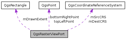
This class provides details of the viewable area that a raster will be rendered into. More...
#include <qgsrasterviewport.h>
Public Attributes | |
| QgsPoint | topLeftPoint |
| Coordinate (in geographic coordinate system) of top left corner of the part of the raster that is to be rendered. | |
| QgsPoint | bottomRightPoint |
| Coordinate (in geographic coordinate system) of bottom right corner of the part of the raster that is to be rendered. | |
| int | drawableAreaXDim |
| Distance in map units from left edge to right edge for the part of the raster that is to be rendered. | |
| int | drawableAreaYDim |
| Distance in map units from bottom edge to top edge for the part of the raster that is to be rendered. | |
| QgsRectangle | mDrawnExtent |
| QgsCoordinateReferenceSystem | mSrcCRS |
| QgsCoordinateReferenceSystem | mDestCRS |
This class provides details of the viewable area that a raster will be rendered into.
The qgsrasterviewport class sets up a viewport / area of interest to be used by rasterlayer draw functions at the point of drawing to the screen.
Definition at line 32 of file qgsrasterviewport.h.
Coordinate (in geographic coordinate system) of bottom right corner of the part of the raster that is to be rendered.
Definition at line 40 of file qgsrasterviewport.h.
Referenced by QgsRasterImageBuffer::drawPixelRectangle(), QgsRasterLayer::thumbnailAsImage(), and QgsRasterLayer::thumbnailAsPixmap().
Distance in map units from left edge to right edge for the part of the raster that is to be rendered.
Definition at line 44 of file qgsrasterviewport.h.
Referenced by QgsRasterLayer::computeMinimumMaximumFromLastExtent(), QgsRasterImageBuffer::createNextPartImage(), QgsRasterLayer::drawMultiBandColor(), QgsRasterLayer::drawPalettedSingleBandColor(), QgsRasterLayer::drawPalettedSingleBandGray(), QgsRasterLayer::drawPalettedSingleBandPseudoColor(), QgsRasterLayer::drawSingleBandColorData(), QgsRasterLayer::drawSingleBandGray(), QgsRasterLayer::drawSingleBandPseudoColor(), QgsRasterLayer::init(), QgsRasterImageBuffer::nextScanLine(), QgsRasterLayer::readData(), QgsRasterImageBuffer::reset(), QgsRasterLayer::thumbnailAsImage(), and QgsRasterLayer::thumbnailAsPixmap().
Distance in map units from bottom edge to top edge for the part of the raster that is to be rendered.
Definition at line 47 of file qgsrasterviewport.h.
Referenced by QgsRasterLayer::computeMinimumMaximumFromLastExtent(), QgsRasterImageBuffer::createNextPartImage(), QgsRasterLayer::init(), QgsRasterLayer::readData(), QgsRasterImageBuffer::reset(), QgsRasterLayer::thumbnailAsImage(), and QgsRasterLayer::thumbnailAsPixmap().
Definition at line 56 of file qgsrasterviewport.h.
Referenced by QgsRasterImageBuffer::createNextPartImage(), QgsRasterLayer::readData(), and QgsRasterLayer::thumbnailAsPixmap().
Definition at line 50 of file qgsrasterviewport.h.
Referenced by QgsRasterImageBuffer::createNextPartImage(), QgsRasterLayer::readData(), and QgsRasterLayer::thumbnailAsPixmap().
Definition at line 53 of file qgsrasterviewport.h.
Referenced by QgsRasterImageBuffer::createNextPartImage(), QgsRasterLayer::readData(), and QgsRasterLayer::thumbnailAsPixmap().
Coordinate (in geographic coordinate system) of top left corner of the part of the raster that is to be rendered.
Definition at line 37 of file qgsrasterviewport.h.
Referenced by QgsRasterImageBuffer::createNextPartImage(), QgsRasterImageBuffer::drawPixelRectangle(), QgsRasterLayer::thumbnailAsImage(), and QgsRasterLayer::thumbnailAsPixmap().
 1.7.6.1

