|
Quantum GIS API Documentation
1.7.4
|
|
Quantum GIS API Documentation
1.7.4
|
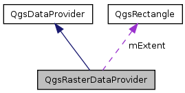
Base class for raster data providers. More...
#include <qgsrasterdataprovider.h>
Public Types | |
| enum | Capability { NoCapabilities = 0, Identify = 1, ExactMinimumMaximum = 1 << 1, ExactResolution = 1 << 2, EstimatedMinimumMaximum = 1 << 3, BuildPyramids = 1 << 4, Histogram = 1 << 5, Size = 1 << 6 } |
| If you add to this, please also add to capabilitiesString() More... | |
| enum | DataType { UnknownDataType = 0, Byte = 1, UInt16 = 2, Int16 = 3, UInt32 = 4, Int32 = 5, Float32 = 6, Float64 = 7, CInt16 = 8, CInt32 = 9, CFloat32 = 10, CFloat64 = 11, ARGBDataType = 12, TypeCount = 13 } |
| enum | ColorInterpretation { UndefinedColorInterpretation = 0, GrayIndex = 1, PaletteIndex = 2, RedBand = 3, GreenBand = 4, BlueBand = 5, AlphaBand = 6, HueBand = 7, SaturationBand = 8, LightnessBand = 9, CyanBand = 10, MagentaBand = 11, YellowBand = 12, BlackBand = 13, YCbCr_YBand = 14, YCbCr_CbBand = 15, YCbCr_CrBand = 16, ColorInterpretationMax = 16 } |
| enum | RasterProgressType { ProgressHistogram = 0, ProgressPyramids = 1, ProgressStatistics = 2 } |
Signals | |
| void | progress (int theType, double theProgress, QString theMessage) |
| Emit a signal to notify of the progress event. | |
Public Member Functions | |
| QgsRasterDataProvider () | |
| QgsRasterDataProvider (QString const &uri) | |
| virtual | ~QgsRasterDataProvider () |
| virtual void | addLayers (QStringList const &layers, QStringList const &styles=QStringList())=0 |
| Add the list of WMS layer names to be rendered by this server. | |
| virtual QStringList | supportedImageEncodings ()=0 |
| get raster image encodings supported by (e.g.) the WMS Server, expressed as MIME types | |
| virtual QString | imageEncoding () const =0 |
| Get the image encoding (as a MIME type) used in the transfer from (e.g.) the WMS server. | |
| virtual void | setImageEncoding (QString const &mimeType)=0 |
| Set the image encoding (as a MIME type) used in the transfer from (e.g.) the WMS server. | |
| virtual void | setImageCrs (QString const &crs)=0 |
| Set the image projection (in WMS CRS format) used in the transfer from (e.g.) the WMS server. | |
| virtual QImage * | draw (QgsRectangle const &viewExtent, int pixelWidth, int pixelHeight)=0 |
| Renders the layer as an image. | |
| virtual int | capabilities () const |
| Returns a bitmask containing the supported capabilities Note, some capabilities may change depending on whether a spatial filter is active on this provider, so it may be prudent to check this value per intended operation. | |
| QString | capabilitiesString () const |
| Returns the above in friendly format. | |
| virtual int | dataType (int bandNo) const |
| Returns data type for the band specified by number. | |
| virtual int | srcDataType (int bandNo) const |
| Returns source data type for the band specified by number, source data type may be shorter than dataType. | |
| int | typeSize (int dataType) const |
| int | dataTypeSize (int bandNo) const |
| virtual int | bandCount () const |
| Get numbur of bands. | |
| virtual int | colorInterpretation (int theBandNo) const |
| Returns data type for the band specified by number. | |
| QString | colorName (int colorInterpretation) const |
| virtual bool | reload () |
| Reload data (data could change) | |
| virtual QString | colorInterpretationName (int theBandNo) const |
| virtual int | xBlockSize () const |
| Get block size. | |
| virtual int | yBlockSize () const |
| virtual int | xSize () const |
| Get raster size. | |
| virtual int | ySize () const |
| virtual void | readBlock (int bandNo, int xBlock, int yBlock, void *data) |
| read block of data | |
| virtual void | readBlock (int bandNo, QgsRectangle const &viewExtent, int width, int height, void *data) |
| read block of data using give extent and size | |
| virtual void | readBlock (int bandNo, QgsRectangle const &viewExtent, int width, int height, QgsCoordinateReferenceSystem theSrcCRS, QgsCoordinateReferenceSystem theDestCRS, void *data) |
| read block of data using give extent and size | |
| virtual double | readValue (void *data, int type, int index) |
| virtual double | noDataValue () const |
| value representing null data | |
| virtual double | minimumValue (int bandNo) const |
| virtual double | maximumValue (int bandNo) const |
| virtual QList < QgsColorRampShader::ColorRampItem > | colorTable (int bandNo) const |
| virtual QStringList | subLayers () const |
| Returns the sublayers of this layer - Useful for providers that manage their own layers, such as WMS. | |
| virtual void | populateHistogram (int theBandNoInt, QgsRasterBandStats &theBandStats, int theBinCountInt=256, bool theIgnoreOutOfRangeFlag=true, bool theThoroughBandScanFlag=false) |
| Populate the histogram vector for a given band. | |
| virtual QString | buildPyramids (const QList< QgsRasterPyramid > &thePyramidList, const QString &theResamplingMethod="NEAREST", bool theTryInternalFlag=false) |
| Create pyramid overviews. | |
| virtual QList< QgsRasterPyramid > | buildPyramidList () |
| Accessor for ths raster layers pyramid list. | |
| virtual QgsRasterBandStats | bandStatistics (int theBandNo) |
| If the provider supports it, return band stats for the given band. | |
| QString | generateBandName (int theBandNumber) |
| helper function to create zero padded band names | |
| virtual QString | metadata ()=0 |
| Get metadata in a format suitable for feeding directly into a subset of the GUI raster properties "Metadata" tab. | |
| virtual bool | identify (const QgsPoint &point, QMap< QString, QString > &results) |
| Identify raster value(s) found on the point position. | |
| virtual QString | identifyAsText (const QgsPoint &point)=0 |
| Identify details from a server (e.g. | |
| virtual QString | identifyAsHtml (const QgsPoint &point)=0 |
| Identify details from a server (e.g. | |
| virtual QString | lastErrorTitle ()=0 |
| Returns the caption error text for the last error in this provider. | |
| virtual QString | lastError ()=0 |
| Returns the verbose error text for the last error in this provider. | |
| virtual QString | lastErrorFormat () |
| Returns the format of the error text for the last error in this provider. | |
| int | dpi () const |
| This helper checks to see whether the file name appears to be a valid raster file name. | |
| void | setDpi (int dpi) |
| Sets the output device resolution. | |
| bool | isNoDataValueValid () const |
| Is the NoDataValue Valid. | |
| QByteArray | noValueBytes (int theBandNo) |
| Set null value in char. | |
| virtual QDateTime | timestamp () const |
| Time stamp of data source in the moment when data/metadata were loaded by provider. | |
| virtual QDateTime | dataTimestamp () const |
| Current time stamp of data source. | |
Static Public Member Functions | |
| static QStringList | cStringList2Q_ (char **stringList) |
| static QString | makeTableCell (QString const &value) |
| static QString | makeTableCells (QStringList const &values) |
Protected Attributes | |
| int | mDpi |
| Dots per intch. | |
| QList< double > | mNoDataValue |
| Cell value representing no data. | |
| bool | mValidNoDataValue |
| Flag indicating if the nodatavalue is valid. | |
| QgsRectangle | mExtent |
Base class for raster data providers.
Definition at line 49 of file qgsrasterdataprovider.h.
If you add to this, please also add to capabilitiesString()
| NoCapabilities | |
| Identify | |
| ExactMinimumMaximum | |
| ExactResolution | |
| EstimatedMinimumMaximum | |
| BuildPyramids | |
| Histogram | |
| Size |
Definition at line 57 of file qgsrasterdataprovider.h.
Definition at line 89 of file qgsrasterdataprovider.h.
Definition at line 70 of file qgsrasterdataprovider.h.
Definition at line 112 of file qgsrasterdataprovider.h.
Definition at line 92 of file qgsrasterdataprovider.cpp.
| QgsRasterDataProvider::QgsRasterDataProvider | ( | QString const & | uri | ) |
Definition at line 96 of file qgsrasterdataprovider.cpp.
| virtual QgsRasterDataProvider::~QgsRasterDataProvider | ( | ) | [inline, virtual] |
Definition at line 123 of file qgsrasterdataprovider.h.
| virtual void QgsRasterDataProvider::addLayers | ( | QStringList const & | layers, |
| QStringList const & | styles = QStringList() |
||
| ) | [pure virtual] |
Add the list of WMS layer names to be rendered by this server.
Referenced by QgsRasterLayer::setDataProvider().
| virtual int QgsRasterDataProvider::bandCount | ( | ) | const [inline, virtual] |
Get numbur of bands.
Definition at line 230 of file qgsrasterdataprovider.h.
Referenced by QgsRasterLayer::bandStatistics(), QgsRasterLayer::hasBand(), QgsRasterLayer::resetNoDataValue(), and QgsRasterLayer::setDataProvider().
| QgsRasterBandStats QgsRasterDataProvider::bandStatistics | ( | int | theBandNo | ) | [virtual] |
If the provider supports it, return band stats for the given band.
Default behaviour is to blockwise read the data and generate the stats unless the provider overloads this function.
Definition at line 239 of file qgsrasterdataprovider.cpp.
References QgsRasterBandStats::bandName, QgsRasterBandStats::bandNumber, dataType(), dataTypeSize(), QgsLogger::debug(), QgsRasterBandStats::elementCount, generateBandName(), QgsRasterBandStats::maximumValue, QgsRasterBandStats::mean, QgsRasterBandStats::minimumValue, mValidNoDataValue, noDataValue(), QgsRasterBandStats::range, readBlock(), readValue(), QgsRasterBandStats::statsGathered, QgsRasterBandStats::stdDev, QgsRasterBandStats::sum, QgsRasterBandStats::sumOfSquares, TINY_VALUE, xBlockSize(), xSize(), yBlockSize(), and ySize().
Referenced by QgsRasterLayer::bandStatistics().
| virtual QList<QgsRasterPyramid> QgsRasterDataProvider::buildPyramidList | ( | ) | [inline, virtual] |
Accessor for ths raster layers pyramid list.
A pyramid list defines the POTENTIAL pyramids that can be in a raster. To know which of the pyramid layers ACTUALLY exists you need to look at the existsFlag member in each struct stored in the list.
Definition at line 370 of file qgsrasterdataprovider.h.
Referenced by QgsRasterLayer::buildPyramidList().
| virtual QString QgsRasterDataProvider::buildPyramids | ( | const QList< QgsRasterPyramid > & | thePyramidList, |
| const QString & | theResamplingMethod = "NEAREST", |
||
| bool | theTryInternalFlag = false |
||
| ) | [inline, virtual] |
Create pyramid overviews.
Definition at line 360 of file qgsrasterdataprovider.h.
Referenced by QgsRasterLayer::buildPyramids().
| virtual int QgsRasterDataProvider::capabilities | ( | ) | const [inline, virtual] |
Returns a bitmask containing the supported capabilities Note, some capabilities may change depending on whether a spatial filter is active on this provider, so it may be prudent to check this value per intended operation.
Definition at line 161 of file qgsrasterdataprovider.h.
References NoCapabilities.
Referenced by capabilitiesString(), QgsRasterLayer::rasterUnitsPerPixel(), readBlock(), and QgsRasterLayer::setDataProvider().
| QString QgsRasterDataProvider::capabilitiesString | ( | ) | const |
Returns the above in friendly format.
Definition at line 154 of file qgsrasterdataprovider.cpp.
References BuildPyramids, capabilities(), Identify, and QgsDebugMsg.
| virtual int QgsRasterDataProvider::colorInterpretation | ( | int | theBandNo | ) | const [inline, virtual] |
Returns data type for the band specified by number.
Definition at line 236 of file qgsrasterdataprovider.h.
References UndefinedColorInterpretation.
Referenced by QgsRasterLayer::setDataProvider().
| virtual QString QgsRasterDataProvider::colorInterpretationName | ( | int | theBandNo | ) | const [inline, virtual] |
Definition at line 305 of file qgsrasterdataprovider.h.
Referenced by QgsRasterLayer::hasBand(), and QgsRasterLayer::legendAsPixmap().
| QString QgsRasterDataProvider::colorName | ( | int | colorInterpretation | ) | const [inline] |
Definition at line 242 of file qgsrasterdataprovider.h.
| virtual QList<QgsColorRampShader::ColorRampItem> QgsRasterDataProvider::colorTable | ( | int | bandNo | ) | const [inline, virtual] |
Definition at line 339 of file qgsrasterdataprovider.h.
Referenced by QgsRasterLayer::paletteAsPixmap(), QgsRasterLayer::readColorTable(), and QgsRasterLayer::setDataProvider().
| QStringList QgsRasterDataProvider::cStringList2Q_ | ( | char ** | stringList | ) | [static] |
Definition at line 109 of file qgsrasterdataprovider.cpp.
| virtual QDateTime QgsRasterDataProvider::dataTimestamp | ( | ) | const [inline, virtual] |
Current time stamp of data source.
Reimplemented from QgsDataProvider.
Definition at line 489 of file qgsrasterdataprovider.h.
Referenced by QgsRasterLayer::update().
| virtual int QgsRasterDataProvider::dataType | ( | int | bandNo | ) | const [inline, virtual] |
Returns data type for the band specified by number.
Definition at line 177 of file qgsrasterdataprovider.h.
Referenced by bandStatistics(), QgsRasterLayer::computeMinimumMaximumFromLastExtent(), QgsRasterLayer::drawMultiBandColor(), QgsRasterLayer::drawPalettedSingleBandColor(), QgsRasterLayer::drawPalettedSingleBandGray(), QgsRasterLayer::drawPalettedSingleBandPseudoColor(), QgsRasterLayer::drawSingleBandGray(), QgsRasterLayer::drawSingleBandPseudoColor(), QgsRasterLayer::metadata(), noValueBytes(), and QgsRasterLayer::setDataProvider().
| int QgsRasterDataProvider::dataTypeSize | ( | int | bandNo | ) | const [inline] |
Definition at line 224 of file qgsrasterdataprovider.h.
Referenced by bandStatistics(), QgsRasterImageBuffer::createNextPartImage(), QgsRasterImageBuffer::nextScanLine(), noValueBytes(), readBlock(), and QgsRasterLayer::readData().
| int QgsRasterDataProvider::dpi | ( | ) | const [inline] |
This helper checks to see whether the file name appears to be a valid raster file name.
If the file name looks like it could be valid, but some sort of error occurs in processing the file, the error is returned in retError.Returns the dpi of the output device.
Definition at line 468 of file qgsrasterdataprovider.h.
| virtual QImage* QgsRasterDataProvider::draw | ( | QgsRectangle const & | viewExtent, |
| int | pixelWidth, | ||
| int | pixelHeight | ||
| ) | [pure virtual] |
Renders the layer as an image.
| QString QgsRasterDataProvider::generateBandName | ( | int | theBandNumber | ) | [inline] |
helper function to create zero padded band names
Definition at line 378 of file qgsrasterdataprovider.h.
Referenced by bandStatistics(), QgsRasterLayer::setDataProvider(), and QgsRasterLayer::validateBandName().
| bool QgsRasterDataProvider::identify | ( | const QgsPoint & | point, |
| QMap< QString, QString > & | results | ||
| ) | [virtual] |
Identify raster value(s) found on the point position.
Definition at line 175 of file qgsrasterdataprovider.cpp.
Referenced by QgsRasterLayer::identify().
| virtual QString QgsRasterDataProvider::identifyAsHtml | ( | const QgsPoint & | point | ) | [pure virtual] |
Identify details from a server (e.g.
WMS) from the last screen update
| [in] | point | The pixel coordinate (as it was displayed locally on screen) |
Referenced by QgsRasterLayer::identifyAsHtml().
| virtual QString QgsRasterDataProvider::identifyAsText | ( | const QgsPoint & | point | ) | [pure virtual] |
Identify details from a server (e.g.
WMS) from the last screen update
| [in] | point | The pixel coordinate (as it was displayed locally on screen) |
Referenced by QgsRasterLayer::identifyAsText().
| virtual QString QgsRasterDataProvider::imageEncoding | ( | ) | const [pure virtual] |
Get the image encoding (as a MIME type) used in the transfer from (e.g.) the WMS server.
Referenced by QgsRasterLayer::writeSymbology().
| bool QgsRasterDataProvider::isNoDataValueValid | ( | ) | const [inline] |
Is the NoDataValue Valid.
Definition at line 475 of file qgsrasterdataprovider.h.
Referenced by QgsRasterLayer::resetNoDataValue(), and QgsRasterLayer::setDataProvider().
| virtual QString QgsRasterDataProvider::lastError | ( | ) | [pure virtual] |
Returns the verbose error text for the last error in this provider.
If an operation returns 0 (e.g. draw()), this function returns the text of the error associated with the failure. Interactive users of this provider can then, for example, call a QMessageBox to display the contents.
| QString QgsRasterDataProvider::lastErrorFormat | ( | ) | [virtual] |
Returns the format of the error text for the last error in this provider.
Definition at line 182 of file qgsrasterdataprovider.cpp.
| virtual QString QgsRasterDataProvider::lastErrorTitle | ( | ) | [pure virtual] |
Returns the caption error text for the last error in this provider.
If an operation returns 0 (e.g. draw()), this function returns the text of the error associated with the failure. Interactive users of this provider can then, for example, call a QMessageBox to display the contents.
| QString QgsRasterDataProvider::makeTableCell | ( | QString const & | value | ) | [static] |
Definition at line 124 of file qgsrasterdataprovider.cpp.
Referenced by makeTableCells().
| QString QgsRasterDataProvider::makeTableCells | ( | QStringList const & | values | ) | [static] |
Definition at line 132 of file qgsrasterdataprovider.cpp.
References makeTableCell().
| virtual double QgsRasterDataProvider::maximumValue | ( | int | bandNo | ) | const [inline, virtual] |
Definition at line 337 of file qgsrasterdataprovider.h.
Referenced by QgsRasterLayer::computeMinimumMaximumEstimates(), QgsRasterLayer::drawMultiBandColor(), QgsRasterLayer::drawSingleBandGray(), and QgsRasterLayer::setDataProvider().
| QString QgsRasterDataProvider::metadata | ( | ) | [pure virtual] |
Get metadata in a format suitable for feeding directly into a subset of the GUI raster properties "Metadata" tab.
Definition at line 148 of file qgsrasterdataprovider.cpp.
Referenced by QgsRasterLayer::metadata().
| virtual double QgsRasterDataProvider::minimumValue | ( | int | bandNo | ) | const [inline, virtual] |
Definition at line 336 of file qgsrasterdataprovider.h.
Referenced by QgsRasterLayer::computeMinimumMaximumEstimates(), QgsRasterLayer::drawMultiBandColor(), QgsRasterLayer::drawSingleBandGray(), and QgsRasterLayer::setDataProvider().
| virtual double QgsRasterDataProvider::noDataValue | ( | ) | const [inline, virtual] |
value representing null data
Definition at line 334 of file qgsrasterdataprovider.h.
Referenced by bandStatistics(), readValue(), QgsRasterLayer::resetNoDataValue(), and QgsRasterLayer::setDataProvider().
| QByteArray QgsRasterDataProvider::noValueBytes | ( | int | theBandNo | ) |
Set null value in char.
Definition at line 187 of file qgsrasterdataprovider.cpp.
References Byte, dataType(), dataTypeSize(), Float32, Float64, Int16, Int32, mNoDataValue, UInt16, UInt32, and QgsLogger::warning().
| virtual void QgsRasterDataProvider::populateHistogram | ( | int | theBandNoInt, |
| QgsRasterBandStats & | theBandStats, | ||
| int | theBinCountInt = 256, |
||
| bool | theIgnoreOutOfRangeFlag = true, |
||
| bool | theThoroughBandScanFlag = false |
||
| ) | [inline, virtual] |
Populate the histogram vector for a given band.
Definition at line 351 of file qgsrasterdataprovider.h.
Referenced by QgsRasterLayer::populateHistogram().
| void QgsRasterDataProvider::progress | ( | int | theType, |
| double | theProgress, | ||
| QString | theMessage | ||
| ) | [signal] |
Emit a signal to notify of the progress event.
Emited theProgress is in percents (0.0-100.0)
| virtual void QgsRasterDataProvider::readBlock | ( | int | bandNo, |
| int | xBlock, | ||
| int | yBlock, | ||
| void * | data | ||
| ) | [inline, virtual] |
read block of data
Definition at line 320 of file qgsrasterdataprovider.h.
Referenced by bandStatistics(), QgsRasterImageBuffer::createNextPartImage(), readBlock(), and QgsRasterLayer::readData().
| virtual void QgsRasterDataProvider::readBlock | ( | int | bandNo, |
| QgsRectangle const & | viewExtent, | ||
| int | width, | ||
| int | height, | ||
| void * | data | ||
| ) | [inline, virtual] |
read block of data using give extent and size
Definition at line 324 of file qgsrasterdataprovider.h.
| void QgsRasterDataProvider::readBlock | ( | int | bandNo, |
| QgsRectangle const & | viewExtent, | ||
| int | width, | ||
| int | height, | ||
| QgsCoordinateReferenceSystem | theSrcCRS, | ||
| QgsCoordinateReferenceSystem | theDestCRS, | ||
| void * | data | ||
| ) | [virtual] |
read block of data using give extent and size
Definition at line 26 of file qgsrasterdataprovider.cpp.
References capabilities(), dataTypeSize(), ExactResolution, QgsDataProvider::extent(), QgsRectangle::height(), QgsCoordinateReferenceSystem::isValid(), QgsDebugMsg, readBlock(), QgsRasterProjector::srcCols(), QgsRasterProjector::srcExtent(), QgsRasterProjector::srcRowCol(), QgsRasterProjector::srcRows(), QgsRectangle::toString(), QgsRectangle::width(), xSize(), and ySize().
| double QgsRasterDataProvider::readValue | ( | void * | data, |
| int | type, | ||
| int | index | ||
| ) | [virtual] |
Definition at line 389 of file qgsrasterdataprovider.cpp.
References Byte, Float32, Float64, Int16, Int32, mValidNoDataValue, noDataValue(), UInt16, UInt32, and QgsLogger::warning().
Referenced by bandStatistics().
| virtual bool QgsRasterDataProvider::reload | ( | ) | [inline, virtual] |
Reload data (data could change)
Definition at line 303 of file qgsrasterdataprovider.h.
| void QgsRasterDataProvider::setDpi | ( | int | dpi | ) | [inline] |
Sets the output device resolution.
Definition at line 472 of file qgsrasterdataprovider.h.
Referenced by QgsRasterLayer::draw().
| virtual void QgsRasterDataProvider::setImageCrs | ( | QString const & | crs | ) | [pure virtual] |
Set the image projection (in WMS CRS format) used in the transfer from (e.g.) the WMS server.
Referenced by QgsRasterLayer::setDataProvider().
| virtual void QgsRasterDataProvider::setImageEncoding | ( | QString const & | mimeType | ) | [pure virtual] |
Set the image encoding (as a MIME type) used in the transfer from (e.g.) the WMS server.
Referenced by QgsRasterLayer::setDataProvider().
| virtual int QgsRasterDataProvider::srcDataType | ( | int | bandNo | ) | const [inline, virtual] |
Returns source data type for the band specified by number, source data type may be shorter than dataType.
Definition at line 185 of file qgsrasterdataprovider.h.
References UnknownDataType.
Referenced by QgsRasterLayer::setDataProvider().
| virtual QStringList QgsRasterDataProvider::subLayers | ( | ) | const [inline, virtual] |
Returns the sublayers of this layer - Useful for providers that manage their own layers, such as WMS.
Reimplemented from QgsDataProvider.
Definition at line 344 of file qgsrasterdataprovider.h.
Referenced by QgsRasterLayer::subLayers().
| virtual QStringList QgsRasterDataProvider::supportedImageEncodings | ( | ) | [pure virtual] |
get raster image encodings supported by (e.g.) the WMS Server, expressed as MIME types
| virtual QDateTime QgsRasterDataProvider::timestamp | ( | ) | const [inline, virtual] |
Time stamp of data source in the moment when data/metadata were loaded by provider.
Reimplemented from QgsDataProvider.
Definition at line 486 of file qgsrasterdataprovider.h.
References QgsDataProvider::mTimestamp.
Referenced by QgsRasterLayer::update().
| int QgsRasterDataProvider::typeSize | ( | int | dataType | ) | const [inline] |
Definition at line 191 of file qgsrasterdataprovider.h.
| virtual int QgsRasterDataProvider::xBlockSize | ( | ) | const [inline, virtual] |
Get block size.
Definition at line 311 of file qgsrasterdataprovider.h.
Referenced by bandStatistics().
| virtual int QgsRasterDataProvider::xSize | ( | ) | const [inline, virtual] |
Get raster size.
Definition at line 315 of file qgsrasterdataprovider.h.
Referenced by bandStatistics(), QgsRasterLayer::rasterUnitsPerPixel(), readBlock(), and QgsRasterLayer::setDataProvider().
| virtual int QgsRasterDataProvider::yBlockSize | ( | ) | const [inline, virtual] |
Definition at line 312 of file qgsrasterdataprovider.h.
Referenced by bandStatistics().
| virtual int QgsRasterDataProvider::ySize | ( | ) | const [inline, virtual] |
Definition at line 316 of file qgsrasterdataprovider.h.
Referenced by bandStatistics(), readBlock(), and QgsRasterLayer::setDataProvider().
int QgsRasterDataProvider::mDpi [protected] |
Dots per intch.
Extended WMS (e.g. QGIS mapserver) support DPI dependent output and therefore are suited for printing. A value of -1 means it has not been set
Definition at line 500 of file qgsrasterdataprovider.h.
QgsRectangle QgsRasterDataProvider::mExtent [protected] |
Definition at line 508 of file qgsrasterdataprovider.h.
QList<double> QgsRasterDataProvider::mNoDataValue [protected] |
Cell value representing no data.
e.g. -9999, indexed from 0
Definition at line 503 of file qgsrasterdataprovider.h.
Referenced by noValueBytes().
bool QgsRasterDataProvider::mValidNoDataValue [protected] |
Flag indicating if the nodatavalue is valid.
Definition at line 506 of file qgsrasterdataprovider.h.
Referenced by bandStatistics(), and readValue().
 1.7.6.1

