QgsMapLayer Class Reference
[QGIS core library]
Base class for all map layer types.
More...
#include <qgsmaplayer.h>
Public Types | |
| enum | LayerType { VectorLayer, RasterLayer, PluginLayer } |
| Layers enum defining the types of layers that can be added to a map. More... | |
Public Slots | |
| virtual void | invalidTransformInput () |
| Event handler for when a coordinate transform fails due to bad vertex error. | |
| void | setMinimumScale (float theMinScale) |
| Accessor and mutator for the minimum scale member. | |
| float | minimumScale () |
| void | setMaximumScale (float theMaxScale) |
| Accessor and mutator for the maximum scale member. | |
| float | maximumScale () |
| void | toggleScaleBasedVisibility (bool theVisibilityFlag) |
| Accessor and mutator for the scale based visilibility flag. | |
| bool | hasScaleBasedVisibility () |
| void | clearCacheImage () |
| Clear cached image added in 1.5. | |
Signals | |
| void | drawingProgress (int theProgress, int theTotalSteps) |
| Emit a signal to notify of a progress event. | |
| void | statusChanged (QString theStatus) |
| Emit a signal with status (e.g. | |
| void | layerNameChanged () |
| Emit a signal that the layer name has been changed. | |
| void | layerCrsChanged () |
| Emit a signal that layer's CRS has been reset added in 1.4. | |
| void | repaintRequested () |
| This signal should be connected with the slot QgsMapCanvas::refresh(). | |
| void | screenUpdateRequested () |
| The layer emits this signal when a screen update is requested. | |
| void | recalculateExtents () |
| This is used to send a request that any mapcanvas using this layer update its extents. | |
| void | dataChanged () |
| data of layer changed added in 1.5 | |
Public Member Functions | |
| QgsMapLayer (QgsMapLayer::LayerType type=VectorLayer, QString lyrname=QString::null, QString source=QString::null) | |
| Constructor. | |
| virtual | ~QgsMapLayer () |
| Destructor. | |
| QgsMapLayer::LayerType | type () const |
| Get the type of the layer. | |
| QString | getLayerID () const |
| Get this layer's unique ID, this ID is used to access this layer from map layer registry. | |
| void | setLayerName (const QString &name) |
| Set the display name of the layer. | |
| QString const & | name () const |
| Get the display name of the layer. | |
| virtual void | reload () |
| Synchronises with changes in the datasource. | |
| virtual bool | draw (QgsRenderContext &rendererContext) |
| This is the method that does the actual work of drawing the layer onto a paint device. | |
| virtual void | drawLabels (QgsRenderContext &rendererContext) |
| Draw labels. | |
| QgsRectangle | extent () const |
| Return the extent of the layer as a QRect. | |
| bool | isValid () |
| QString | publicSource () const |
| QString const & | source () const |
| Returns the source for the layer. | |
| virtual QStringList | subLayers () |
| Returns the sublayers of this layer (Useful for providers that manage their own layers, such as WMS). | |
| virtual void | setLayerOrder (QStringList layers) |
| Reorders the *previously selected* sublayers of this layer from bottom to top (Useful for providers that manage their own layers, such as WMS). | |
| virtual void | setSubLayerVisibility (QString name, bool vis) |
| Set the visibility of the given sublayer name. | |
| virtual bool | isEditable () const |
| True if the layer can be edited. | |
| bool | readXML (QDomNode &layer_node) |
| sets state from Dom document | |
| bool | writeXML (QDomNode &layer_node, QDomDocument &document) |
| stores state in Dom node | |
| void | setCustomProperty (const QString &key, const QVariant &value) |
| Set a custom property for layer. | |
| QVariant | customProperty (const QString &value, const QVariant &defaultValue=QVariant()) const |
| Read a custom property from layer. | |
| void | removeCustomProperty (const QString &key) |
| Remove a custom property from layer. | |
| virtual bool | copySymbologySettings (const QgsMapLayer &other)=0 |
| Copies the symbology settings from another layer. | |
| virtual bool | hasCompatibleSymbology (const QgsMapLayer &other) const =0 |
| Returns true if this layer can be in the same symbology group with another layer. | |
| unsigned int | getTransparency () |
| Accessor for transparency level. | |
| void | setTransparency (unsigned int) |
| Mutator for transparency level. | |
| virtual QString | lastErrorTitle () |
| If an operation returns 0 (e.g. | |
| virtual QString | lastError () |
| If an operation returns 0 (e.g. | |
| const QgsCoordinateReferenceSystem & | crs () |
| Returns layer's spatial reference system. | |
| const QgsCoordinateReferenceSystem & | srs () |
| Returns layer's spatial reference system. | |
| void | setCrs (const QgsCoordinateReferenceSystem &srs, bool emitSignal=true) |
| Sets layer's spatial reference system. | |
| virtual QString | loadDefaultStyle (bool &theResultFlag) |
| Retrieve the default style for this layer if one exists (either as a .qml file on disk or as a record in the users style table in their personal qgis.db). | |
| virtual QString | loadNamedStyle (const QString theURI, bool &theResultFlag) |
| Retrieve a named style for this layer if one exists (either as a .qml file on disk or as a record in the users style table in their personal qgis.db). | |
| virtual bool | loadNamedStyleFromDb (const QString db, const QString theURI, QString &qml) |
| virtual QString | saveDefaultStyle (bool &theResultFlag) |
| Save the properties of this layer as the default style (either as a .qml file on disk or as a record in the users style table in their personal qgis.db). | |
| virtual QString | saveNamedStyle (const QString theURI, bool &theResultFlag) |
| Save the properties of this layer as a named style (either as a .qml file on disk or as a record in the users style table in their personal qgis.db). | |
| virtual bool | readSymbology (const QDomNode &node, QString &errorMessage)=0 |
| Read the symbology for the current layer from the Dom node supplied. | |
| virtual bool | writeSymbology (QDomNode &node, QDomDocument &doc, QString &errorMessage) const =0 |
| Write the symbology for the layer into the docment provided. | |
| QUndoStack * | undoStack () |
| Return pointer to layer's undo stack. | |
| QImage * | cacheImage () |
| Get the QImage used for caching render operations. | |
| void | setCacheImage (QImage *thepImage) |
| Set the QImage used for caching render operations. | |
Static Public Member Functions | |
| static QString | capitaliseLayerName (const QString name) |
| A convenience function to capitalise the layer name. | |
Protected Member Functions | |
| void | setValid (bool valid) |
| set whether layer is valid or not - should be used in constructor. | |
| virtual bool | readXml (QDomNode &layer_node) |
| called by readXML(), used by children to read state specific to them from project files. | |
| virtual bool | writeXml (QDomNode &layer_node, QDomDocument &document) |
| called by writeXML(), used by children to write state specific to them to project files. | |
| void | readCustomProperties (QDomNode &layerNode) |
| Read custom properties from project file. | |
| void | writeCustomProperties (QDomNode &layerNode, QDomDocument &doc) |
| Write custom properties to project file. | |
| void | connectNotify (const char *signal) |
| debugging member - invoked when a connect() is made to this object | |
Protected Attributes | |
| unsigned int | mTransparencyLevel |
| Transparency level for this layer should be 0-255 (255 being opaque). | |
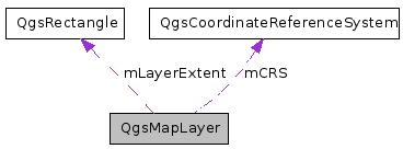
| QgsRectangle | mLayerExtent |
| Extent of the layer. | |
| bool | mValid |
| Indicates if the layer is valid and can be drawn. | |
| QString | mDataSource |
| data source description string, varies by layer type | |
| QString | mLayerName |
| Name of the layer - used for display. | |
| QgsCoordinateReferenceSystem * | mCRS |
| layer's Spatial reference system | |
Private Member Functions | |
| QgsMapLayer (QgsMapLayer const &) | |
| private copy constructor - QgsMapLayer not copyable | |
| QgsMapLayer & | operator= (QgsMapLayer const &) |
| private assign operator - QgsMapLayer not copyable | |
Private Attributes | |
| QString | mID |
| Unique ID of this layer - used to refer to this layer in map layer registry. | |
| QgsMapLayer::LayerType | mLayerType |
| Type of the layer (eg. | |
| QString | mTag |
| Tag for embedding additional information. | |
| float | mMinScale |
| Minimum scale at which this layer should be displayed. | |
| float | mMaxScale |
| Maximum scale at which this layer should be displayed. | |
| bool | mScaleBasedVisibility |
| A flag that tells us whether to use the above vars to restrict layer visibility. | |
| QUndoStack | mUndoStack |
| Collection of undoable operations for this layer. | |
| QMap< QString, QVariant > | mCustomProperties |
| QImage * | mpCacheImage |
| QImage for caching of rendering operations. | |
Detailed Description
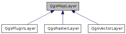
Base class for all map layer types.This is the base class for all map layer types (vector, raster).
Definition at line 42 of file qgsmaplayer.h.
Member Enumeration Documentation
Layers enum defining the types of layers that can be added to a map.
Reimplemented in QgsRasterLayer.
Definition at line 48 of file qgsmaplayer.h.
Constructor & Destructor Documentation
| QgsMapLayer::QgsMapLayer | ( | QgsMapLayer::LayerType | type = VectorLayer, |
|
| QString | lyrname = QString::null, |
|||
| QString | source = QString::null | |||
| ) |
Constructor.
- Parameters:
-
type Type of layer as defined in QgsMapLayer::LayerType enum lyrname Display Name of the layer source datasource of layer
Definition at line 45 of file qgsmaplayer.cpp.
References capitaliseLayerName(), mCRS, mID, mLayerName, mMaxScale, mMinScale, mpCacheImage, mScaleBasedVisibility, and QgsDebugMsg.
| QgsMapLayer::~QgsMapLayer | ( | ) | [virtual] |
| QgsMapLayer::QgsMapLayer | ( | QgsMapLayer const & | ) | [private] |
private copy constructor - QgsMapLayer not copyable
Member Function Documentation
| QgsMapLayer::LayerType QgsMapLayer::type | ( | ) | const |
Get the type of the layer.
- Returns:
- Integer matching a value in the QgsMapLayer::LayerType enum
Definition at line 92 of file qgsmaplayer.cpp.
References mLayerType.
Referenced by QgsLegendModel::addLayer(), QgsRasterLayer::copySymbologySettings(), QgsVectorLayer::geometryType(), QgsRasterLayer::hasCompatibleSymbology(), QgsVectorLayer::hasCompatibleSymbology(), QgsRasterLayer::identify(), QgsRasterLayer::readData(), QgsPluginLayerRegistry::removePluginLayerType(), and QgsMapRenderer::render().
| QString QgsMapLayer::getLayerID | ( | ) | const |
Get this layer's unique ID, this ID is used to access this layer from map layer registry.
Get this layer's unique ID.
Definition at line 98 of file qgsmaplayer.cpp.
References mID.
Referenced by QgsLegendModel::addLayer(), QgsMapLayerRegistry::addMapLayer(), QgsLegendModel::addRasterLayerItem(), QgsLegendModel::addVectorLayerItems(), QgsVectorLayer::commitChanges(), QgsPalLabeling::prepareLayer(), QgsComposerAttributeTable::removeLayer(), QgsPluginLayerRegistry::removePluginLayerType(), QgsMapCanvas::setLayerSet(), QgsFormAnnotationItem::writeXML(), writeXML(), and QgsComposerAttributeTable::writeXML().
| void QgsMapLayer::setLayerName | ( | const QString & | name | ) |
Set the display name of the layer.
Write property of QString layerName.
- Parameters:
-
name New name for the layer
Definition at line 104 of file qgsmaplayer.cpp.
References capitaliseLayerName(), layerNameChanged(), mLayerName, and QgsDebugMsg.
Referenced by QgsRasterLayer::QgsRasterLayer(), readXML(), and QgsVectorLayer::setDataProvider().
| QString const & QgsMapLayer::name | ( | ) | const |
Get the display name of the layer.
Read property of QString layerName.
- Returns:
- the layer name
Definition at line 112 of file qgsmaplayer.cpp.
References mLayerName, and QgsDebugMsgLevel.
Referenced by QgsLegendModel::addLayer(), QgsRasterLayer::bandStatistics(), QgsVectorLayer::checkedState(), QgsVectorLayer::commitChanges(), QgsVectorLayer::editType(), QgsVectorLayer::hasCompatibleSymbology(), QgsRasterLayer::legendAsPixmap(), QgsQuickPrint::printMap(), QgsRasterLayer::readData(), QgsRasterLayer::readFile(), QgsVectorLayer::readSymbology(), QgsMapRenderer::render(), QgsVectorLayer::setCheckedState(), QgsVectorLayer::setCoordinateSystem(), QgsRasterLayer::setDataProvider(), QgsVectorLayer::setDataProvider(), QgsVectorLayer::setEditType(), QgsMapCanvas::showError(), QgsMapRenderer::updateFullExtent(), QgsLegendModel::updateLayer(), QgsVectorLayer::writeSymbology(), and writeXML().
| virtual void QgsMapLayer::reload | ( | ) | [inline, virtual] |
Synchronises with changes in the datasource.
- Note:
- added in version 1.6
Reimplemented in QgsVectorLayer, and QgsRasterLayer.
Definition at line 85 of file qgsmaplayer.h.
Referenced by QgsMapLayerRegistry::reloadAllLayers().
| bool QgsMapLayer::draw | ( | QgsRenderContext & | rendererContext | ) | [virtual] |
This is the method that does the actual work of drawing the layer onto a paint device.
- Parameters:
-
rendererContext describes the extents, resolution etc. that should be used when rendering the layer.
Reimplemented in QgsVectorLayer, and QgsRasterLayer.
Definition at line 136 of file qgsmaplayer.cpp.
Referenced by QgsMapRenderer::render().
| void QgsMapLayer::drawLabels | ( | QgsRenderContext & | rendererContext | ) | [virtual] |
Draw labels.
- Todo:
- to be removed: used only in vector layers
Reimplemented in QgsVectorLayer.
Definition at line 141 of file qgsmaplayer.cpp.
Referenced by QgsMapRenderer::render().
| QgsRectangle QgsMapLayer::extent | ( | ) | const |
Return the extent of the layer as a QRect.
Definition at line 131 of file qgsmaplayer.cpp.
References mLayerExtent.
Referenced by QgsGeometryAnalyzer::extent(), QgsMapRenderer::render(), and QgsMapRenderer::updateFullExtent().
| bool QgsMapLayer::isValid | ( | ) |
Return the status of the layer. An invalid layer is one which has a bad datasource or other problem. Child classes set this flag when intialized
- Returns:
- True if the layer is valid and can be accessed
Definition at line 358 of file qgsmaplayer.cpp.
References mValid.
Referenced by QgsMapLayerRegistry::addMapLayer(), QgsRasterLayer::readFile(), and QgsProjectFileTransform::transform0110to1000().
| QString QgsMapLayer::publicSource | ( | ) | const |
Gets a version of the internal layer definition that has sensitive bits removed (for example, the password). This function should be used when displaying the source name for general viewing.
Definition at line 118 of file qgsmaplayer.cpp.
References mDataSource, and QgsDataSourceURI::removePassword().
Referenced by loadDefaultStyle(), and saveDefaultStyle().
| QString const & QgsMapLayer::source | ( | ) | const |
Returns the source for the layer.
Definition at line 126 of file qgsmaplayer.cpp.
References mDataSource.
Referenced by QgsRasterLayer::readXml(), QgsRasterLayer::update(), and writeXML().
| QStringList QgsMapLayer::subLayers | ( | ) | [virtual] |
Returns the sublayers of this layer (Useful for providers that manage their own layers, such as WMS).
Definition at line 420 of file qgsmaplayer.cpp.
| void QgsMapLayer::setLayerOrder | ( | QStringList | layers | ) | [virtual] |
Reorders the *previously selected* sublayers of this layer from bottom to top (Useful for providers that manage their own layers, such as WMS).
Definition at line 425 of file qgsmaplayer.cpp.
| void QgsMapLayer::setSubLayerVisibility | ( | QString | name, | |
| bool | vis | |||
| ) | [virtual] |
| bool QgsMapLayer::isEditable | ( | ) | const [virtual] |
True if the layer can be edited.
Reimplemented in QgsVectorLayer, and QgsRasterLayer.
Definition at line 859 of file qgsmaplayer.cpp.
| bool QgsMapLayer::readXML | ( | QDomNode & | layer_node | ) |
sets state from Dom document
- Parameters:
-
layer_node is Dom node corresponding to ``maplayer'' tag
- Note:
This, in turn, calls readXml(), which is over-rideable by sub-classes so that they can read their own specific state from the given Dom node.
Invoked by QgsProject::read().
- Returns:
- true if successful
Definition at line 146 of file qgsmaplayer.cpp.
References QgsCoordinateReferenceSystem::customSrsValidation(), QgsDataSourceURI::database(), QgsProject::instance(), mCRS, mDataSource, mID, readCustomProperties(), QgsProject::readPath(), readXml(), QgsCoordinateReferenceSystem::readXML(), QgsCoordinateReferenceSystem::setCustomSrsValidation(), QgsDataSourceURI::setDatabase(), setLayerName(), setMaximumScale(), setMinimumScale(), setTransparency(), QgsCoordinateReferenceSystem::setValidationHint(), toggleScaleBasedVisibility(), QgsDataSourceURI::uri(), and QgsCoordinateReferenceSystem::validate().
Referenced by QgsProject::_getMapLayers(), and QgsProject::read().
| bool QgsMapLayer::writeXML | ( | QDomNode & | layer_node, | |
| QDomDocument & | document | |||
| ) |
stores state in Dom node
- Parameters:
-
layer_node is Dom node corresponding to ``projectlayers'' tag document is Dom document
- Note:
This, in turn, calls writeXml(), which is over-rideable by sub-classes so that they can write their own specific state to the given Dom node.
Invoked by QgsProject::write().
- Returns:
- true if successful
Definition at line 268 of file qgsmaplayer.cpp.
References QgsDataSourceURI::database(), getLayerID(), getTransparency(), hasScaleBasedVisibility(), QgsDataSourceURI::host(), QgsProject::instance(), maximumScale(), mCRS, minimumScale(), name(), QgsDataSourceURI::password(), QgsDataSourceURI::port(), QgsVectorLayer::providerType(), QgsDataSourceURI::setConnection(), source(), QgsDataSourceURI::uri(), QgsDataSourceURI::username(), writeCustomProperties(), QgsProject::writePath(), writeXml(), and QgsCoordinateReferenceSystem::writeXML().
Referenced by QgsProject::write().
| void QgsMapLayer::setCustomProperty | ( | const QString & | key, | |
| const QVariant & | value | |||
| ) |
Set a custom property for layer.
Properties are stored in a map and saved in project file.
- Note:
- Added in v1.4
Definition at line 792 of file qgsmaplayer.cpp.
References mCustomProperties.
Referenced by _writeColor(), _writeDataDefinedPropertyMap(), and QgsPalLayerSettings::writeToLayer().
| QVariant QgsMapLayer::customProperty | ( | const QString & | value, | |
| const QVariant & | defaultValue = QVariant() | |||
| ) | const |
Read a custom property from layer.
Properties are stored in a map and saved in project file.
- Note:
- Added in v1.4
Definition at line 797 of file qgsmaplayer.cpp.
References mCustomProperties.
Referenced by _readColor(), _readDataDefinedProperty(), and QgsPalLayerSettings::readFromLayer().
| void QgsMapLayer::removeCustomProperty | ( | const QString & | key | ) |
Remove a custom property from layer.
Properties are stored in a map and saved in project file.
- Note:
- Added in v1.4
Definition at line 802 of file qgsmaplayer.cpp.
References mCustomProperties.
| virtual bool QgsMapLayer::copySymbologySettings | ( | const QgsMapLayer & | other | ) | [pure virtual] |
Copies the symbology settings from another layer.
Returns true in case of success
Implemented in QgsVectorLayer, and QgsRasterLayer.
| virtual bool QgsMapLayer::hasCompatibleSymbology | ( | const QgsMapLayer & | other | ) | const [pure virtual] |
Returns true if this layer can be in the same symbology group with another layer.
Implemented in QgsVectorLayer, and QgsRasterLayer.
| unsigned int QgsMapLayer::getTransparency | ( | ) |
Accessor for transparency level.
Definition at line 454 of file qgsmaplayer.cpp.
References mTransparencyLevel.
Referenced by QgsLegendModel::addVectorLayerItems(), QgsComposerLegend::drawLayerItem(), saveNamedStyle(), and writeXML().
| void QgsMapLayer::setTransparency | ( | unsigned int | theInt | ) |
Mutator for transparency level.
Should be between 0 and 255
Definition at line 459 of file qgsmaplayer.cpp.
References mTransparencyLevel.
Referenced by loadNamedStyle(), and readXML().
| QString QgsMapLayer::lastErrorTitle | ( | ) | [virtual] |
If an operation returns 0 (e.g.
draw()), this function returns the text of the error associated with the failure. Interactive users of this provider can then, for example, call a QMessageBox to display the contents.
Reimplemented in QgsRasterLayer.
Definition at line 371 of file qgsmaplayer.cpp.
Referenced by QgsMapCanvas::showError().
| QString QgsMapLayer::lastError | ( | ) | [virtual] |
If an operation returns 0 (e.g.
draw()), this function returns the text of the error associated with the failure. Interactive users of this provider can then, for example, call a QMessageBox to display the contents.
Reimplemented in QgsRasterLayer.
Definition at line 376 of file qgsmaplayer.cpp.
Referenced by QgsMapCanvas::showError().
| const QgsCoordinateReferenceSystem & QgsMapLayer::crs | ( | ) |
Returns layer's spatial reference system.
- Note:
- This was introduced in QGIS 1.4
Definition at line 435 of file qgsmaplayer.cpp.
References mCRS.
Referenced by QgsRasterLayer::readXml().
| const QgsCoordinateReferenceSystem & QgsMapLayer::srs | ( | ) |
Returns layer's spatial reference system.
- Note:
- This method is here for API compatibility and will be deprecited in 2.0
- See also:
- crs()
Definition at line 440 of file qgsmaplayer.cpp.
References mCRS.
Referenced by QgsGeometryAnalyzer::buffer(), QgsGeometryAnalyzer::centroids(), QgsGeometryAnalyzer::convexHull(), QgsGeometryAnalyzer::dissolve(), QgsGeometryAnalyzer::extent(), QgsOverlayAnalyzer::intersection(), QgsMapRenderer::layerExtentToOutputExtent(), QgsMapRenderer::layerToMapCoordinates(), QgsMapRenderer::mapToLayerCoordinates(), QgsPalLabeling::prepareLayer(), QgsRasterLayer::readXml(), QgsMapRenderer::render(), QgsGeometryAnalyzer::simplify(), QgsMapRenderer::splitLayersExtent(), and QgsVectorFileWriter::writeAsVectorFormat().
| void QgsMapLayer::setCrs | ( | const QgsCoordinateReferenceSystem & | srs, | |
| bool | emitSignal = true | |||
| ) |
Sets layer's spatial reference system.
- Note:
- emitSignal added in 1.4
Definition at line 447 of file qgsmaplayer.cpp.
References layerCrsChanged(), and mCRS.
| QString QgsMapLayer::capitaliseLayerName | ( | const QString | name | ) | [static] |
A convenience function to capitalise the layer name.
Definition at line 464 of file qgsmaplayer.cpp.
Referenced by QgsMapLayer(), and setLayerName().
| QString QgsMapLayer::loadDefaultStyle | ( | bool & | theResultFlag | ) | [virtual] |
Retrieve the default style for this layer if one exists (either as a .qml file on disk or as a record in the users style table in their personal qgis.db).
- Parameters:
-
theResultFlag a reference to a flag that will be set to false if we did not manage to load the default style.
- Returns:
- a QString with any status messages
- See also:
- also loadNamedStyle ();
Definition at line 479 of file qgsmaplayer.cpp.
References loadNamedStyle(), and publicSource().
Referenced by QgsRasterLayer::QgsRasterLayer(), and QgsVectorLayer::QgsVectorLayer().
| QString QgsMapLayer::loadNamedStyle | ( | const QString | theURI, | |
| bool & | theResultFlag | |||
| ) | [virtual] |
Retrieve a named style for this layer if one exists (either as a .qml file on disk or as a record in the users style table in their personal qgis.db).
- Parameters:
-
theURI - the file name or other URI for the style file. First an attempt will be made to see if this is a file and load that, if that fails the qgis.db styles table will be consulted to see if there is a style who's key matches the URI. theResultFlag a reference to a flag that will be set to false if we did not manage to load the default style.
- Returns:
- a QString with any status messages
- See also:
- also loadDefaultStyle ();
Definition at line 538 of file qgsmaplayer.cpp.
References QgsProject::instance(), loadNamedStyleFromDb(), QgsApplication::pkgDataPath(), QgsApplication::qgisSettingsDirPath(), QgsDebugMsg, readSymbology(), setMaximumScale(), setMinimumScale(), setTransparency(), and toggleScaleBasedVisibility().
Referenced by loadDefaultStyle().
| bool QgsMapLayer::loadNamedStyleFromDb | ( | const QString | db, | |
| const QString | theURI, | |||
| QString & | qml | |||
| ) | [virtual] |
Definition at line 496 of file qgsmaplayer.cpp.
References QgsDebugMsg.
Referenced by loadNamedStyle().
| QString QgsMapLayer::saveDefaultStyle | ( | bool & | theResultFlag | ) | [virtual] |
Save the properties of this layer as the default style (either as a .qml file on disk or as a record in the users style table in their personal qgis.db).
- Parameters:
-
theResultFlag a reference to a flag that will be set to false if we did not manage to save the default style.
- Returns:
- a QString with any status messages
- See also:
- loadNamedStyle() and
Definition at line 620 of file qgsmaplayer.cpp.
References publicSource(), and saveNamedStyle().
| QString QgsMapLayer::saveNamedStyle | ( | const QString | theURI, | |
| bool & | theResultFlag | |||
| ) | [virtual] |
Save the properties of this layer as a named style (either as a .qml file on disk or as a record in the users style table in their personal qgis.db).
- Parameters:
-
theURI the file name or other URI for the style file. First an attempt will be made to see if this is a file and save to that, if that fails the qgis.db styles table will be used to create a style entry who's key matches the URI. theResultFlag a reference to a flag that will be set to false if we did not manage to save the default style.
- Returns:
- a QString with any status messages
- See also:
- saveDefaultStyle()
Definition at line 625 of file qgsmaplayer.cpp.
References getTransparency(), hasScaleBasedVisibility(), maximumScale(), minimumScale(), QgsVectorLayer::providerType(), QGis::QGIS_VERSION, QgsApplication::qgisSettingsDirPath(), and writeSymbology().
Referenced by saveDefaultStyle().
| virtual bool QgsMapLayer::readSymbology | ( | const QDomNode & | node, | |
| QString & | errorMessage | |||
| ) | [pure virtual] |
Read the symbology for the current layer from the Dom node supplied.
- Parameters:
-
node node that will contain the symbology definition for this layer. errorMessage reference to string that will be updated with any error messages
- Returns:
- true in case of success.
Implemented in QgsVectorLayer, and QgsRasterLayer.
Referenced by loadNamedStyle().
| virtual bool QgsMapLayer::writeSymbology | ( | QDomNode & | node, | |
| QDomDocument & | doc, | |||
| QString & | errorMessage | |||
| ) | const [pure virtual] |
Write the symbology for the layer into the docment provided.
- Parameters:
-
node the node that will have the style element added to it. doc the document that will have the QDomNode added. errorMessage reference to string that will be updated with any error messages
- Returns:
- true in case of success.
Implemented in QgsVectorLayer, and QgsRasterLayer.
Referenced by saveNamedStyle().
| QUndoStack * QgsMapLayer::undoStack | ( | ) |
Return pointer to layer's undo stack.
Definition at line 786 of file qgsmaplayer.cpp.
References mUndoStack.
Referenced by QgsVectorLayer::commitChanges(), QgsVectorLayer::endEditCommand(), and QgsVectorLayer::rollBack().
| QImage* QgsMapLayer::cacheImage | ( | ) | [inline] |
Get the QImage used for caching render operations.
- Note:
- This method was added in QGIS 1.4
Definition at line 301 of file qgsmaplayer.h.
Referenced by QgsMapRenderer::render().
| void QgsMapLayer::setCacheImage | ( | QImage * | thepImage | ) |
Set the QImage used for caching render operations.
- Note:
- This method was added in QGIS 1.4
Definition at line 846 of file qgsmaplayer.cpp.
References mpCacheImage, and QgsDebugMsg.
Referenced by QgsVectorLayer::addFeatures(), clearCacheImage(), QgsVectorLayer::commitChanges(), QgsVectorLayer::deleteSelectedFeatures(), QgsVectorLayer::deselect(), QgsVectorLayer::invertSelection(), QgsVectorLayer::invertSelectionInRectangle(), QgsVectorLayer::removeSelection(), QgsMapRenderer::render(), QgsVectorLayer::rollBack(), QgsVectorLayer::select(), QgsVectorLayer::setSelectedFeatures(), and QgsVectorLayer::setSubsetString().
| void QgsMapLayer::invalidTransformInput | ( | ) | [virtual, slot] |
Event handler for when a coordinate transform fails due to bad vertex error.
Definition at line 364 of file qgsmaplayer.cpp.
References QgsDebugMsg.
| void QgsMapLayer::setMinimumScale | ( | float | theMinScale | ) | [slot] |
Accessor and mutator for the minimum scale member.
Definition at line 398 of file qgsmaplayer.cpp.
References mMinScale.
Referenced by loadNamedStyle(), and readXML().
| float QgsMapLayer::minimumScale | ( | ) | [slot] |
Definition at line 403 of file qgsmaplayer.cpp.
References mMinScale.
Referenced by QgsMapRenderer::render(), saveNamedStyle(), and writeXML().
| void QgsMapLayer::setMaximumScale | ( | float | theMaxScale | ) | [slot] |
Accessor and mutator for the maximum scale member.
Definition at line 409 of file qgsmaplayer.cpp.
References mMaxScale.
Referenced by loadNamedStyle(), and readXML().
| float QgsMapLayer::maximumScale | ( | ) | [slot] |
Definition at line 414 of file qgsmaplayer.cpp.
References mMaxScale.
Referenced by QgsMapRenderer::render(), saveNamedStyle(), and writeXML().
| void QgsMapLayer::toggleScaleBasedVisibility | ( | bool | theVisibilityFlag | ) | [slot] |
Accessor and mutator for the scale based visilibility flag.
Definition at line 388 of file qgsmaplayer.cpp.
References mScaleBasedVisibility.
Referenced by loadNamedStyle(), and readXML().
| bool QgsMapLayer::hasScaleBasedVisibility | ( | ) | [slot] |
Definition at line 393 of file qgsmaplayer.cpp.
References mScaleBasedVisibility.
Referenced by QgsMapRenderer::render(), saveNamedStyle(), and writeXML().
| void QgsMapLayer::clearCacheImage | ( | ) | [slot] |
Clear cached image added in 1.5.
Definition at line 869 of file qgsmaplayer.cpp.
References setCacheImage().
| void QgsMapLayer::drawingProgress | ( | int | theProgress, | |
| int | theTotalSteps | |||
| ) | [signal] |
Emit a signal to notify of a progress event.
Referenced by QgsRasterLayer::bandStatistics(), QgsRasterLayer::buildPyramids(), and QgsRasterLayer::updateProgress().
| void QgsMapLayer::statusChanged | ( | QString | theStatus | ) | [signal] |
Emit a signal with status (e.g.
to be caught by QgisApp and display a msg on status bar)
Referenced by QgsRasterLayer::bandStatistics(), QgsRasterLayer::QgsRasterLayer(), and QgsRasterLayer::showStatusMessage().
| void QgsMapLayer::layerNameChanged | ( | ) | [signal] |
| void QgsMapLayer::layerCrsChanged | ( | ) | [signal] |
| void QgsMapLayer::repaintRequested | ( | ) | [signal] |
This signal should be connected with the slot QgsMapCanvas::refresh().
- Todo:
- to be removed - GUI dependency
Referenced by QgsRasterLayer::triggerRepaint(), and QgsVectorLayer::triggerRepaint().
| void QgsMapLayer::screenUpdateRequested | ( | ) | [signal] |
The layer emits this signal when a screen update is requested.
This signal should be connected with the slot QgsMapCanvas::updateMap()
Referenced by QgsVectorLayer::draw(), and QgsVectorLayer::drawRendererV2().
| void QgsMapLayer::recalculateExtents | ( | ) | [signal] |
This is used to send a request that any mapcanvas using this layer update its extents.
Referenced by QgsVectorLayer::updateExtents().
| void QgsMapLayer::dataChanged | ( | ) | [signal] |
data of layer changed added in 1.5
| void QgsMapLayer::setValid | ( | bool | valid | ) | [protected] |
set whether layer is valid or not - should be used in constructor.
- Note:
- added in v1.5
Definition at line 864 of file qgsmaplayer.cpp.
References mValid.
| bool QgsMapLayer::readXml | ( | QDomNode & | layer_node | ) | [protected, virtual] |
called by readXML(), used by children to read state specific to them from project files.
Reimplemented in QgsVectorLayer, and QgsRasterLayer.
Definition at line 259 of file qgsmaplayer.cpp.
Referenced by readXML().
| bool QgsMapLayer::writeXml | ( | QDomNode & | layer_node, | |
| QDomDocument & | document | |||
| ) | [protected, virtual] |
called by writeXML(), used by children to write state specific to them to project files.
Reimplemented in QgsVectorLayer, and QgsRasterLayer.
Definition at line 348 of file qgsmaplayer.cpp.
Referenced by writeXML().
| void QgsMapLayer::readCustomProperties | ( | QDomNode & | layerNode | ) | [protected] |
Read custom properties from project file.
Added in v1.4
Definition at line 807 of file qgsmaplayer.cpp.
References mCustomProperties.
Referenced by readXML().
| void QgsMapLayer::writeCustomProperties | ( | QDomNode & | layerNode, | |
| QDomDocument & | doc | |||
| ) | [protected] |
Write custom properties to project file.
Added in v1.4
Definition at line 831 of file qgsmaplayer.cpp.
References mCustomProperties.
Referenced by writeXML().
| void QgsMapLayer::connectNotify | ( | const char * | signal | ) | [protected] |
debugging member - invoked when a connect() is made to this object
Definition at line 381 of file qgsmaplayer.cpp.
References QgsDebugMsgLevel.
| QgsMapLayer& QgsMapLayer::operator= | ( | QgsMapLayer const & | ) | [private] |
private assign operator - QgsMapLayer not copyable
Member Data Documentation
unsigned int QgsMapLayer::mTransparencyLevel [protected] |
Transparency level for this layer should be 0-255 (255 being opaque).
Definition at line 386 of file qgsmaplayer.h.
Referenced by QgsRasterLayer::draw(), QgsVectorLayer::draw(), QgsVectorLayer::drawLineString(), QgsRasterLayer::drawMultiBandColor(), QgsRasterLayer::drawPalettedSingleBandColor(), QgsRasterLayer::drawPalettedSingleBandGray(), QgsRasterLayer::drawPalettedSingleBandPseudoColor(), QgsVectorLayer::drawPolygon(), QgsRasterLayer::drawSingleBandGray(), QgsRasterLayer::drawSingleBandPseudoColor(), getTransparency(), and setTransparency().
QgsRectangle QgsMapLayer::mLayerExtent [protected] |
Extent of the layer.
Definition at line 389 of file qgsmaplayer.h.
Referenced by QgsRasterLayer::draw(), extent(), QgsRasterLayer::identify(), QgsRasterLayer::readFile(), QgsRasterLayer::setDataProvider(), QgsVectorLayer::setDataProvider(), QgsPluginLayer::setExtent(), and QgsVectorLayer::updateExtents().
bool QgsMapLayer::mValid [protected] |
Indicates if the layer is valid and can be drawn.
Definition at line 392 of file qgsmaplayer.h.
Referenced by QgsRasterLayer::closeDataset(), isValid(), QgsVectorLayer::QgsVectorLayer(), QgsRasterLayer::readFile(), QgsVectorLayer::readXml(), QgsRasterLayer::setDataProvider(), QgsVectorLayer::setDataProvider(), setValid(), and QgsVectorLayer::~QgsVectorLayer().
QString QgsMapLayer::mDataSource [protected] |
data source description string, varies by layer type
Definition at line 395 of file qgsmaplayer.h.
Referenced by QgsRasterLayer::buildPyramids(), publicSource(), QgsVectorLayer::readXml(), readXML(), QgsRasterLayer::setDataProvider(), QgsVectorLayer::setDataProvider(), QgsVectorLayer::setSubsetString(), and source().
QString QgsMapLayer::mLayerName [protected] |
Name of the layer - used for display.
Definition at line 398 of file qgsmaplayer.h.
Referenced by name(), QgsMapLayer(), and setLayerName().
QgsCoordinateReferenceSystem* QgsMapLayer::mCRS [protected] |
layer's Spatial reference system
Definition at line 401 of file qgsmaplayer.h.
Referenced by QgsVectorLayer::addTopologicalPoints(), crs(), QgsRasterLayer::metadata(), QgsMapLayer(), QgsRasterLayer::readFile(), readXML(), QgsVectorLayer::setCoordinateSystem(), setCrs(), QgsRasterLayer::setDataProvider(), srs(), writeXML(), and ~QgsMapLayer().
QString QgsMapLayer::mID [private] |
Unique ID of this layer - used to refer to this layer in map layer registry.
Definition at line 412 of file qgsmaplayer.h.
Referenced by getLayerID(), QgsMapLayer(), and readXML().
Type of the layer (eg.
vector, raster)
Definition at line 415 of file qgsmaplayer.h.
Referenced by type().
QString QgsMapLayer::mTag [private] |
float QgsMapLayer::mMinScale [private] |
Minimum scale at which this layer should be displayed.
Definition at line 421 of file qgsmaplayer.h.
Referenced by minimumScale(), QgsMapLayer(), and setMinimumScale().
float QgsMapLayer::mMaxScale [private] |
Maximum scale at which this layer should be displayed.
Definition at line 423 of file qgsmaplayer.h.
Referenced by maximumScale(), QgsMapLayer(), and setMaximumScale().
bool QgsMapLayer::mScaleBasedVisibility [private] |
A flag that tells us whether to use the above vars to restrict layer visibility.
Definition at line 425 of file qgsmaplayer.h.
Referenced by hasScaleBasedVisibility(), QgsMapLayer(), and toggleScaleBasedVisibility().
QUndoStack QgsMapLayer::mUndoStack [private] |
Collection of undoable operations for this layer.
Definition at line 428 of file qgsmaplayer.h.
Referenced by undoStack().
QMap<QString, QVariant> QgsMapLayer::mCustomProperties [private] |
Definition at line 430 of file qgsmaplayer.h.
Referenced by customProperty(), readCustomProperties(), removeCustomProperty(), setCustomProperty(), and writeCustomProperties().
QImage* QgsMapLayer::mpCacheImage [private] |
QImage for caching of rendering operations.
- Note:
- This property was added in QGIS 1.4
Definition at line 434 of file qgsmaplayer.h.
Referenced by QgsMapLayer(), setCacheImage(), and ~QgsMapLayer().
The documentation for this class was generated from the following files:
- src/core/qgsmaplayer.h
- src/core/qgsmaplayer.cpp