Class: QgsProjectionSelectionDialog
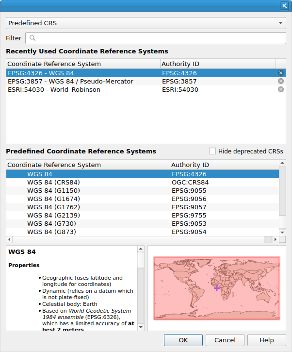
A generic dialog to prompt the user for a Coordinate Reference System.
Typically you will use this when you want to prompt the user for a coordinate system identifier e.g. from a plugin you might do this to get an epsg code:
crs = QgsCoordinateReferenceSystem()
mySelector = QgsProjectionSelectionDialog( iface.mainWindow() )
mySelector.setCrs( crs )
if mySelector.exec():
  mCrs = mySelector.crs()
If you wish to embed the projection selector into an existing dialog the
you probably want to look at QgsProjectionSelectionWidget
instead.
QgsProjectionSelectionDialog
Class Hierarchy
Base classes
- class qgis.gui.QgsProjectionSelectionDialog[source]
Bases:
QDialog- __init__(parent: QWidget | None = None, fl: Qt.WindowFlags | Qt.WindowType = QgsGuiUtils.ModalDialogFlags, filters: QgsCoordinateReferenceSystemProxyModel.Filters | QgsCoordinateReferenceSystemProxyModel.Filter = QgsCoordinateReferenceSystemProxyModel.FilterHorizontal | QgsCoordinateReferenceSystemProxyModel.FilterCompound)
Constructor for QgsProjectionSelectionDialog.
Since QGIS 3.36, the optional
filterargument can be used to specify filters on the systems shown in the dialog. The default is to show all horizontal and compound CRS in order to match the behavior of older QGIS releases. Thefiltercan be altered to also include vertical CRS if desired.- Parameters:
parent (Optional[QWidget] = None)
fl (Union[Qt.WindowFlags, Qt.WindowType] = QgsGuiUtils.ModalDialogFlags)
filters (Union[QgsCoordinateReferenceSystemProxyModel.Filters, QgsCoordinateReferenceSystemProxyModel.Filter] = QgsCoordinateReferenceSystemProxyModel.FilterHorizontal|QgsCoordinateReferenceSystemProxyModel.FilterCompound)
- crs(self) QgsCoordinateReferenceSystem[source]
Returns the CRS currently selected in the widget.
See also
- Return type:
- filters(self) QgsCoordinateReferenceSystemProxyModel.Filters[source]
Returns the filters set on the available CRS.
See also
Added in version 3.36.
- Return type:
- hasValidSelection(self) bool[source]
Returns
Trueif the dialog has a valid CRS defined.Added in version 3.24.
- Return type:
bool
- setCrs(self, crs: QgsCoordinateReferenceSystem)[source]
Sets the initial
crsto show within the dialog.See also
- Parameters:
- setFilters(self, filters: QgsCoordinateReferenceSystemProxyModel.Filters | QgsCoordinateReferenceSystemProxyModel.Filter)[source]
Sets
filtersfor the available CRS.See also
Added in version 3.36.
- Parameters:
filters (Union[QgsCoordinateReferenceSystemProxyModel.Filters, QgsCoordinateReferenceSystemProxyModel.Filter])
- setMessage(self, message: str | None)[source]
Sets a
messageto show in the dialog.See also
- Parameters:
message (Optional[str])
- setNotSetText(self, text: str | None, description: str | None = '')[source]
Sets the text to show for the not set option. Note that this option is not shown by default and must be set visible by calling
setShowNoProjection().Since QGIS 3.24, the
descriptionargument can be used to specify a detailed description which is shown when the option is selected.Added in version 3.16.
- Parameters:
text (Optional[str])
description (Optional[str] = '')
- setOgcWmsCrsFilter(self, crsFilter: Iterable[str | None])[source]
filters this dialog by the given CRSs
Sets this dialog to filter the available projections to those listed by the given Coordinate Reference Systems.
- Parameters:
crsFilter (Iterable[Optional[str]]) – a list of OGC Coordinate Reference Systems to filter the list of projections by. This is useful in (e.g.) WMS situations where you just want to offer what the WMS server can support.
Warning
This function’s behavior is undefined if it is called after the dialog is shown.
- setRequireValidSelection(self)[source]
Sets the dialog to require a valid selection only, preventing users from accepting the dialog if no selection is present.
Added in version 3.18.
- setShowNoProjection(self, show: bool)[source]
Sets whether a “no/invalid” projection option should be shown. If this option is selected, calling
crs()will return an invalidQgsCoordinateReferenceSystem.See also
- Parameters:
show (bool)
- showNoCrsForLayerMessage(self)[source]
When called, the dialog will show a default “layer has no CRS set” message above the projection selector.
See also
Added in version 3.16.
- showNoProjection(self) bool[source]
Returns whether the “no/invalid” projection option is shown. If this option is selected, calling
crs()will return an invalidQgsCoordinateReferenceSystem.See also
- Return type:
bool