A QGIS 2.6 változásnaplója
Release date: 2014-10-31
Változásnapló a következő QGIS 2.6.0 kiadáshoz. Sok új funkciót , gyorsításokat és fejlesztéseket adtunk a legnépszerűbb szabad asztali GIS-hez, hogy még funkció gazdagabbá és hasznosabbá tegyük.
Amikor egy új funkciót adnak a szoftverhez azzal az új hibák lehetőségét is bevezetik - ha bármilyen problémával találkozik ebben a kiadásban, kérjük küldjön egy jelzést a QGIS hibakövetőben.
Szeretnénk megköszönni a fejlesztőknek, a dokumentáció készítőknek, tesztelőknek és a sok embernek akik önként adják az idejüket és energiájukat (vagy finanszírozza, hogy mások tegyenek így).
From the QGIS community we hope you enjoy this release! If you wish to donate time, money or otherwise get involved in making QGIS more awesome, please wander along to qgis.org and lend a hand!
Végül szeretnénk megköszönni a hivatalos szponzorainknak a felbecsülhetetlen anyagi támogatást, melyet a projektnek nyújtottak:
ARANY szponzor: Asia Air Survey, Japán http://www.asiaairsurvey.com/
Ezüst szponzor: Sourcepole AG, Svájc
EZÜST szponzor: State of Vorarlberg, Ausztria
BRONZ szponzor: Lutra Consulting, UK
BRONZ szponzor: www.molitec.it, Olaszország
Bronz szponzor: www.argusoft.de, Germany
Bronz szponzor: www.openrunner.com, Franciaország
BRONZ szponzor: GKG Kassel,(Dr.-Ing. Claas Leiner), Németország
A current list of donors who have made financial contributions large and small to the project can be seen on our donors list. If you would like to become an official project sponsor, please visit our sponsorship page for details. Sponsoring QGIS helps us to fund our six monthly developer meetings, maintain project infrastructure and fund bug fixing efforts.
If you enjoy using QGIS, please consider making a donation to support the project - either financial or of your time and skills! Lastly we would like to also take a moment to encourage you to fund a special campaign by one of our QGIS developers to get a working test suite for QGIS so that we can improve out quality assurance process and deliver you the best possible releases.
A QGIS szabad szoftver és semmi sem kötelezi arra, hogy fizessen használatáért. Valójában a QGIS használatára bátorítjuk az embereket, legyenek bárhol a világon, pénzügyi és társadalmi helyzetüktől függetlenül. Hiszünk benne, hogy térbeli döntéstámogatási eszközök biztosítása jobb társadalmakat eredményez az emberiség egészének hasznára.
Általános
Funkció: Projekt fájlnév a tulajdonságokban
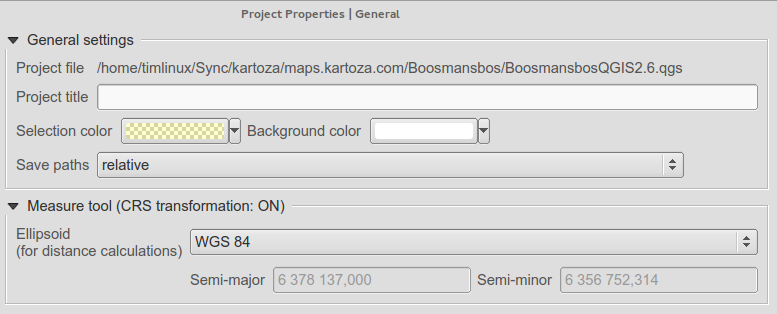
Megnézheti a QGIS projekt fájl teljes útvonalát a projekt tulajdonságok párbeszédablakban.
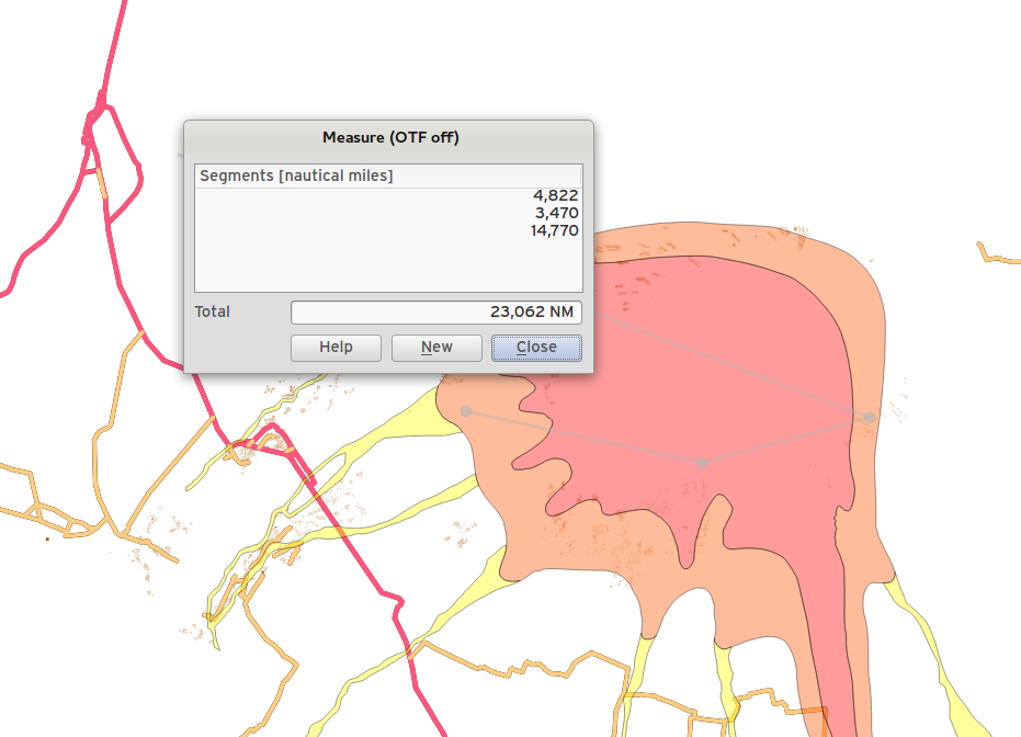
Funkció: Az utolsó pont törölhető a mérés közben a del/backspace billentyűvel.
Amikor területet és távolságot mér eltávolíthatja a nem kívánt pontot a mérési vonalból a delete vagy backspace billentyűvel.
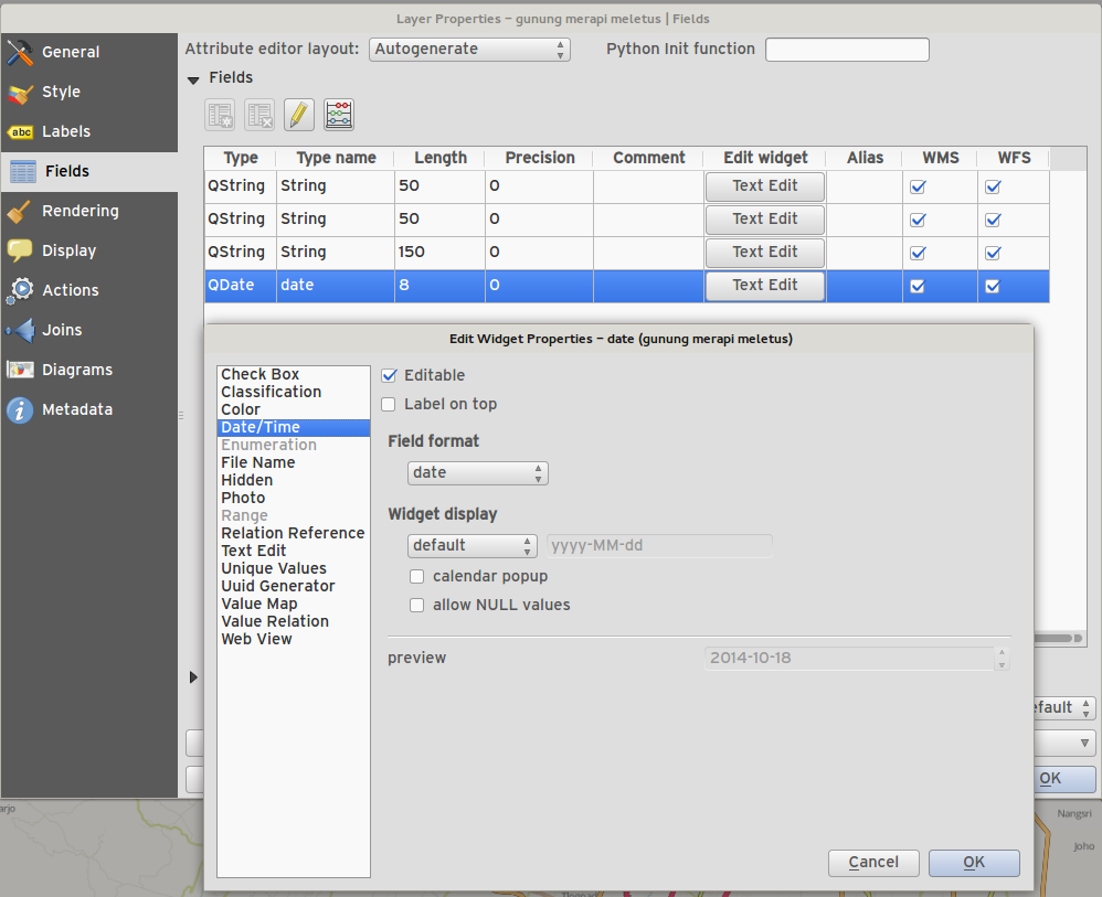
Feature: Editor widgets
We have made a number of improvements to the editor widgets:
new edit widget for date/time capable of setting null dates
filter line edit
Proper handling of NULL values for edit widgets
Photo widget preserves NULL value
Web widget preserves NULL value
Az attribútum tábla meg tudja különböztetni a 0 és NULL értéket
Add suffix support for range widget
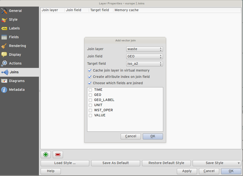
Feature: Optionally use just a subset of fields from the joined layer
You can now use just a subset of related fields when creating a vector join.
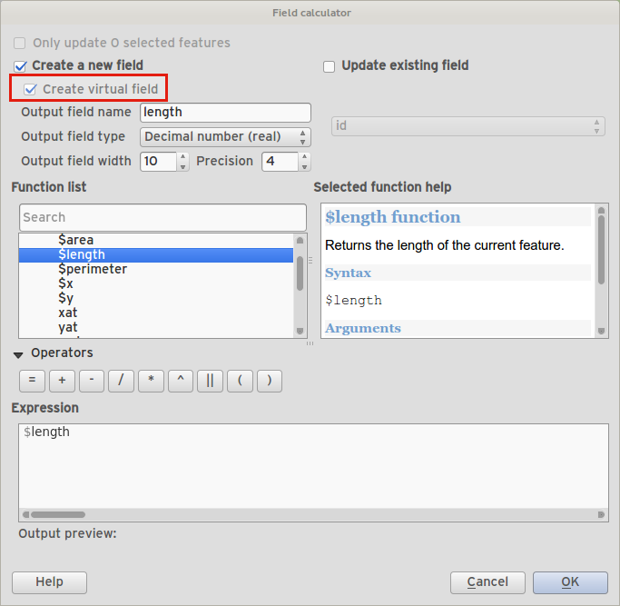
Funkció: Kifejezés mező (virtuális mezők)
Időnként olyan attribútumot akarunk, mely számított és az értéke mindig aktuális - az elem tulajdonságok aktuális állapotát tükrözi. Most virtuális mezőket adhat a táblájához, melyek egy kifejezésen alapulnak.
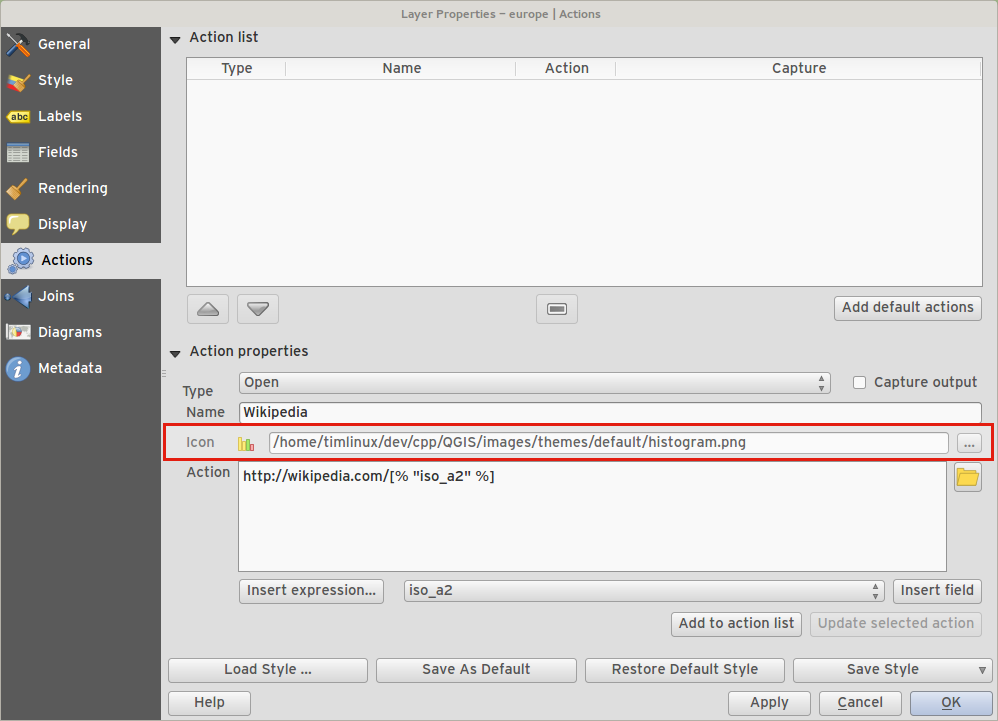
Funkció: A művelethez egy ikon rendelhető
When creating a custom action for a vector layer, you can now define an icon to be used for the action too.
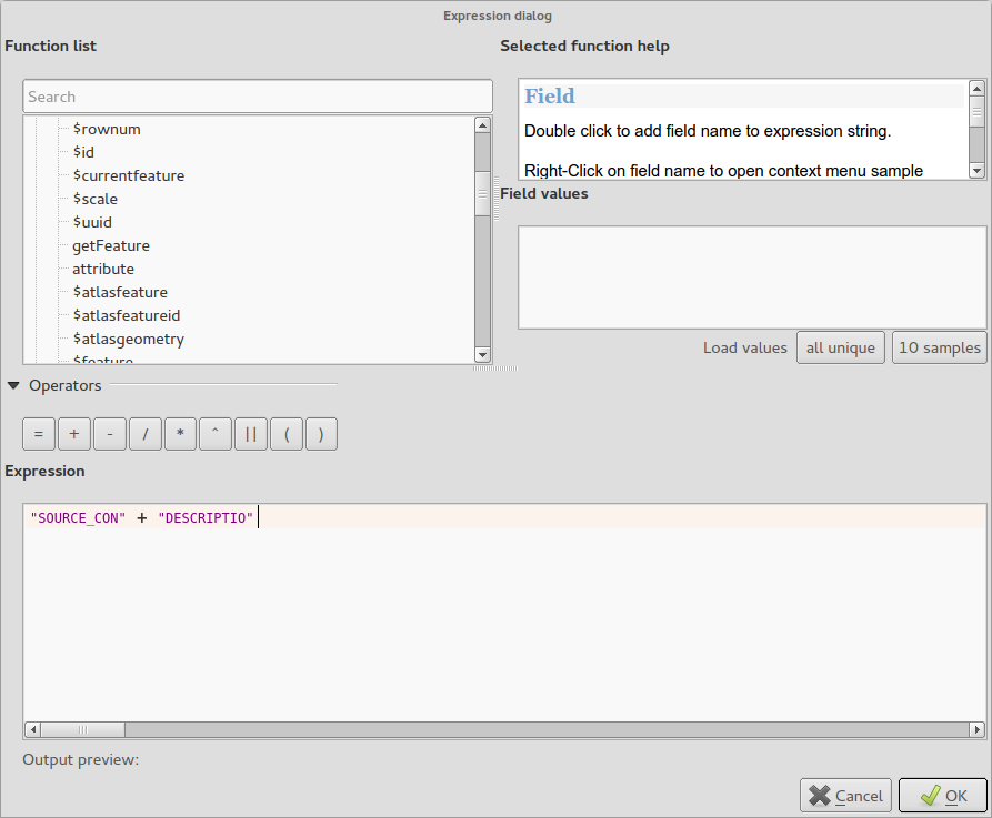
Funkció: További kifejezés típusok és beállítások
Allow using
+for string concatenation.Új kulcsszó:
attribute( elem, attribútum_név )- az elem megadott attribútumát adja meg.Új kulcsszó:
$currentfeature- az aktuális elemet adja vissza.Új kulcsszó:
$atlasfeature- az atlasz elemet adja vissza.Új kulcsszó:
getFeature- a megfelelő elemet veszi a rétegből.
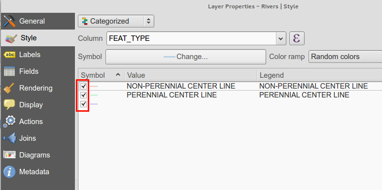
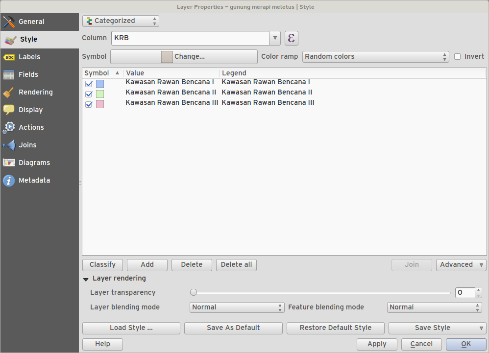
Feature: Classes within graduated and categorised renderers can be toggled
You can now choose to disable certain classes in graduated and categorised renderers without actually removing them.
Funkció: Jelmagyarázat fejlesztések
The second phase of the legend / table of contents overhaul has been completed. This includes:
API tisztítás (fejlesztőknek)
Visibility groups of map layers in layer tree. This new toolbar button allows quick changes between the groups of layers that should be visible.
Ability to manage layer groups from the legend toolbar
The new legend filter option on the legend toolbar will remove legend items for any classes which are not currently in the view extent. This is an awesome improvement as it ensures that your map legend does not contain entries for items not currently in the map view. It is available in the main map legend and in map composer and for WMS layers.
Rule-based renderer legends can now be displayed in a pseudo-tree
Adatszolgáltatók
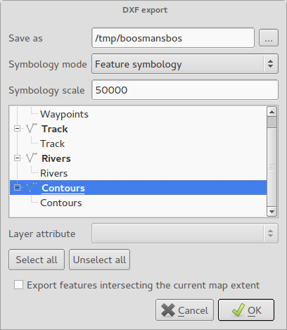
Funkció: DXF export fejlesztések
tree view and attribute selection for layer assigment in dialog
polygon kitöltés/sraffozás támogatása
szövegek leképzése MTEXT-be a TEXT helyett (tartalmazza a betűkészletet, dőlést és vastagságok)
support for RGB colors when there’s no exact color match
AutoCAD 2000 DXF (R15) használata a R12 helyett
R18 teszt metódusok eltávolítása
Térkép összeállítás
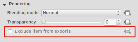
Feature: Control over hiding print composer items from prints/exports
We have added a checkbox and data defined button for controlling whether an item is excluded from composer exports/printouts. If the item is unchecked it will be visible at composition design time only.
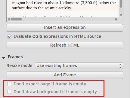
Feature: Control over page printing for empty composer frames
For table or HTML frames, a checkbox now controls whether the containing page should be exported when the frame is empty.
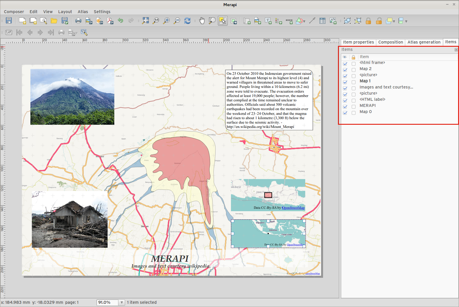
Funkció: elem fa panel
The item tree panel in the map composer allows for selection of items, hiding/showing items, toggling lock status of items and double-clicking to edit item id. You can also use drag and drop to reorder items.
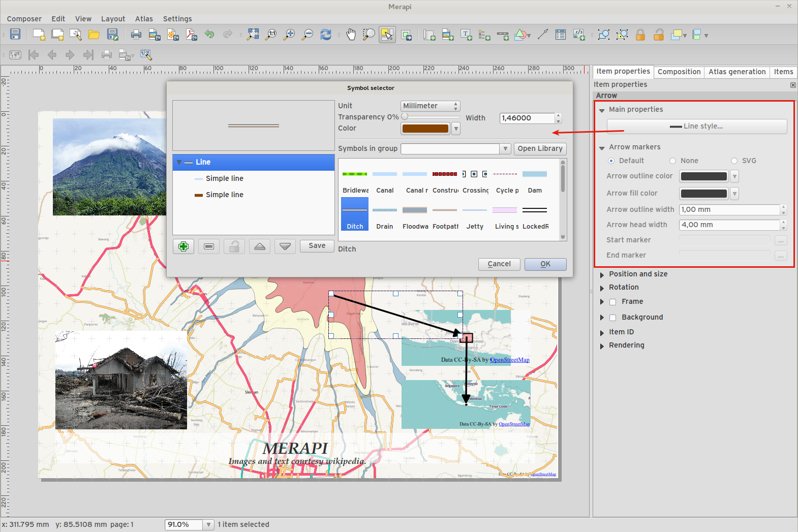
Feature: More control over appearance of composer arrow/line items
Lines can be styled using line symbol style dialog
Arrow head fill and outline colors can be user defined
Arrow head outline width can be user defined
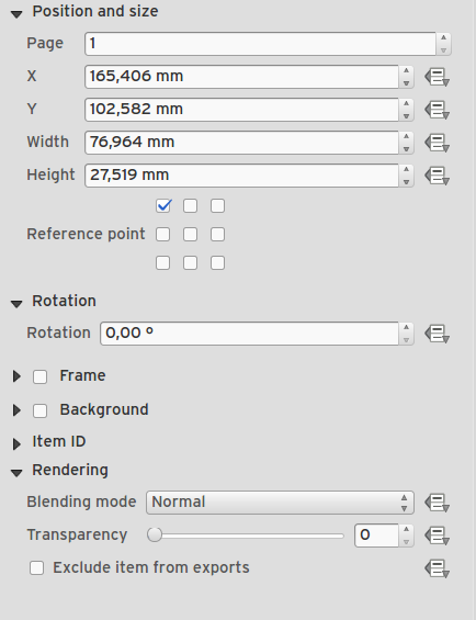
Feature: Data defined control of composer items
Many properties of composer items can now be controlled using data binding. These include:
Transparency and blend mode.
Elem forgatás.
Térkép méretarány, terjedelem és forgatás.
Atlas feature margin.
Elem méret és pozíció.
Lapméret, tájolás és lapok száma.
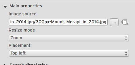
Funkció: Összeállítás képek távoli URL-lel megadhatók
A térkép összeállítás kép eleminél egy távoli url-t is megadhatunk képforrásként. Ez a forrás adatvezérelt is lehet.
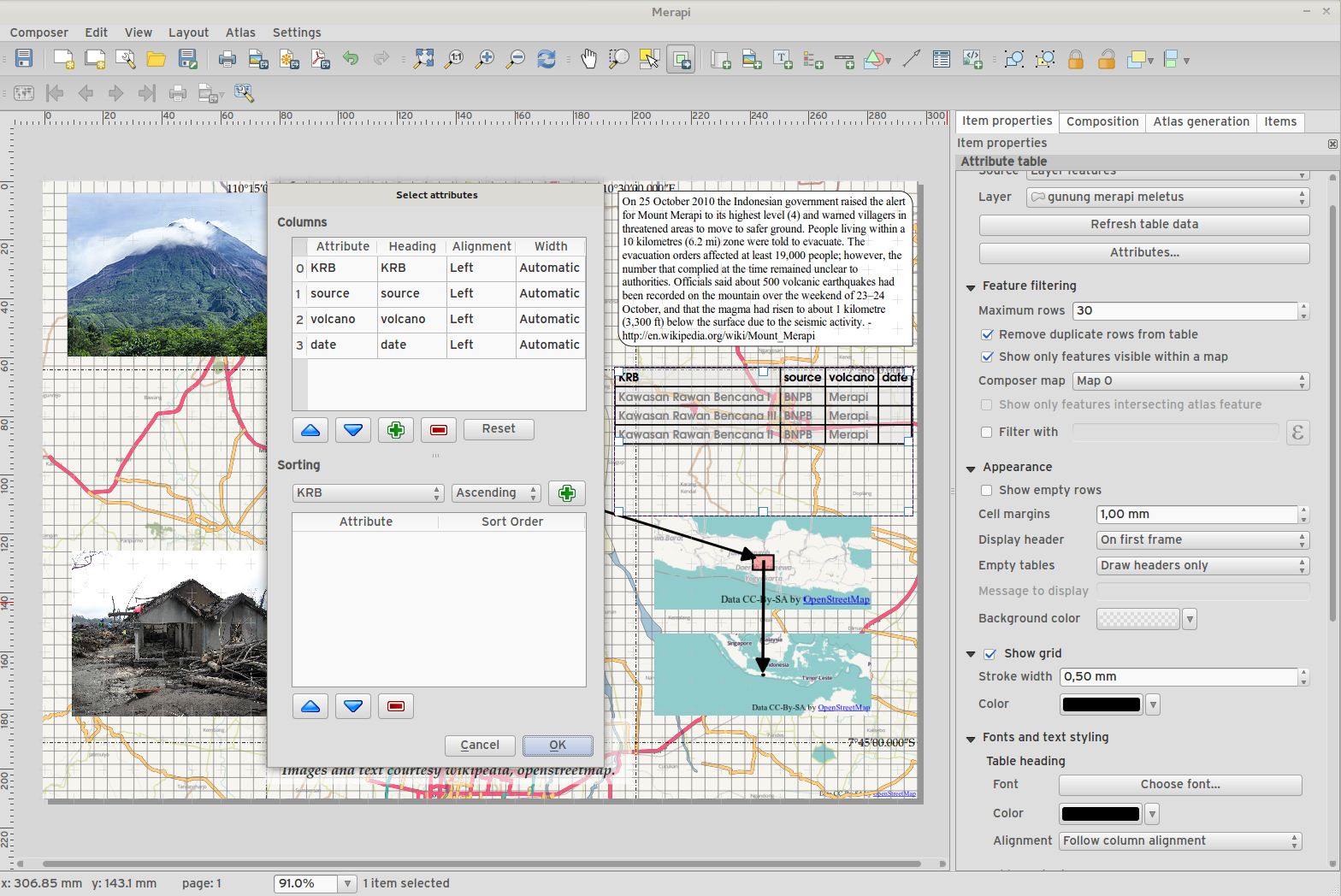
Funkció: Összeállítás tábla fejlesztések
Beállíthatja a tábla fejléc és tartalom betű színét.
Tables can now be split across multiple frames, allowing their content to be distributed over columns or over different pages.
Added option show headers on first frame, all frames, or no frames.
Oszlop szélességek manuális beállításának lehetősége.
New options for table source, including current atlas feature and child features from a relation.
Choice of behaviour for empty tables, include hiding the entire table, showing empty cells, or displaying a set message in the table body.
Added a checkbox to filter table features to those which intersect the current atlas feature.
Jelölőnégyzet a duplikált sorok eltávolítására a táblából.
Note that tables in existing projects are not automatically updated to the new table format which supports these features, and tables must be readded to a composition for the new settings to appear.
Funkció: Összeállítás fejlesztések
The map composer (used to prepare printable map compositions) has received a number of improvements in QGIS 2.6.
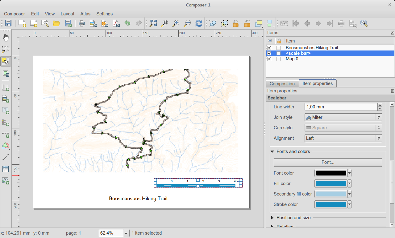
A lépték vonalzó másodlagos kitöltési színét módosíthatja.
Holding shift while drawing line/arrow items constrains drawing to horizontal, vertical or 45 degree angles
Holding shift while drawing other new items constrains them to squares, holding alt causes item to be drawn from the center
Right click no longer locks/unlocks items, this is now handled by the new items panel. Locked items can no longer be selected from the composer canvas, allowing for interaction with items below them.
Holding alt while pressing cursor keys results in a 1px movement for items
Removed the destructive «Load from template» menu item, replace with a new non-destructive «Add items from template» action
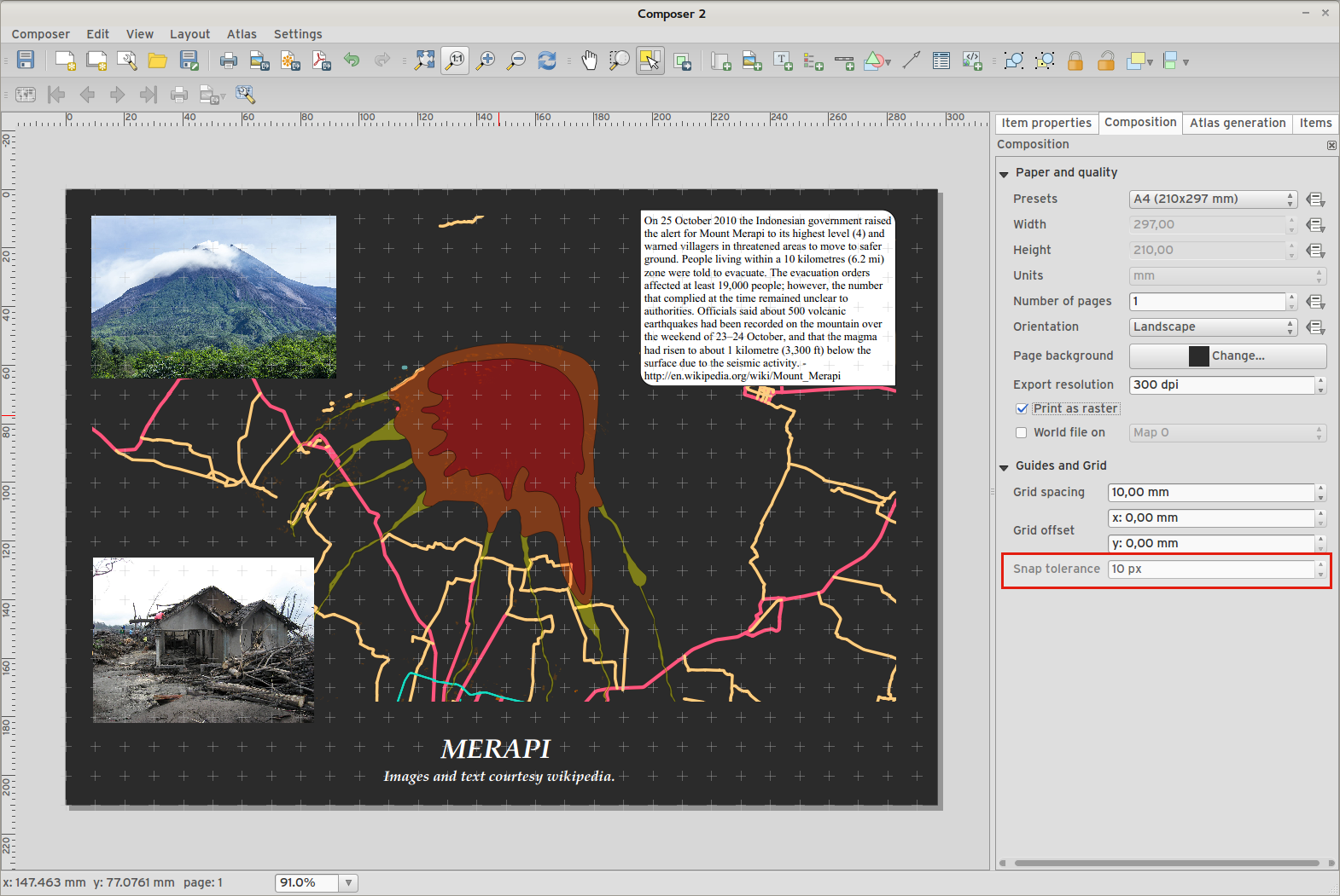
Feature: Improved item snapping
Snapping thresholds are now set in pixels, allowing for finer movement and resizing of items when zoomed in to a composition. Items within a group are no longer used for auto snap lines.
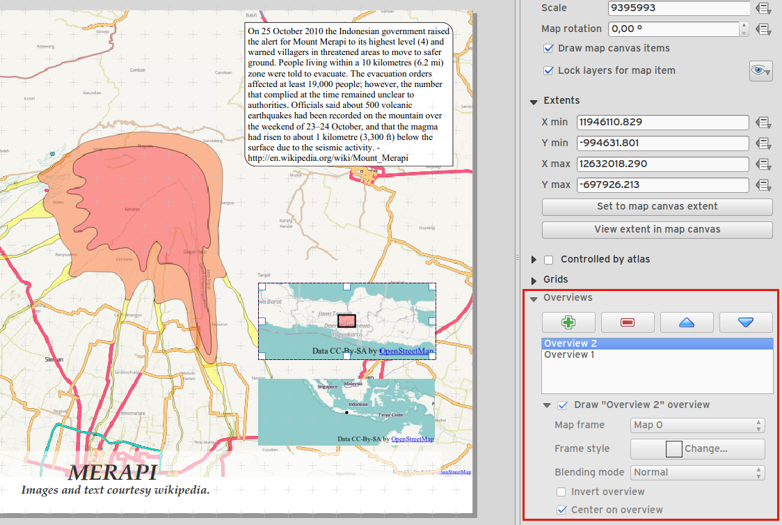
Feature: Multiple overviews for a map item
Sometimes it is useful to be able to show more than one overview frame for a map frame. For example if you want to show where your map is in local, regional and global context, using multiple overview maps can help you to achieve this. As of QGIS 2.6 you can now achieve this by assigning as many maps as you like to the «overview» role in your composition.
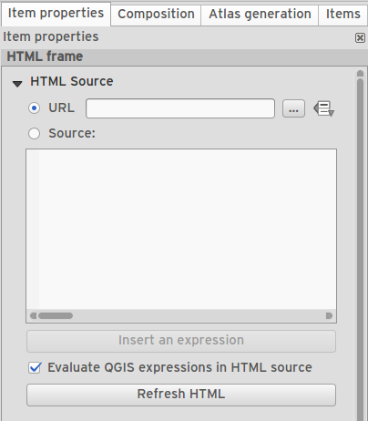
Funkció: HTML elem fejlesztések
There are a number of useful new options for the HTML composer item:
Lehetőség a HTML forrás manuális bevitelére
QGIS expressions within HTML source can be evaluated prior to rendering HTML content
Adat vezérelt URL a HTML forráshoz
Allow for creating a user stylesheet to override HTML styles
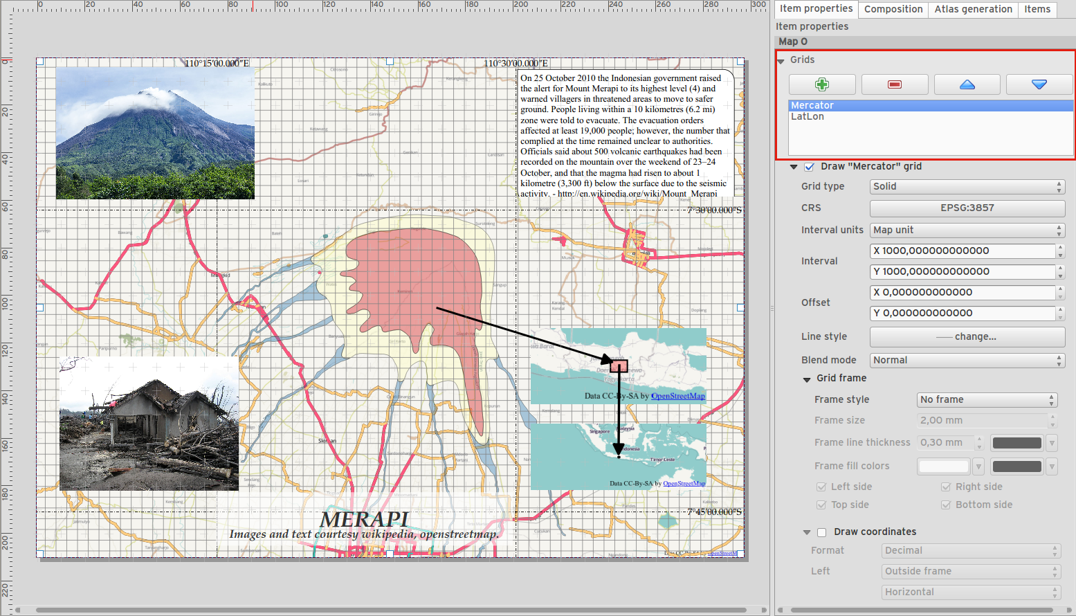
Feature: Composer map grid improvements
You can now have multiple grids with different properties.
You can mix reprojected grids and Lat/Long grids.
You can use standard QGIS symbology grid lines etc.
There is a new frame/annotations only grid style. Selecting this style causes only the frame and annotations to be drawn, with no grid lines or other markings over the map.
There are now options for controlling which side of a map item the frame is drawn on.
There are new tick styles for frames, with inner ticks, outer ticks and both inner and outer tick options.
We have made improvements to grid annotations, including many new formats for annotations.
Grid annotations now use the typographically correct prime and double prime symbols for grid annotations.
Feldolgozás
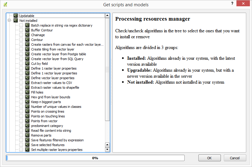
Feature: On-line collection of models and scripts
Models and scripts can be downloaded from the online collection and installed directly from the Processing interface. The collection will be expanded with new scripts and models provided by Processing users.
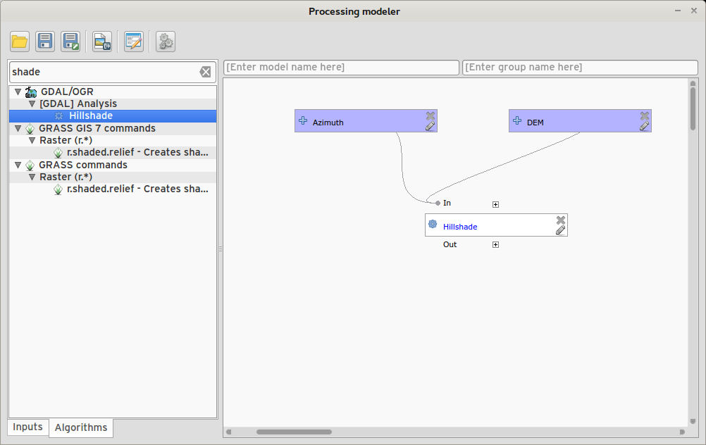
Feature: New modeler implementation
The modeler has been rewritten, and now provides extra functionality such as allowing nested models with no depth limit. Models are now stored as JSON files. Backwards compatibility is kept, so all models can still be used. You can also now drag and drop items from the inputs and algorithms onto the modeler graph.
Programozhatóság
Feature: API changes for QGIS widgets
In order to normalise the naming of QGIS widgets, some minor API changes have been made. Almost all edit widgets were renamed by adding „Wrapper” at the end of their names. In particular this concerns:
QgsCheckboxWidget -> QgsCheckboxWidgetWrapper
QgsClassificationWidget -> QgsClassificationWidgetWrapper
QgsColorWidget -> QgsColorWidgetWrapper
QgsEnumerationWidget -> QgsEnumerationWidgetWrapper
QgsFilenameWidget -> QgsFilenameWidgetWrapper
QgsHiddenWidget -> QgsHiddenWidgetWrapper
QgsPhotoWidget -> QgsPhotoWidgetWrapper
QgsRangeWidget -> QgsRangeWidgetWrapper
QgsTexteditWidget -> QgsTexteditWrapper
QgsUniquevalueWidget -> QgsUniquevalueWidgetWrapper
QgsUuidWidget -> QgsUuidWidgetWrapper
QgsValuemapWidget -> QgsValuemapWidgetWrapper
QgsValuerelationWidget -> QgsValuerelationWidgetWrapper
QgsWebviewWidget -> QgsWebviewWidgetWrapper
QGIS szerver
Feature: Enhancements of searching with GetFeatureInfo request
https://github.com/qgis/QGIS/commit/8888c5f0c0e0ffdf23453a20addf6abaf125845d
Feature: Add a precision setting for GetFeatureInfo geometry attributes
Jelrendszer
Feature: Better random colour choice
We have improved the random colour algorithm for classified renderer so that the colours generated are more visually distinct from each other.
Feature: Symbology user interface improvements
Where possible, properties of symbol layer are maintained when changing symbol layer type.
Added an edit button for shapeburst and gradient color ramps.
Automatic update of label and neighboring ranges boundaries.
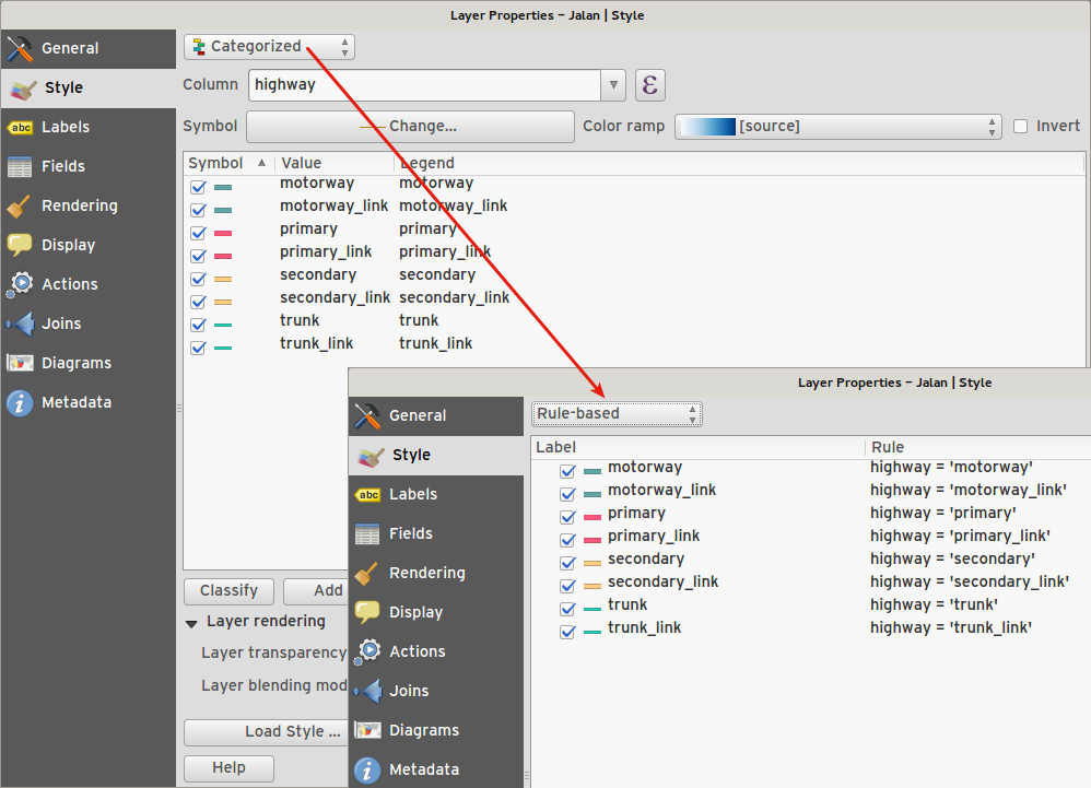
Classes are automatically converted from categorised and graduated classes when switching to rule based renderer.
Added units and number of decimal places to graduated renderer labels.
Improved responsiveness to changes in color ramp, inverted colour ramp, and other options in GUI.
Retain symbol when switching between simple, graduated, categorized, and other renderers.
Improved labelling of StdDev calculation mode.
Felhasználói felület
Funkció: Szintakszis színező szövegszerkesztő
For python script editors, expression builder, filter window, composer HTML and CSS editors

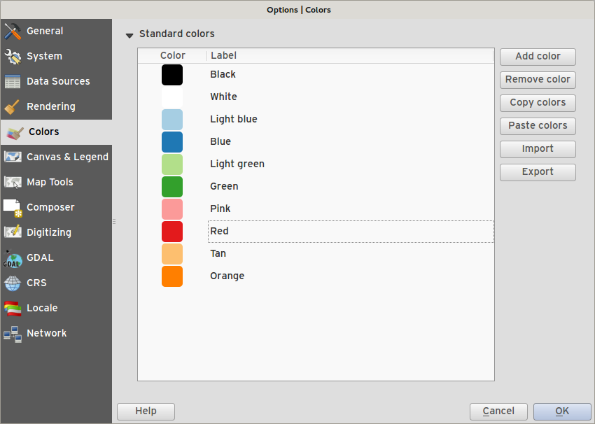
Funkció: Szín paletták
Most már saját testreszabott szín palettákat definiálhat a QGIS-ben.
Custom user global color palette (in options dialog).
Per project color palette (in project properties dialog).
Colors are shown in color button menus and new color picker dialog.
You can import/export colors to a GPL palette file.
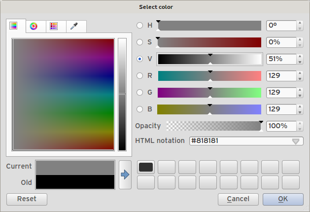
Funkció: Új szín kiválasztó párbeszédablak
- There is a new custom QGIS color picker dialog. Features include:
Sliders for hue, saturation, value, red, green, blue color components.
Alpha slider.
Option to copy/paste html color codes (in a variety of formats).
Before/after color preview, with alpha preview.
Interactive 2D color ramp widget.
Hue wheel/triangle widget.
Editable color palettes, including the ability to create new palettes and import/export colors to a GPL palette file.
Live color sampler with option to sample over a set radius (OS support dependant).
Supports interaction with other apps via drag and drop of colors (OS support dependant).
Option to disable the dialog and use the native picker dialog instead.
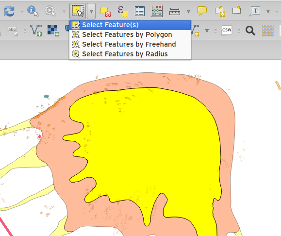
Funkció: Egy elem szelektálást egybedolgoztuk a téglalappal szelektálással
We have merged the single selection tool into the rectangle tool. If you want to select a single feature, simply enable the rectangle tool and then single click (rather than dragging a rectangle) a feature.
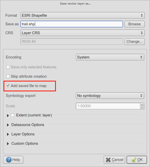
Feature: Add layer to map canvas behaviour
In many of QGIS» dialogs that generate a new layer, the «Add layer to map canvas» checkbox is now checked by default so that the new layer automatically gets added to the map.
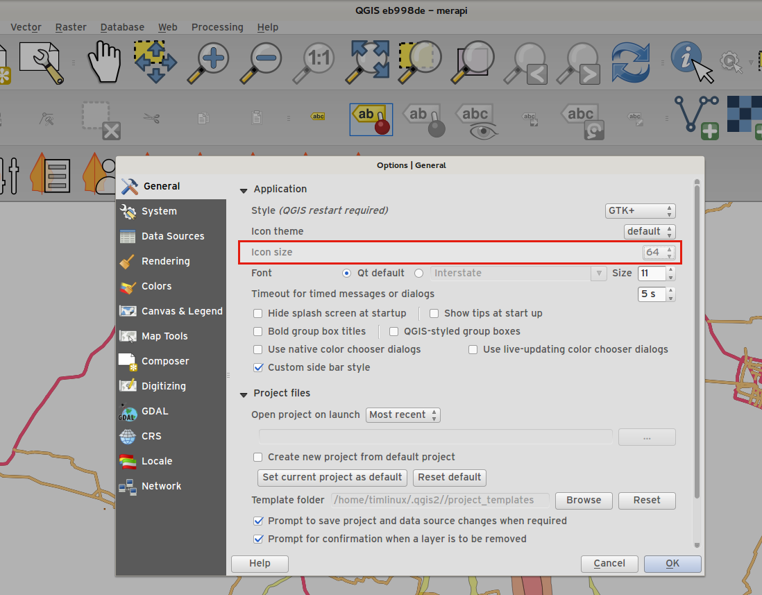
Feature: Add icon size 48 and 64
For those using QGIS on touch devices (or if you just like big, chunky icons), you can now set the icons up to 64 x 64 pixels in size.
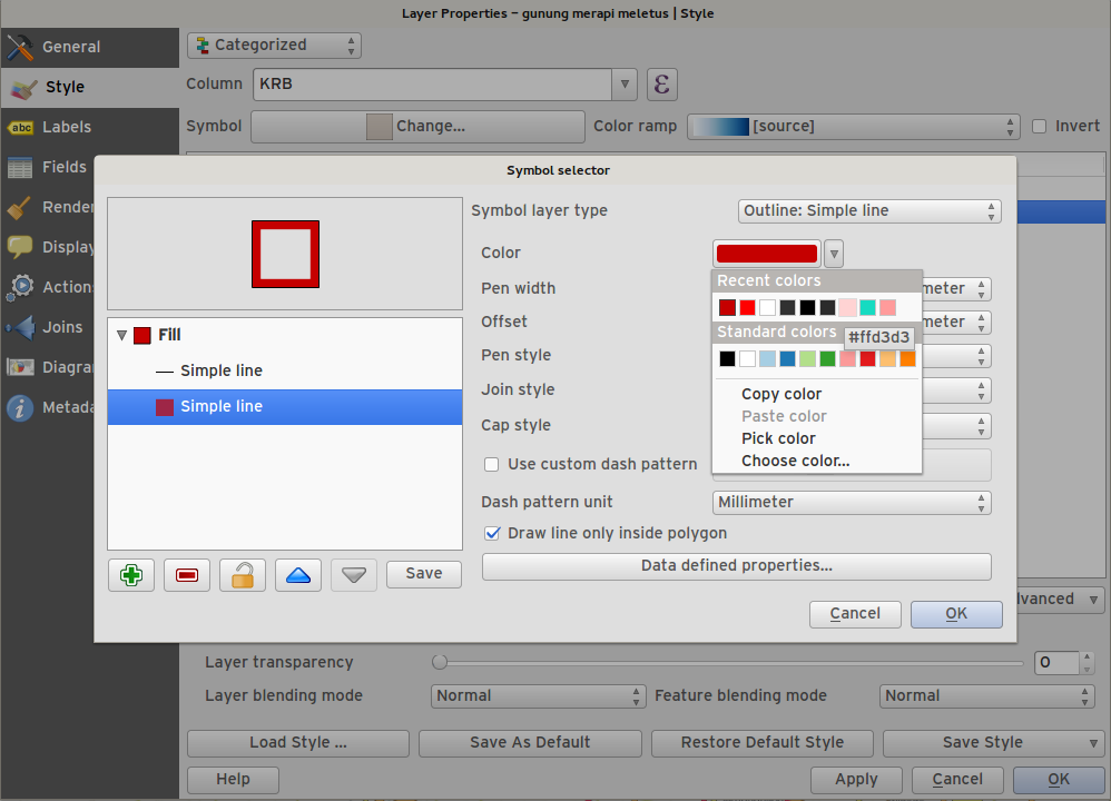
Funkció: Új szín gomb
This is probably one of the most useful new features in QGIS 2.6 - especially if you are involved a lot in cartography work. The colour button used everywhere in QGIS has been enhanced, with drop down menus, colour swatches, default colours, etc. Click on the drop down item to the right of the colour button to see the quick options. Click on the button to the left of the colour widget to see a standard colour chooser dialog.
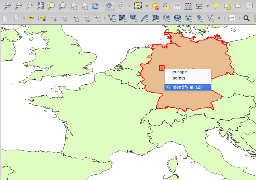
Feature: Context menu for identify tool
When using the identify tool, you can now right click on the canvas to use the identify tool in context mode. In the menu that appears you can define which feature types you wish to identify (all all if you like).