|
QGIS API Documentation
2.0.1-Dufour
|


All Classes Namespaces Files Functions Variables Typedefs Enumerations Enumerator Properties Friends Macros Groups Pages
|
QGIS API Documentation
2.0.1-Dufour
|
Abstract base class for spatial data provider implementations. More...
#include <qgsdataprovider.h>
Public Types | |
| enum | DataCapability { NoDataCapabilities = 0, File = 1, Dir = 1 << 1, Database = 1 << 2, Net = 1 << 3 } |
Signals | |
| void | fullExtentCalculated () |
| This is emitted whenever the worker thread has fully calculated the PostGIS extents for this layer, and its event has been received by this provider. | |
| void | dataChanged () |
| This is emitted whenever an asynchronous operation has finished and the data should be redrawn. | |
| void | dataChanged (int changed) |
| This is emitted whenever data or metadata (e.g. | |
Public Member Functions | |
| QgsDataProvider (QString const &uri="") | |
| virtual | ~QgsDataProvider () |
| We need this so the subclass destructors get called. | |
| virtual QgsCoordinateReferenceSystem | crs ()=0 |
| virtual void | setDataSourceUri (const QString &uri) |
| Set the data source specification. | |
| virtual QString | dataSourceUri () const |
| Get the data source specification. | |
| virtual QgsRectangle | extent ()=0 |
| Get the extent of the layer. | |
| virtual bool | isValid ()=0 |
| Returns true if this is a valid layer. | |
| virtual void | updateExtents () |
| Update the extents of the layer. | |
| virtual bool | setSubsetString (QString subset, bool updateFeatureCount=true) |
| Set the subset string used to create a subset of features in the layer. | |
| virtual bool | supportsSubsetString () |
| provider supports setting of subset strings | |
| virtual QString | subsetString () |
| Returns the subset definition string (typically sql) currently in use by the layer and used by the provider to limit the feature set. | |
| virtual QStringList | subLayers () const |
| Sub-layers handled by this provider, in order from bottom to top. | |
| virtual QStringList | subLayerStyles () const |
| Sub-layer styles for each sub-layer handled by this provider, in order from bottom to top. | |
| virtual uint | subLayerCount () const |
| return the number of layers for the current data source | |
| virtual void | setLayerOrder (const QStringList &layers) |
| Reorder the list of layer names to be rendered by this provider (in order from bottom to top) | |
| virtual void | setSubLayerVisibility (const QString &name, bool vis) |
| Set the visibility of the given sublayer name. | |
| virtual QString | name () const =0 |
| return a provider name | |
| virtual QString | description () const =0 |
| return description | |
| virtual QString | fileVectorFilters () const |
| return vector file filter string | |
| virtual QString | fileRasterFilters () const |
| return raster file filter string | |
| virtual void | reloadData () |
| Reloads the data from the source. | |
| virtual QDateTime | timestamp () const |
| Time stamp of data source in the moment when data/metadata were loaded by provider. | |
| virtual QDateTime | dataTimestamp () const |
| Current time stamp of data source. | |
| virtual QgsError | error () const |
| Get current status error. | |
Protected Member Functions | |
| void | appendError (const QgsErrorMessage &theMessage) |
| Add error message. | |
| void | setError (const QgsError &theError) |
| Set error message. | |
Protected Attributes | |
| QDateTime | mTimestamp |
| Timestamp of data in the moment when the data were loaded by provider. | |
| QgsError | mError |
| Error. | |
Private Attributes | |
| QString | mDataSourceURI |
| Universal Resource Identifier for source data. | |
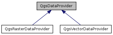
Abstract base class for spatial data provider implementations.
This object needs to inherit from QObject to enable event processing in the Postgres/PostGIS provider (QgsPostgresProvider). It is called here so that this vtable and the vtable for QgsPostgresProvider don't get misaligned - the QgsVectorLayer class factory (which refers to generic QgsVectorDataProvider's) depends on it.
Definition at line 44 of file qgsdataprovider.h.
Definition at line 52 of file qgsdataprovider.h.
|
inline |
Definition at line 61 of file qgsdataprovider.h.
|
inlinevirtual |
We need this so the subclass destructors get called.
Definition at line 68 of file qgsdataprovider.h.
|
inlineprotected |
Add error message.
Definition at line 333 of file qgsdataprovider.h.
|
pure virtual |
Get the QgsCoordinateReferenceSystem for this layer
Referenced by QgsMapToolIdentify::identifyRasterLayer(), QgsVectorLayer::setCoordinateSystem(), and QgsRasterLayer::setDataProvider().
|
signal |
This is emitted whenever an asynchronous operation has finished and the data should be redrawn.
|
signal |
This is emitted whenever data or metadata (e.g.
color table, extent) has changed
| changed | binary combination of changes |
|
inlinevirtual |
Get the data source specification.
This may be a path or database connection string
Definition at line 94 of file qgsdataprovider.h.
Referenced by QgsRasterLayer::setDataProvider(), QgsVectorLayer::setDataProvider(), and QgsVectorLayer::setSubsetString().
|
inlinevirtual |
Current time stamp of data source.
Reimplemented in QgsRasterDataProvider.
Definition at line 292 of file qgsdataprovider.h.
|
pure virtual |
return description
Return a terse string describing what the provider is.
Instead of being pure virtual, might be better to generalize this behavior and presume that none of the sub-classes are going to do anything strange with regards to their name or description?
Referenced by QgsRasterLayer::metadata(), and QgsVectorLayer::metadata().
|
inlinevirtual |
Get current status error.
This error describes some principal problem for which provider cannot work and thus is not valid. It is not last error after accessing data by block(), identify() etc.
Definition at line 298 of file qgsdataprovider.h.
Referenced by QgsRasterLayer::setDataProvider().
|
pure virtual |
Get the extent of the layer.
Implemented in QgsRasterDataProvider.
Referenced by QgsVectorLayer::extent(), and QgsVectorLayer::setDataProvider().
|
inlinevirtual |
return raster file filter string
Returns a string suitable for a QFileDialog of raster file formats supported by the data provider. Naturally this will be an empty string for those data providers that do not deal with plain files, such as databases and servers.
It'd be nice to eventually be raster/vector neutral.
Definition at line 279 of file qgsdataprovider.h.
|
inlinevirtual |
return vector file filter string
Returns a string suitable for a QFileDialog of vector file formats supported by the data provider. Naturally this will be an empty string for those data providers that do not deal with plain files, such as databases and servers.
It'd be nice to eventually be raster/vector neutral.
Definition at line 262 of file qgsdataprovider.h.
|
signal |
This is emitted whenever the worker thread has fully calculated the PostGIS extents for this layer, and its event has been received by this provider.
|
pure virtual |
Returns true if this is a valid layer.
It is up to individual providers to determine what constitutes a valid layer
Referenced by QgsVectorLayerImport::QgsVectorLayerImport(), QgsRasterChecker::runTest(), QgsRasterLayer::setDataProvider(), and QgsVectorLayer::setDataProvider().
|
pure virtual |
return a provider name
Essentially just returns the provider key. Should be used to build file dialogs so that providers can be shown with their supported types. Thus if more than one provider supports a given format, the user is able to select a specific provider to open that file.
Instead of being pure virtual, might be better to generalize this behavior and presume that none of the sub-classes are going to do anything strange with regards to their name or description?
Referenced by QgsComposerMap::containsWMSLayer(), QgsVectorDataProvider::fieldNameIndex(), QgsVectorDataProvider::fieldNameMap(), QgsRasterLayerSaveAsDialog::on_mFormatComboBox_currentIndexChanged(), QgsProviderRegistry::provider(), and QgsRasterLayerSaveAsDialog::QgsRasterLayerSaveAsDialog().
|
inlinevirtual |
Reloads the data from the source.
Needs to be implemented by providers with data caches to synchronize with changes in the data source
Definition at line 286 of file qgsdataprovider.h.
Referenced by QgsRasterLayer::reload(), and QgsVectorLayer::reload().
|
inlinevirtual |
Set the data source specification.
This may be a path or database connection string
| uri | source specification |
Definition at line 84 of file qgsdataprovider.h.
|
inlineprotected |
Set error message.
Definition at line 336 of file qgsdataprovider.h.
|
inlinevirtual |
Reorder the list of layer names to be rendered by this provider (in order from bottom to top)
Definition at line 195 of file qgsdataprovider.h.
Referenced by QgsRasterLayer::setLayerOrder().
|
inlinevirtual |
Set the visibility of the given sublayer name.
Definition at line 209 of file qgsdataprovider.h.
Referenced by QgsRasterLayer::setSubLayerVisibility().
|
inlinevirtual |
Set the subset string used to create a subset of features in the layer.
This may be a sql where clause or any other string that can be used by the data provider to create a subset. Must be implemented in the dataprovider.
Definition at line 129 of file qgsdataprovider.h.
Referenced by QgsVectorLayer::setSubsetString().
|
inlinevirtual |
return the number of layers for the current data source
Definition at line 184 of file qgsdataprovider.h.
|
inlinevirtual |
Sub-layers handled by this provider, in order from bottom to top.
Sub-layers are used when the provider's source can combine layers it knows about in some way before it hands them off to the provider.
Reimplemented in QgsRasterDataProvider.
Definition at line 162 of file qgsdataprovider.h.
|
inlinevirtual |
Sub-layer styles for each sub-layer handled by this provider, in order from bottom to top.
Sub-layer styles are used to abstract the way the provider's source can symbolise layers in some way at the server, before it serves them to the provider.
Definition at line 175 of file qgsdataprovider.h.
|
inlinevirtual |
Returns the subset definition string (typically sql) currently in use by the layer and used by the provider to limit the feature set.
Must be overridden in the dataprovider, otherwise returns a null QString.
Definition at line 150 of file qgsdataprovider.h.
Referenced by QgsVectorLayer::subsetString().
|
inlinevirtual |
provider supports setting of subset strings
Definition at line 142 of file qgsdataprovider.h.
|
inlinevirtual |
Time stamp of data source in the moment when data/metadata were loaded by provider.
Reimplemented in QgsRasterDataProvider.
Definition at line 289 of file qgsdataprovider.h.
|
inlinevirtual |
Update the extents of the layer.
Not implemented by default
Definition at line 117 of file qgsdataprovider.h.
Referenced by QgsVectorLayer::commitChanges(), and QgsVectorLayer::extent().
|
private |
Universal Resource Identifier for source data.
This could be a file, database, or server address.
Definition at line 344 of file qgsdataprovider.h.
|
protected |
Error.
Definition at line 330 of file qgsdataprovider.h.
|
protected |
Timestamp of data in the moment when the data were loaded by provider.
Definition at line 327 of file qgsdataprovider.h.
Referenced by QgsRasterDataProvider::timestamp().
 1.8.1.2