QgsRasterViewPort Struct Reference
[QGIS core library]
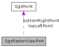
This class provides details of the viewable area that a raster will be rendered into.
More...
#include <qgsrasterviewport.h>

Public Attributes | |
| int | rectXOffset |
| The offset from the left hand edge of the raster for the rectangle that will be drawn to screen. | |
| float | rectXOffsetFloat |
| int | rectYOffset |
| The offset from the bottom edge of the raster for the rectangle that will be drawn to screen. | |
| float | rectYOffsetFloat |
| double | clippedXMin |
| Lower left X dimension of clipped raster image in raster pixel space. | |
| double | clippedXMax |
| Top Right X dimension of clipped raster image in raster pixel space. | |
| double | clippedYMin |
| Lower left Y dimension of clipped raster image in raster pixel space. | |
| double | clippedYMax |
| Top Right X dimension of clipped raster image in raster pixel space. | |
| int | clippedWidth |
| Distance in pixels from clippedXMin to clippedXMax. | |
| int | clippedHeight |
| Distance in pixels from clippedYMin to clippedYMax. | |
| QgsPoint | topLeftPoint |
| Coordinate (in geographic coordinate system) of top left corner of the part of the raster that is to be rendered. | |
| QgsPoint | bottomRightPoint |
| Coordinate (in geographic coordinate system) of bottom right corner of the part of the raster that is to be rendered. | |
| int | drawableAreaXDim |
| Distance in map units from left edge to right edge for the part of the raster that is to be rendered. | |
| int | drawableAreaYDim |
| Distance in map units from bottom edge to top edge for the part of the raster that is to be rendered. | |
Detailed Description
This class provides details of the viewable area that a raster will be rendered into.The qgsrasterviewport class sets up a viewport / area of interest to be used by rasterlayer draw functions at the point of drawing to the screen.
Definition at line 31 of file qgsrasterviewport.h.
Member Data Documentation
The offset from the left hand edge of the raster for the rectangle that will be drawn to screen.
TODO Check this explanation is correc!
Definition at line 35 of file qgsrasterviewport.h.
Referenced by QgsRasterImageBuffer::createNextPartImage(), QgsRasterImageBuffer::drawPixelRectangle(), QgsRasterLayer::paintImageToCanvas(), QgsRasterLayer::QgsRasterLayer(), QgsRasterLayer::readData(), QgsRasterLayer::thumbnailAsImage(), and QgsRasterLayer::thumbnailAsPixmap().
Definition at line 36 of file qgsrasterviewport.h.
Referenced by QgsRasterImageBuffer::createNextPartImage(), QgsRasterImageBuffer::drawPixelRectangle(), QgsRasterLayer::paintImageToCanvas(), and QgsRasterLayer::QgsRasterLayer().
The offset from the bottom edge of the raster for the rectangle that will be drawn to screen.
TODO Check this explanation is correc!
Definition at line 39 of file qgsrasterviewport.h.
Referenced by QgsRasterImageBuffer::createNextPartImage(), QgsRasterImageBuffer::drawPixelRectangle(), QgsRasterLayer::paintImageToCanvas(), QgsRasterLayer::QgsRasterLayer(), QgsRasterLayer::readData(), QgsRasterLayer::thumbnailAsImage(), and QgsRasterLayer::thumbnailAsPixmap().
Definition at line 40 of file qgsrasterviewport.h.
Referenced by QgsRasterImageBuffer::createNextPartImage(), QgsRasterImageBuffer::drawPixelRectangle(), QgsRasterLayer::paintImageToCanvas(), and QgsRasterLayer::QgsRasterLayer().
Lower left X dimension of clipped raster image in raster pixel space.
RasterIO will do the scaling for us, so for example, if the user is zoomed in a long way, there may only be e.g. 5x5 pixels retrieved from the raw raster data, but rasterio will seamlessly scale the up to whatever the screen coordinates are (e.g. a 600x800 display window)
Definition at line 45 of file qgsrasterviewport.h.
Referenced by QgsRasterLayer::QgsRasterLayer(), QgsRasterLayer::thumbnailAsImage(), and QgsRasterLayer::thumbnailAsPixmap().
Top Right X dimension of clipped raster image in raster pixel space.
RasterIO will do the scaling for us, so for example, if the user is zoomed in a long way, there may only be e.g. 5x5 pixels retrieved from the raw raster data, but rasterio will seamlessly scale the up to whatever the screen coordinates are (e.g. a 600x800 display window)
Definition at line 50 of file qgsrasterviewport.h.
Referenced by QgsRasterLayer::QgsRasterLayer(), QgsRasterLayer::thumbnailAsImage(), and QgsRasterLayer::thumbnailAsPixmap().
Lower left Y dimension of clipped raster image in raster pixel space.
RasterIO will do the scaling for us, so for example, if the user is zoomed in a long way, there may only be e.g. 5x5 pixels retrieved from the raw raster data, but rasterio will seamlessly scale the up to whatever the screen coordinates are (e.g. a 600x800 display window)
Definition at line 55 of file qgsrasterviewport.h.
Referenced by QgsRasterLayer::QgsRasterLayer(), QgsRasterLayer::thumbnailAsImage(), and QgsRasterLayer::thumbnailAsPixmap().
Top Right X dimension of clipped raster image in raster pixel space.
RasterIO will do the scaling for us, so for example, if the user is zoomed in a long way, there may only be e.g. 5x5 pixels retrieved from the raw raster data, but rasterio will seamlessly scale the up to whatever the screen coordinates are (e.g. a 600x800 display window)
Definition at line 60 of file qgsrasterviewport.h.
Referenced by QgsRasterLayer::QgsRasterLayer(), QgsRasterLayer::thumbnailAsImage(), and QgsRasterLayer::thumbnailAsPixmap().
Distance in pixels from clippedXMin to clippedXMax.
Definition at line 62 of file qgsrasterviewport.h.
Referenced by QgsRasterImageBuffer::createNextPartImage(), QgsRasterImageBuffer::drawPixelRectangle(), QgsRasterLayer::paintImageToCanvas(), QgsRasterLayer::QgsRasterLayer(), QgsRasterLayer::readData(), QgsRasterImageBuffer::reset(), QgsRasterLayer::thumbnailAsImage(), and QgsRasterLayer::thumbnailAsPixmap().
Distance in pixels from clippedYMin to clippedYMax.
Definition at line 64 of file qgsrasterviewport.h.
Referenced by QgsRasterImageBuffer::createNextPartImage(), QgsRasterImageBuffer::drawPixelRectangle(), QgsRasterLayer::paintImageToCanvas(), QgsRasterLayer::QgsRasterLayer(), QgsRasterLayer::readData(), QgsRasterImageBuffer::reset(), QgsRasterLayer::thumbnailAsImage(), and QgsRasterLayer::thumbnailAsPixmap().
Coordinate (in geographic coordinate system) of top left corner of the part of the raster that is to be rendered.
Definition at line 67 of file qgsrasterviewport.h.
Referenced by QgsRasterImageBuffer::createNextPartImage(), QgsRasterImageBuffer::drawPixelRectangle(), QgsRasterLayer::paintImageToCanvas(), QgsRasterLayer::thumbnailAsImage(), and QgsRasterLayer::thumbnailAsPixmap().
Coordinate (in geographic coordinate system) of bottom right corner of the part of the raster that is to be rendered.
Definition at line 70 of file qgsrasterviewport.h.
Referenced by QgsRasterImageBuffer::drawPixelRectangle(), QgsRasterLayer::paintImageToCanvas(), QgsRasterLayer::thumbnailAsImage(), and QgsRasterLayer::thumbnailAsPixmap().
Distance in map units from left edge to right edge for the part of the raster that is to be rendered.
Definition at line 73 of file qgsrasterviewport.h.
Referenced by QgsRasterLayer::computeMinimumMaximumFromLastExtent(), QgsRasterImageBuffer::createNextPartImage(), QgsRasterLayer::drawMultiBandColor(), QgsRasterLayer::drawPalettedSingleBandColor(), QgsRasterLayer::drawPalettedSingleBandGray(), QgsRasterLayer::drawPalettedSingleBandPseudoColor(), QgsRasterLayer::drawSingleBandGray(), QgsRasterLayer::drawSingleBandPseudoColor(), QgsRasterImageBuffer::nextScanLine(), QgsRasterLayer::QgsRasterLayer(), QgsRasterLayer::readData(), QgsRasterImageBuffer::reset(), QgsRasterLayer::thumbnailAsImage(), and QgsRasterLayer::thumbnailAsPixmap().
Distance in map units from bottom edge to top edge for the part of the raster that is to be rendered.
Definition at line 76 of file qgsrasterviewport.h.
Referenced by QgsRasterLayer::computeMinimumMaximumFromLastExtent(), QgsRasterImageBuffer::createNextPartImage(), QgsRasterLayer::QgsRasterLayer(), QgsRasterLayer::readData(), QgsRasterImageBuffer::reset(), QgsRasterLayer::thumbnailAsImage(), and QgsRasterLayer::thumbnailAsPixmap().
The documentation for this struct was generated from the following file:
- src/core/raster/qgsrasterviewport.h
 1.5.6
1.5.6