QGIS presso il Dipartimento federale di pianificazione di città e contea, Malaysia Peninsulare
Introduzione
Il Dipartimento federale di pianificazione di città e contea, Malaysia peninsulare (JPBD) è un’agenzia federale che fornisce consulenza su questioni di pianificazione urbanistica e territoriale. L’ambito di amministrazione per il reparto è limitato alla Malesia peninsulare come Sabah e Sarawak, in Malesia orientale hanno le loro rispettive agenzie urbanistiche. La pianificazione urbana e territoriale è nel diritto federale, e per questo, JPBD è consulente del Ministero del governo sulle abitazioni e località, da cui JPBD prende il suo patrocinio, così come è consulente al Consiglio di Pianificazione Fisica Nazionale, presieduto dal Primo Ministro. A livello statale, il direttore è stato consulente del Comitato di pianificazione di Stato presieduto dal Primo Ministro. A livello locale, JPBD è consulente presso autorità urbanistiche locali in materia di pianificazione, coinvolti nella preparazione dei piani di sviluppo obbligatori. Il Piano nazionale della divisione della fisica prepara il piano mentre quattro uffici regionali assistono alla preparazione dei Piani di struttura statale, Distretto Piani locali e aree speciali. Come ente pubblico, JPBD è custode di informazioni sull’uso del suolo.
Il progetto
QGIS was first introduced to the Malaysian Open Source community as a viable alternative to proprietary GIS for public agencies by JPBD at the Malaysian Government Open Source Conference (MyGOSSCON) in 2009 and to the Malaysian GIS community at the 4th National GIS Conference and Exhibition (NGIS) in 2010. JPBD has traditionally been a user of proprietary GIS thus the introduction of QGIS was a real eye opener not only from the point-of-view of Open Source Software (OSS), what more, OSS GIS. Open source philosophy was different thus QGIS felt alien, unsure and unsafe, not surprisingly the idea to use QGIS did not receive much support internally, in fact, it faced resistance in 2010 from the top managment all the way down to the support group.

MyGOSSCON, 2009
On the opposite side, request for technical talks on QGIS came from other technical agencies which JPBD gave to the Ministry of Works and the Department of Irrigation and Drainage. Other works to promote QGIS from JPBD came in the form of newsletter articles on QGIS to the Open Source Competency Centre (OSCC) at the Prime Minister’s Department and articles introducing QGIS to the Survey Department’s GIS Bulletin and the Ministry of Natural Resource’s Public Sector GeoSpatial Bulletin. In the meantime, JPBD researched on developing a slope analysis module for QGIS’s Windows and Ubuntu version.
The study highlighted pros and cons of customizing a module and the high level of commitment from the management needed to ensure its continual success and adoption. In 2011, JPBD began to further research on QGIS more as an analytical tool rather than a mapping tool in order to pioneer untapped modules or new approaches at exploiting QGIS.
Il dipartimento infine ha promosso il pacchetto QGIS-GRASS, invece di limitarsi al solo QGIS, in quanto la combinazione è utile ai fini urbanistici come la pulizia di errori di topologia e per superare i limiti degli input standard di default. Quello era solo l’inizio.
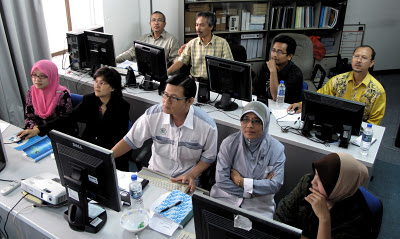
L’Office Project Northern durante un corso di QGIS
In order to centralize and share findings in the use of QGIS for town planning purpose which could also be use in other fields dealing with spatial analysis, an unofficial blog established by the author called “QGIS MALAYSIA” at http://www.qgismalaysia.blogspot.com was made to generate a QGIS community in Malaysia. External agencies seem to have more interest in QGIS than JPBD itself and upon their request, JPBD gave QGIS training to the Fire and Safety Department as well as to the Ministry of Education whom later was convinced QGIS will be their de facto GIS tool.
Hearing this, JPBD’s Research and Development Division took the initiative and requested for QGIS training and subsequently 12 persons were trained. Word of mouth (a godsend thing, though at times, extremely detrimental) spread that QGIS was indeed user-friendly, easy to use and at par with proprietary GIS in mapping task and could take on proprietary GIS when optimized with GRASS modules.
Interest in QGIS stirred and in 2012, with the support of all project office directors, an all-out effort was undertaken by the National Landuse Information Division that spearheaded QGIS to train the 4 project offices as they hold the greatest number of GIS users. By the end of 2012, it is anticipated that at least 320 staff throughout JPBD will use QGIS which accounts for approximately 90 % of GIS users in the department.
That is not all. States town planning departments have also requested QGIS training such as Perak including strong interest from poorer states like Perlis and Kelantan. If this catches on, it is anticipated that the use of QGIS may dominate states planning departments and even extend to local planning authorities, many of which are not wealthy. In the meantime, JPBD is seriously studying the use of the QGIS-PosgreSQL-PostGIS package for every planning office’s client GIS-geodatabase server structure to serve as the foundation of JPBD’s integrated landuse (iPLAN) network.
Risultato ottenuto con l’adozione di QGIS
Sull’ipotesi di RM10.000 per ogni licenza GIS proprietaria, l’uso di 320 postazioni QGIS aiuterà a risparmiare RM3.200.000 al governo;
Una eliminazione totale di GIS pirata e aumentare la fiducia e la fiducia nell’uso di OSS in generale e in particolare OSS GIS;
Imparare ad usare QGIS è stato sempre più semplice. Questo significa cross-learning tra il personale, le divisioni, enti pubblici e le autorità di pianificazione, anche locali, che imparare ad usare QGIS può essere più efficace perché il GIS utilizzato è unico;
L’uso di QGIS aiuta nella sinergia con un geodatabase PostgreSQL, PostGIS che il reparto sta progettando di usare come base di uso del suolo geodatabase in tutta la Malesia peninsulare.
È stato anche più veloce il processo di verifica dei dati e pulire gli errori di topologia.
Gli utenti prendono più fiducia e cominciano ad avventurarsi in Google Maps e altre fonti Internet per informazioni secondarie;
QGIS essendo amichevole incoraggia gli utenti a essere più avventuroso ed esplorare i tanti plugin disponibili a loro vantaggio e fanno il loro compito più facilmente.
GIS, uno strumento complesso, diventa un amico piuttosto che un impedimento.
Autore

Abbas Abdul Wahab
Questo articolo è stato scritto nel mese di gennaio del 2012 da Abbas Abdul Wahab. Abbas laureato come urbanista dal Gloucestershire College of Arts & Design, Regno Unito nel 1980 e ha conseguito un Master of Science in GIS e Geomatica Ingegneria dell’Università di Putra Malaysia nel 2002. Attualmente è il capo del National Landuse Unità d’informazione presso il National uso del suolo Informazioni Divisione del Dipartimento federale di Town & Country Planning, Malaysia peninsulare.